
Historic houses · Yorkshire & the Humber
The Grange
In or near Cawood.
The Grange — Grade II* listed house in Cawood, Selby, England, UK.

Wikimedia Commons contributors — see linked file page for photographer and licence licence

Plan your visit
- Typical visit
- 1 h–2 h
- Nearest railway station
- Ulleskelf · 6.3 km
- Family-friendly
- Limited wheelchair access
Getting there & planning your visit
To visit The Grange, the nearest railway station is Ulleskelf, which is 6.3 km away. The postcode for sat-nav is YO8 3TE. Accessibility is limited for wheelchair users.
About
The Grange is a historic house in the United Kingdom — typically a country seat, manor, or town house with notable architecture or history. Heritage designation: Grade II* listed building. Wikidata describes it as: "Grade II* listed house in Cawood, Selby, England, UK". Coordinates: 53.8305°, -1.1259°.
Photo gallery
From the Wikipedia article
The Grange is a historic building in Cawood, a village in North Yorkshire, in England. The building was constructed in the 16th century, for the Nicholson family, who held offices under the Archbishop of York. It was rebuilt in the mid-17th century, and was altered in the 18th century, and again around 1900. As part of these last changes, the original roof was replaced. Around this time, four life-sized Mediaeval sculptures believed to represent the Four Evangelists were found buried at All Saints' Church, Cawood, and were put on display outside the house. They were later passed to the owner of Cawood Castle, and two are now in the Yorkshire Museum. The house was Grade II* listed in 1966. The house is partly timber framed, with the rest in orange-red brick, with floor bands, a dentilled moulded cornice, a pantile roof with brick-capped kneelers and gable ends, and a curvilinear gable on the rear wing. It has two storeys and an L-shaped plan, with a front range of three bays, a rear wing, and two outshuts. On the front is a two-storey pedimented porch with an elliptical entrance, side seats inside, and an internal doorway. The windows on the front are sashes with alternate proud and flush voussoirs, and elsewhere there are mullioned windows. Inside, there is 17th-century panelling in the hall, with a 20th-century frieze, and original 17th-century panelling in a room to its right. There are also some early panelled doors.
Excerpt from Wikipedia under CC BY-SA 4.0. See the source article linked in Sources below.
- Coordinates
- 53.8305, -1.1259
- District
- North Yorkshire
- Parish
- Cawood
- Postcode
- YO8 3TE
- Parliamentary constituency
- Selby
- Nearest railway station
- Ulleskelf — 6.3 km
Sources
- wikidata: Q17542141 (CC0)
- wikipedia: The Grange, Cawood (CC BY-SA 4.0)
- commons: House on Wistowgate, Cawood - geograph.org.uk - 6383476.jpg (CC BY-SA 4.0)
Other places nearby

Cawood Castle
Literary houses · 0.3 km

Cawood Castle
Castles · 0.3 km
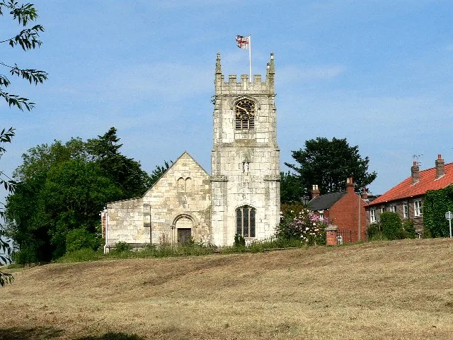
All Saints' Church, Cawood
Historic churches · 0.3 km

Cawood Bridge
Historic bridges · 0.4 km

Cawood
Towns & cities · 0.5 km

Cawood Park
Caravan parks · 1.2 km

River Wharfe
Museums · 1.5 km

York South Caravan & Camping
Caravan parks · 1.7 km

Wistow
Villages · 2.3 km
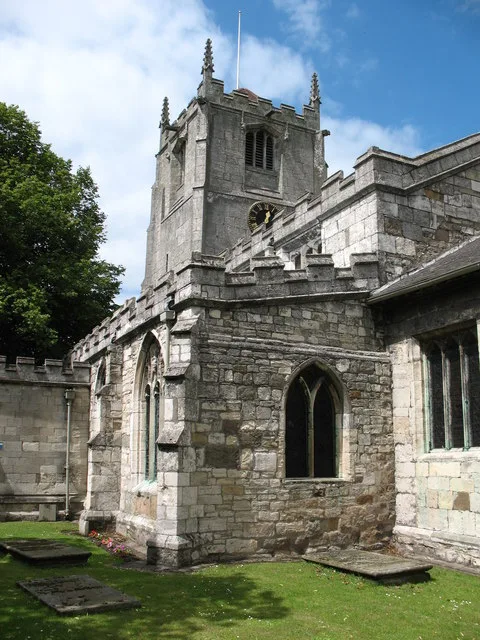
All Saints' Church, Wistow
Historic churches · 2.4 km

Wistow War Memorial
Memorials & monuments · 2.4 km

Church of All Saints
Historic churches · 2.9 km
Nearby
📷 5Literary houses · Yorkshire & the Humber
Cawood Castle
Grade I listed quadrangular castle in Cawood, Selby, North Yorkshire, England, United Kingdom
📷 3Castles · Yorkshire & the Humber
Cawood Castle
Cawood Castle — a castle in england-yorkshire, United Kingdom.
📷 3Historic churches · Yorkshire & the Humber
All Saints' Church, Cawood
All Saints' Church, Cawood — historic church in Cawood, Selby, North Yorkshire, England, UK.
📷 3Historic bridges · Yorkshire & the Humber
Cawood Bridge
Cawood Bridge is a historic bridge in the United Kingdom.
📷 5Towns & cities · Yorkshire & the Humber
Cawood
Cawood — village in North Yorkshire, England, UK.
📷 5Where to eat & stay near The Grange
Places to stay
📷 5📷 5Caravan parks · Yorkshire & the Humber
York South Caravan & Camping
York South Caravan & Camping — a caravan park in england yorkshire.
 📷 5
📷 5Campsites · Yorkshire & the Humber
Moss Hagg Farm Campsite
Moss Hagg Farm Campsite — a campsite in england yorkshire.
 📷 5
📷 5 📷 5
📷 5Caravan parks · Yorkshire & the Humber
Greenacres Mobile Home Park
Greenacres Mobile Home Park — a caravan park in england yorkshire.

Caravan parks · Yorkshire & the Humber
Approach Farm Caravan Site
Approach Farm Caravan Site — a caravan park in england yorkshire.
Places to eat & drink
 📷 5
📷 5Historic pubs · Yorkshire & the Humber
The Angel And White Horse
The Angel And White Horse in England Yorkshire, United Kingdom.
 📷 5
📷 5Cafés · Yorkshire & the Humber
Rowntree Park Reading Café
Rowntree Park Reading Café — a café in england yorkshire.
 📷 5
📷 5Historic pubs · Yorkshire & the Humber
Golden Fleece Inn, York
Golden Fleece Inn, York in England Yorkshire, United Kingdom.
 📷 7
📷 7Historic pubs · Yorkshire & the Humber
The Roman Bath Public House
The Roman Bath Public House in England Yorkshire, United Kingdom.
 📷 7
📷 7 📷 5
📷 5Historic pubs · Yorkshire & the Humber
The Black Swan Public House
The Black Swan Public House in England Yorkshire, United Kingdom.
More historic houses in this region
 📷 3
📷 3Historic houses · Yorkshire & the Humber
213, Chestergate
213, Chestergate — Grade II listed house in Stockport, Greater Manchester, England, UK.
 📷 3
📷 3Historic houses · Yorkshire & the Humber
96, Churchgate
96, Churchgate — Grade II listed house in Stockport, Greater Manchester, England, UK.
 📷 3
📷 3Historic houses · Yorkshire & the Humber
Broadbottom Hall
Broadbottom Hall — Grade II* listed house in Broadbottom, Tameside, Greater Manchester, England, UK.
.jpg?width=1200) 📷 3
📷 3Historic houses · Yorkshire & the Humber
Charles Head House
Charles Head House — house in Rainow, Cheshire East, England, UK.
Frequently asked questions
- Where is The Grange?
- The Grange is in Yorkshire, United Kingdom (postcode YO8 3TE), in the parish of Cawood.
- What is The Grange?
- The Grange — Grade II* listed house in Cawood, Selby, England, UK.
- How do I get to The Grange?
- The nearest railway station is Ulleskelf, about 6.3 km away. Drivers can use postcode YO8 3TE.
- Is The Grange a listed building?
- The Grange is officially recognised as Grade II* listed building listed.
- How do I get to The Grange?
- The nearest railway station is Ulleskelf, about 6.3 km away. Drivers can navigate to postcode YO8 3TE.