
Natural landmarks · Scottish Highlands
The Devil's Point
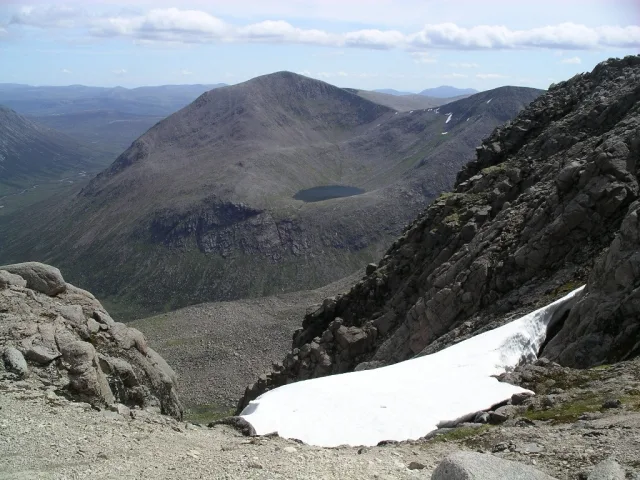
The Devil's Point — 1004m high mountain in Aberdeenshire, Scotland, UK.

Wikimedia Commons contributors — see linked file page for photographer and licence licence

Plan your visit
- Typical visit
- 1 h–2 h
- Free entry
- Dog-friendly
About
The Devil's Point is a named natural landmark in the United Kingdom. Wikidata describes it as: "1004m high mountain in Aberdeenshire, Scotland, UK". Coordinates: 57.0357°, -3.6888°.
Photo gallery
Official information
The Devil's Point is a prominent mountain in the Cairngorms, known for its distinctive pyramid shape. It serves as a gateway to the Lairig Ghru and offers various climbing routes, particularly from Deeside.
From the Wikipedia article
The Devil's Point (Scottish Gaelic: Bod an Deamhain) is a mountain in the Cairngorms of Scotland, lying to the west of the Lairig Ghru pass. The Gaelic name means "Penis of the Demon". The English name is a result of a visit to the area by Queen Victoria. She asked her local ghillie, John Brown, to translate the name; to avoid embarrassment he gave a euphemistic answer. Although The Devil's Point is strikingly distinct when seen from the south, it is a subsidiary peak of Cairn Toul, the summit of which lies some three kilometres (two miles) to the north. The easiest route is to follow the path leading up the Coire Odhar from Corrour Bothy, on the eastern side of the mountain. To reach the bothy requires a long walk in; the most usual route is to follow the Lairig Ghru from Linn of Dee, a distance of some 12 km (7+1⁄2 mi). The Devil's Point is often climbed along with Cairn Toul. Sgòr an Lochain Uaine, which lies to the north of Cairn Toul is sometimes called The Angel's Peak, in contrast to The Devil's Point.
Excerpt from Wikipedia under CC BY-SA 4.0. See the source article linked in Sources below.
- Coordinates
- 57.0357, -3.6888
- Address
- Cairngorms, Scotland
- Official site
- www.walkhighlands.co.uk
Sources
- wikidata: Q1164285 (CC0)
- wikipedia: The Devil's Point (CC BY-SA 4.0)
- commons: Coire Odhar, Devil's Point - geograph.org.uk - 229151.jpg (CC BY-SA 4.0)
Other places nearby
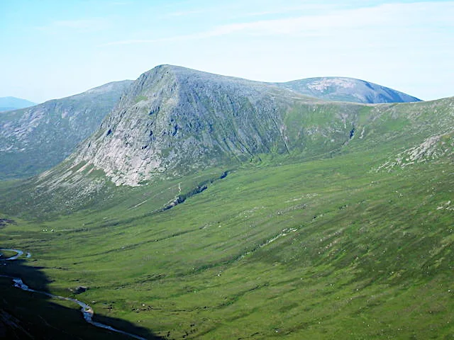
The Devil's Point
Mountains & hills · 0.0 km

Glen Geusachan
Gorges · 1.2 km

Glen Dee
Gorges · 1.5 km

Stob Coire an t-Saighdeir
Mountains & hills · 1.8 km

Stob Coire an t-Saighdeir
Mountains & hills · 1.8 km
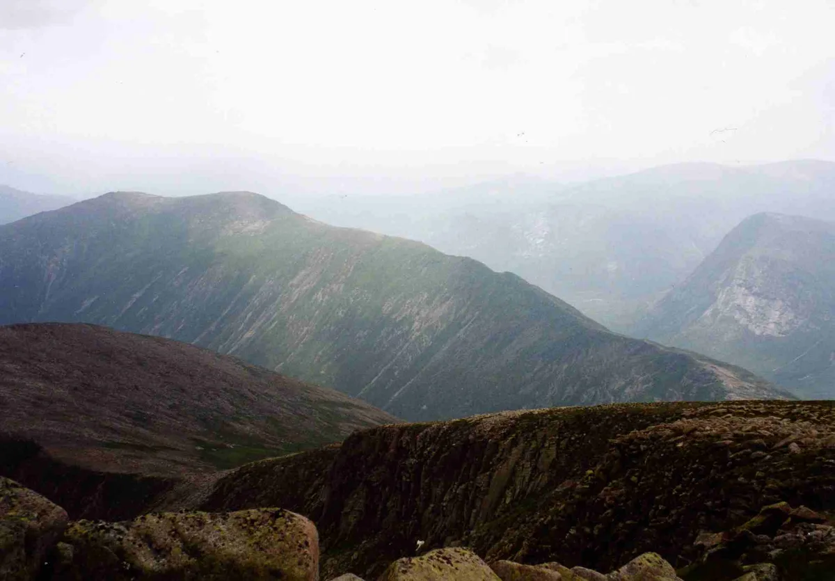
Càrn a' Mhàim
Mountains & hills · 1.8 km
Càrn a' Mhàim
Natural landmarks · 1.8 km

Carn a' Mhaim
Mountains & hills · 1.8 km
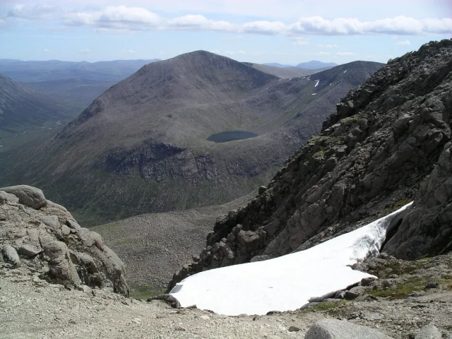
Cairn Toul
Mountains & hills · 2.5 km
Cairn Toul
Natural landmarks · 2.5 km

Beinn Bhrotain East Top
Mountains & hills · 3.1 km

Cairngorms Loop
Mountain bike trails · 3.1 km
Nearby
📷 3Mountains & hills · Scottish Highlands
The Devil's Point
The Devil's Point — Named summit at 1004 m.
📷 5📷 5📷 5Mountains & hills · Scottish Highlands
Stob Coire an t-Saighdeir
Stob Coire an t-Saighdeir — mountain in scotland highlands. Elevation: 1213 m.
📷 3Mountains & hills · Scottish Highlands
Stob Coire an t-Saighdeir
Stob Coire an t-Saighdeir — a mountain in scotland-highlands, United Kingdom.
📷 3Mountains & hills · Scottish Highlands
Càrn a' Mhàim
Càrn a' Mhàim — Named summit at 1037 m.
Where to eat & stay near The Devil's Point
Places to stay
 📷 5
📷 5Hostels · Scottish Highlands
Glen Feshie Hostel
Glen Feshie Hostel — a hostel in scotland highlands.
 📷 5
📷 5Campsites · Scottish Highlands
Glenmore Camp Site
Glenmore Camp Site — a campsite in scotland highlands.
📷 5Hostels · Scottish Highlands
Cairngorm Lodge Youth Hostel
Cairngorm Lodge Youth Hostel — a hostel in scotland highlands.
 📷 5
📷 5 📷 5
📷 5Campsites · Scottish Highlands
Rothiemurchus Camp and Caravan
Rothiemurchus Camp and Caravan — a campsite in scotland highlands.
 📷 5
📷 5Hostels · Scottish Highlands
Loch Insh Watersports Bunkhouse
Loch Insh Watersports Bunkhouse — a hostel in scotland highlands.
More natural landmarks in this region
 Flagship📷 3
Natural landmarks · Scottish Highlands
Dunalastair Water
Dunalastair Water — lake in Perth and Kinross, Scotland, UK, on the River Tummel.
 Flagship📷 3
Natural landmarks · Scottish Highlands
Loch Arkaig
Loch Arkaig — lake in Highland, Scotland, UK, outflows east to River Arkaig.
 Flagship📷 3
Natural landmarks · Scottish Highlands
Loch Assynt
Loch Assynt — lake in Highland, Scotland, UK, outflows to the River Inver and Loch na Garbh Uidhe.
 Flagship📷 5
Natural landmarks · Scottish Highlands
Loch Eilt
Loch Eilt — lake in Highland, Scotland, UK, outflows west to River Ailort.
Frequently asked questions
- Where is The Devil's Point?
- The Devil's Point is in the Scottish Highlands, United Kingdom.
- What is The Devil's Point?
- The Devil's Point — 1004m high mountain in Aberdeenshire, Scotland, UK.
- How do I get to The Devil's Point?
- Its coordinates are 57.0357°, -3.6888°.
- Is The Devil's Point free to visit?
- Yes, The Devil's Point is free to enter.