
National parks · North East England
The Cheviot Hills
In or near Akeld.
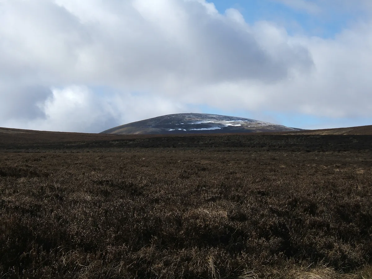
The Cheviot Hills in England North East, United Kingdom.

Stephen Craven — CC BY-SA 2.0 via Wikimedia Commons licence

Plan your visit
- Typical visit
- 4 h–8 h
- Best time of year
- Spring – autumn (Apr–Oct)
- Free entry
- Family-friendly
- Dog-friendly
About
The Cheviot Hills is a place of interest in England North East, United Kingdom — drawn from open-data sources for visitor reference. See the linked Wikipedia article for the full description.
Photo gallery
Protected designations
- Site of Special Scientific Interest: The Cheviot SSSI
- Site of Special Scientific Interest: Tweed Catchment Rivers - England: Till Catchment SSSI
Designations sourced from Natural England open data under OGL v3.
From the Wikipedia article
The Cheviot Hills (), or sometimes The Cheviots, are a range of uplands straddling the Anglo-Scottish border between Northumberland and the Scottish Borders. The English section is within the Northumberland National Park. The range includes The Cheviot (the highest hill), plus Hedgehope Hill to the east, Windy Gyle to the west, and Cushat Law and Bloodybush Edge to the south. The hills are sometimes considered a part of the Southern Uplands of Scotland as they adjoin the uplands to the north. Since the Pennine Way runs through the region, the hills are also considered a part of the northern Pennines although they are separated from the Cheviot Hills by the Tyne Gap, part of which lies within the southern extent of the Northumberland National Park. The Cheviot Hills are primarily associated with geological activity from approximately 480 to 360 million years ago, when the continents of Avalonia and Laurentia collided, resulting in extensive volcanic activity (the Caledonian orogeny) which created a granite outcrop surrounded by lava flows. The area enjoys a general right to roam under both the English Countryside and Rights of Way Act 2000 and the Scottish Land Reform (Scotland) Act 2003. The Southern Cheviots include the Otterburn Training Area, the UK's largest firing range, where the Ministry of Defence train up to 30,000 soldiers a year. The area is the traditional home of the Cheviot sheep breed. It is also the home of Cheviot primitive feral goats, classified as a "Native Breed at Risk".
Excerpt from Wikipedia under CC BY-SA 4.0. See the source article linked in Sources below.
Background
History
in the northern Cheviots, near Hethpool]] To the south of the Cheviot hills was the site of the Battle of Otterburn in 1388, and possibly a separate bloody battle between English and Scottish forces, after which only 110 people survived, which is described in "The Ballad of Chevy Chase". The origin of the border skirmishes between Percy, the Earl of Northumberland, and the Scottish Earl of Douglas may have been a hunt that strayed into Scotland and was interpreted as an invasion. Two other related battles were the Battle of Homildon Hill, fought within the Cheviots near Wooler in 1402, and the Battle of Hedgeley Moor, fought north of Powburn in 1464.
Description
The Cheviot is the highest hill in the range, and in the whole of Northumberland, at 815 m. Other notable tops are Hedgehope Hill (714 m), Windy Gyle (619 m), Cushat Law (616 m) and Bloodybush Edge (610 m). Of the hills mentioned, only Windy Gyle has its summit on the border; the rest are all within England. The English section is protected within the Northumberland National Park. Although many of the summits top 500 m, most have a relatively low prominence. Only three rise 150 m or more above the surrounding terrain: The Cheviot itself, Shillhope Law and Housedon Hill, a small northern outlier (see Marilyn). To the southwest the Cheviots merge into the Kielder Forest group of hills. and…
Visiting
Most of the range on the English side is mapped as 'open country' and hence there is a general right to roam over it as prescribed in the Countryside and Rights of Way Act 2000. Traditional rights of access in Scotland, bolstered by the Land Reform (Scotland) Act 2003, provide for similar access for the public to the north of the border. In addition, a sparse network of public bridleways and footpaths stretches around the area, often providing useful means of access from the lower ground onto the open hills. The northernmost leg of the Pennine Way runs from Byrness in England to Kirk Yetholm in Scotland. It is the longest, and most exposed, on the whole of the national trail. The Way…
Sourced from Wikipedia under CC BY-SA 4.0.
- Coordinates
- 55.4780, -2.1520
- Address
- Northumberland, England
Sources
- wikidata: Q383335 (CC0)
- wikipedia: Cheviot Hills (CC BY-SA 4.0)
Other places nearby
The Cheviot
Mountains & hills · 0.4 km

Cairn Hill
Mountains & hills · 1.0 km

West Hill
Mountains & hills · 1.6 km

Comb Fell
Mountains & hills · 2.3 km
Comb Fell
Mountains & hills · 2.6 km

Scald Hill
Mountains & hills · 2.7 km

Viewpoint at end of trail into Hen Hole
Viewpoints · 2.9 km

Mounthooly Bunk House
Hostels · 3.1 km

Fawcett Shank defended settlement, 620m SSE of Fleehope
Vineyards · 3.2 km

Auchope Rigg
Mountains & hills · 3.2 km

Fawcett
Historic houses · 3.6 km

Coldburn Hill
Mountains & hills · 3.6 km
Nearby
📷 3Mountains & hills · North East England
The Cheviot
The Cheviot — Named summit at 815 m.
📷 5Mountains & hills · North East England
Cairn Hill
Cairn Hill — mountain in scotland lowlands. Elevation: 777 m.
📷 5Mountains & hills · North East England
West Hill
West Hill — mountain in scotland lowlands. Elevation: 717 m.
📷 5Mountains & hills · North East England
Comb Fell
Comb Fell — mountain in scotland lowlands. Elevation: 652 m.
📷 5Mountains & hills · North East England
Comb Fell
Comb Fell — a hill or mountain in scotland lowlands.
📷 5Mountains & hills · North East England
Scald Hill
Scald Hill — mountain in scotland lowlands. Elevation: 549 m.
Where to eat & stay near The Cheviot Hills
Places to stay
📷 5Hostels · North East England
Mounthooly Bunk House
Mounthooly Bunk House — a hostel in scotland lowlands.
 📷 7
📷 7B&Bs · North East England
Mill House
Mill House — a bed-and-breakfast in scotland central.
 📷 5
📷 5Hostels · North East England
Friends Of Nature House
Friends Of Nature House — a hostel in scotland central.
 📷 5
📷 5Caravan parks · North East England
Highburn House Country Holiday Park
Highburn House Country Holiday Park — a caravan park in scotland central.
 📷 5
📷 5Campsites · North East England
Firing Point - Farm
Firing Point - Farm — a campsite in scotland lowlands.
 📷 5
📷 5Hostels · North East England
Wooler Hostel
Wooler Hostel — a hostel in scotland central.
Places to eat & drink
 📷 7
📷 7 📷 7
📷 7Historic pubs · North East England
Plough Inn With Outbuilding To North
Plough Inn With Outbuilding To North in Scotland Lowlands, United Kingdom.
 📷 7
📷 7Historic pubs · North East England
Bridge Of Aln Hotel
Bridge Of Aln Hotel in Scotland Lowlands, United Kingdom.
 📷 4
📷 4Historic pubs · Scottish Lowlands
Newcastle Arms
Newcastle Arms — Historic pub — listed building or notable heritage status.
 📷 5
📷 5Historic pubs · North East England
The Redesdale Arms
The Redesdale Arms in Scotland Lowlands, United Kingdom.
More national parks in this region
 📷 4
📷 4 📷 4
📷 4National parks · North East England
Mallerstang
Mallerstang in England North East, United Kingdom.
 📷 4
📷 4National parks · North East England
Kisdon Force
Kisdon Force in England North East, United Kingdom.
 📷 4
📷 4Frequently asked questions
- Where is The Cheviot Hills?
- The Cheviot Hills is in North-East England, United Kingdom.
- What is The Cheviot Hills?
- The Cheviot Hills in England North East, United Kingdom.
- How do I get to The Cheviot Hills?
- Its coordinates are 55.4780°, -2.1520°.
- Is The Cheviot Hills a protected site?
- Yes — The Cheviot Hills is part of the The Cheviot SSSI Site of Special Scientific Interest and the Tweed Catchment Rivers - England: Till Catchment SSSI Site of Special Scientific Interest.
- Is The Cheviot Hills free to visit?
- Yes, The Cheviot Hills is free to enter.