Mountains & hills · Scottish Highlands
The Blair
The Blair — mountain in scotland highlands. Elevation: 202 m.

Scott Cormie — CC BY-SA 2.0 via Wikimedia Commons licence
Plan your visit
- Typical visit
- 3 h–8 h
- Best time of year
- Late spring – early autumn (May–Oct)
About
The Blair is a mountain located in scotland highlands. Elevation: 202 m. A named British peak recorded in OpenStreetMap. Peaks are typically named on Ordnance Survey 1:50k mapping.
Photo gallery
Place summary
The Blair is a mountain located in the Scottish Highlands. It is characterised by rugged terrain and scenic vistas typical of the region. Visitors can expect a variety of outdoor activities, including hiking and exploration of the surrounding natural landscape. The area is known for its remote beauty and offers a chance to experience the unique highland environment.
AI-generated from the structured facts on this page (operator, designation, listing, era). Not a substitute for visiting.
- Coordinates
- 56.8278, -2.7023
Sources
- osm: n2437253497 (ODbL)
Other places nearby
Loading nearby places…
Nearby
 📷 5
📷 5Mountains & hills · Scottish Highlands
Hill of Edzell
Hill of Edzell — a hill or mountain in scotland highlands.
📷 5Mountains & hills · Scottish Highlands
Hill of Edzell
Hill of Edzell — mountain in scotland highlands. Elevation: 227 m.
 📷 5
📷 5Historic bridges · Scottish Highlands
Bridge of Margie
Bridge of Margie — category C listed building-listed bridge in scotland-highlands, United Kingdom.
 📷 5
📷 5Mountains & hills · Scottish Highlands
Hill of Corathro
Hill of Corathro — mountain in scotland highlands. Elevation: 402 m.
 📷 5
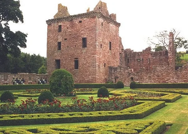
📷 5Castles · Scottish Highlands
Edzell Castle
Edzell Castle — castle ruin and walled garden in Edzell, Angus, Scotland, UK.
 📷 5
📷 5Mountains & hills · Scottish Highlands
The Crannel
The Crannel — mountain in scotland highlands. Elevation: 290 m.
Where to eat & stay near The Blair
Places to stay
 📷 5
📷 5Campsites · Scottish Highlands
Glenesk Caravan Park
Glenesk Caravan Park — a campsite in scotland highlands.
 📷 5
📷 5Caravan parks · Scottish Highlands
Clochie Caravan Site
Clochie Caravan Site — a caravan park in scotland highlands.
 📷 5
📷 5Caravan parks · Scottish Highlands
Dovecot Caravan Park
Dovecot Caravan Park — a caravan park in scotland highlands.
 📷 5
📷 5Hotels · Scottish Highlands
House of Mark
House of Mark — a hotel in scotland highlands.
 📷 5
📷 5Caravan parks · Scottish Highlands
Tayock Park
Tayock Park — a caravan park in scotland highlands.
 📷 5
📷 5Caravan parks · Scottish Highlands
Ecclesgreig Holiday Park
Ecclesgreig Holiday Park — a caravan park in scotland highlands.


More mountains in this region
 📷 3
📷 3Mountains & hills · Scottish Highlands
A' Bhuidheanach Bheag
A' Bhuidheanach Bheag — Named summit at 936 m.
 📷 3
📷 3Mountains & hills · Scottish Highlands
A' Chailleach
A' Chailleach — Named summit at 997 m.
 📷 3
📷 3Mountains & hills · Scottish Highlands
A' Chailleach
A' Chailleach — Named summit at 930 m.
 📷 3
📷 3Mountains & hills · Scottish Highlands
A' Chaoirnich
A' Chaoirnich — Named summit at 875 m.
Frequently asked questions
- Where is The Blair?
- The Blair is in the Scottish Highlands, United Kingdom.
- What is The Blair?
- The Blair — mountain in scotland highlands. Elevation: 202 m.
- How do I get to The Blair?
- Its coordinates are 56.8278°, -2.7023°.