
Natural landmarks · Northern Ireland
The Birches
In or near Bannfoot.
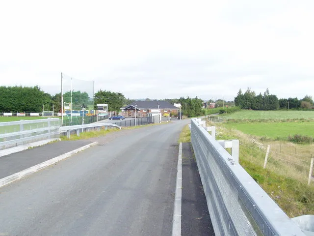
The Birches in Northern Ireland, United Kingdom.

P Flannagan — CC BY-SA 2.0 via Wikimedia Commons licence

Plan your visit
- Typical visit
- 1 h–2 h
- Nearest railway station
- Peatlands Park Railway · 4.4 km
- Free entry
- Dog-friendly
Getting there & planning your visit
To visit The Birches, the nearest railway station is Peatlands Park Railway, located 4.4 km away. The postcode for sat-nav is BT62 1LS, and entry is free.
About
The Birches is a place of interest in Northern Ireland, United Kingdom — drawn from open-data sources for visitor reference. See the linked Wikipedia article for the full description.
Photo gallery
From the Wikipedia article
The Birches (Irish: Coill Bheithe) is a small village in northern County Armagh, Northern Ireland. It is 6 miles northwest of Portadown, close to junction 12 on the M1 Motorway and to the southern shore of Lough Neagh. In the 2001 Census it had a population of 150. It is within the Armagh City, Banbridge and Craigavon council area. The Birches is part of the civil parish of Tartaraghan, and most of the settlement is within the townlands of Ballynarry and Clonmakate. Two parts to the village can be distinguished, that at Robinstown Road, centred on a public housing estate and a school, and that part adjacent to the M1 junction.
Excerpt from Wikipedia under CC BY-SA 4.0. See the source article linked in Sources below.
- Coordinates
- 54.4833, -6.5500
- Postcode
- BT62 1LS
- Parliamentary constituency
- Upper Bann
- Nearest railway station
- Peatlands Park Railway — 4.4 km
Sources
- wikidata: Q7718047 (CC0)
- wikipedia: The Birches, County Armagh (CC BY-SA 4.0)
Other places nearby

Tartaraghan
Natural landmarks · 0.6 km

Milltown
Villages · 2.1 km

Bannfoot
Towns & cities · 2.8 km

Charlestown
Villages · 2.8 km

Derrycoose
Natural landmarks · 3.3 km

Annaghmore railway station
Natural landmarks · 3.4 km

Maghery
Natural landmarks · 3.4 km
River Blackwater
Natural landmarks · 3.6 km
Maghery Sean MacDermott's GAC
Natural landmarks · 3.7 km

Coney Island
Islands · 3.7 km

Peatlands Park
Parks · 3.8 km
Derrywarragh Island
Islands · 3.9 km
Nearby
📷 4Natural landmarks · Northern Ireland
Tartaraghan
Tartaraghan in Northern Ireland, United Kingdom.
📷 5📷 3Towns & cities · Northern Ireland
Bannfoot
Bannfoot — village in County Armagh, Northern Ireland, UK.
📷 5📷 3📷 3Natural landmarks · Northern Ireland
Annaghmore railway station
Annaghmore railway station in Northern Ireland, United Kingdom.
Where to eat & stay near The Birches
Places to stay
 📷 5
📷 5Caravan parks · Northern Ireland
Kinnego Marina Camping & Caravanning
Kinnego Marina Camping & Caravanning — a caravan park in northern ireland.
 📷 5
📷 5Caravan parks · Northern Ireland
Dungannon Park Caravan & Camping
Dungannon Park Caravan & Camping — a caravan park in northern ireland.
 📷 5
📷 5Caravan parks · Northern Ireland
Dungannon Park Caravan & Camping
Dungannon Park Caravan & Camping — a caravan park in northern ireland.
 📷 4
📷 4Caravan parks · Northern Ireland
Clare Glen Caravan Park
Clare Glen Caravan Park — a caravan park in northern ireland.
 📷 5
📷 5Places to eat & drink
 📷 5
📷 5 📷 7
📷 7Historic pubs · Northern Ireland
1-3 High Street, Moneymore
1-3 High Street, Moneymore in Northern Ireland, United Kingdom.
More natural landmarks in this region
 Flagship📷 4
Natural landmarks · Northern Ireland
Lough Erne
Lough Erne — lake in County Fermanagh, Northern Ireland, UK.
 Flagship📷 4
Natural landmarks · Northern Ireland
Lough Neagh
Lough Neagh — large lake in Northern Ireland.
 📷 3
📷 3Natural landmarks · Northern Ireland
Ballysaggart Lough
Ballysaggart Lough — lake in the United Kingdom.
 📷 5
📷 5Natural landmarks · Northern Ireland
Belmore Mountain
Belmore Mountain — mountain in the United Kingdom.
Frequently asked questions
- Where is The Birches?
- The Birches is in Northern Ireland, United Kingdom (postcode BT62 1LS).
- What is The Birches?
- The Birches in Northern Ireland, United Kingdom.
- How do I get to The Birches?
- The nearest railway station is Peatlands Park Railway, about 4.4 km away. Drivers can use postcode BT62 1LS.
- Is The Birches free to visit?
- Yes, The Birches is free to enter.
- How do I get to The Birches?
- The nearest railway station is Peatlands Park Railway, about 4.4 km away. Drivers can navigate to postcode BT62 1LS.