
Castles · Central Scotland
The Bass
In or near North Berwick.
The Bass — castle ruin on Bass Rock, East Lothian, Scotland, UK.

Wikimedia Commons contributors — see linked file page for photographer and licence licence

Plan your visit
- Typical visit
- 1.5 h–3 h
- Nearest railway station
- North Berwick · 6.0 km
- Family-friendly
- Limited wheelchair access
Getting there & planning your visit
To visit The Bass, the nearest railway station is North Berwick, which is 6 km away. Entry details are not provided, and wheelchair accessibility is limited.
About
The Bass is a castle in the United Kingdom — fortified architecture from the medieval, Tudor, or Victorian-revival period. Heritage designation: scheduled monument. Wikidata describes it as: "castle ruin on Bass Rock, East Lothian, Scotland, UK". Coordinates: 56.0766°, -2.6419°.
Photo gallery
Heritage listing
Date Added 17/01/1950 Supplementary Information Updated 02/12/2025 Type Secular: castle Local Authority East Lothian Planning Authority East Lothian Parish North Berwick NGR NT 60147 87264 Coordinates 360147, 687264
From Historic Environment Scotland under OGL v3.
From the Wikipedia article
Bass Castle is a castle on Bass Rock located off the coast of North Berwick, Scotland.
Excerpt from Wikipedia under CC BY-SA 4.0. See the source article linked in Sources below.
Background
History
The current structure dates back to the sixteenth century. However, a castle on the Bass rock has been referred to as early as 1405, when the castle was said to have been a temporary refuge for Prince James from the Duke of Albany. The oldest building was thought to a hermitage built by Baldred of Tyninghame, and the chapel is known to have been consecrated in 1542 by David Beaton. The castle was described by the French soldier Jean de Beaugué who visited during the war now known as the Rough Wooing. He wrote that the garrison of 120 subsisted on fish dropped by sea birds. The castle and island were owned by the Lauders of Bass in the sixteenth century until 1671, when it was sold to the…
Sourced from Wikipedia under CC BY-SA 4.0.
- Coordinates
- 56.0766, -2.6419
- Address
- Bass Rock, North Berwick
- Nearest railway station
- North Berwick — 6 km
Sources
- wikidata: Q9705135 (CC0)
- wikipedia: Bass Castle (CC BY-SA 4.0)
- commons: Bass Rock Castle Lighthouse 1.jpg (CC BY-SA 4.0)
Other places nearby
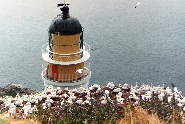
Bass Rock Lighthouse
Lighthouses · 0.1 km

Bass Rock Light
Lighthouses · 0.1 km

Bass Rock
Mountains & hills · 0.2 km
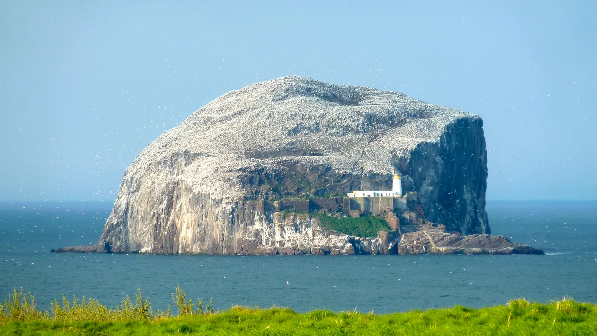
Bass Rock
Islands · 0.4 km

Harbour
Harbours & ports · 2.3 km
Douglas Tower
Natural landmarks · 2.3 km
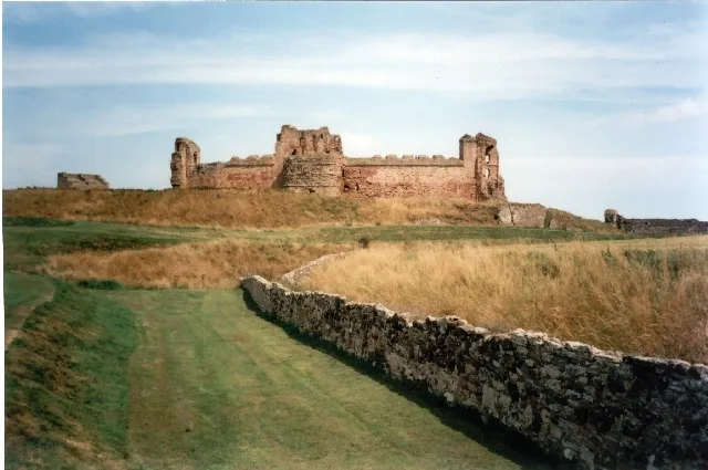
Tantallon Castle
Castles · 2.3 km

Oxroad Bay
Natural landmarks · 2.3 km

Outer gate
Natural landmarks · 2.4 km

Trench
Natural landmarks · 2.4 km

Auldhame
Vineyards · 2.5 km
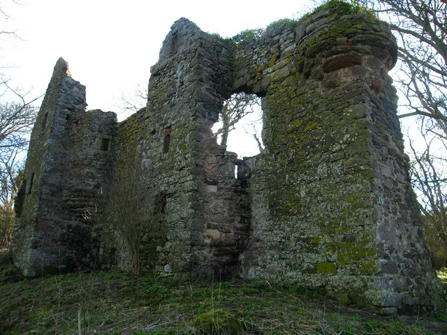
Auldhame Castle
Castles · 2.6 km
Nearby
📷 3Lighthouses · Central Scotland
Bass Rock Lighthouse
Bass Rock Lighthouse — lighthouse on Bass Rock, Scotland.
📷 5📷 5Mountains & hills · Central Scotland
Bass Rock
Bass Rock — mountain in scotland central. Elevation: 107 m.
Flagship📷 5Islands · Central Scotland
Bass Rock
Bass Rock — island in the east of Scotland.
📷 3Harbours & ports · Central Scotland
Harbour
Harbour — a other in scotland-central, United Kingdom.
📷 3Natural landmarks · Central Scotland
Douglas Tower
Douglas Tower — a other in scotland-central, United Kingdom.
Where to eat & stay near The Bass
Places to stay
 📷 5
📷 5Campsites · Central Scotland
Tantallon Caravan & Camping Park
Tantallon Caravan & Camping Park — a campsite in scotland central.
 📷 5
📷 5 📷 5
📷 5Caravan parks · Central Scotland
Gilsland Caravan Park
Gilsland Caravan Park — a caravan park in scotland central.
 📷 5
📷 5Caravan parks · Central Scotland
Yellowcraig Caravan & Motorhome Club Site
Yellowcraig Caravan & Motorhome Club Site — a caravan park in scotland central.
 📷 5
📷 5Caravan parks · Central Scotland
East Fortune Farm CL
East Fortune Farm CL — a caravan park in scotland central.
 📷 5
📷 5Caravan parks · Central Scotland
Station Park Caravan Site
Station Park Caravan Site — a caravan park in scotland central.
Places to eat & drink
 📷 5
📷 5Historic pubs · Central Scotland
The Crown & Kitchen
The Crown & Kitchen in Scotland Central, United Kingdom.
 📷 5
📷 5Historic pubs · Central Scotland
Gardner's Arms Public House, Market Street, Haddington
Gardner's Arms Public House, Market Street, Haddington in Scotland Central, United Kingdom.
 📷 7
📷 7Historic pubs · Central Scotland
12 Shore Street, Anstruther Easter
12 Shore Street, Anstruther Easter in Scotland Central, United Kingdom.
 📷 7
📷 7Historic pubs · Central Scotland
Railway Tavern, 14, 16 High Street West, Anstruther Wester
Railway Tavern, 14, 16 High Street West, Anstruther Wester in Scotland Central, United Kingdom.
 📷 7
📷 7Historic pubs · Central Scotland
Balcarres Arms Hotel, 59 Main Street, Colinsburgh
Balcarres Arms Hotel, 59 Main Street, Colinsburgh in Scotland Central, United Kingdom.
More castles in this region
 📷 3
📷 3 📷 5
📷 5 📷 4
📷 4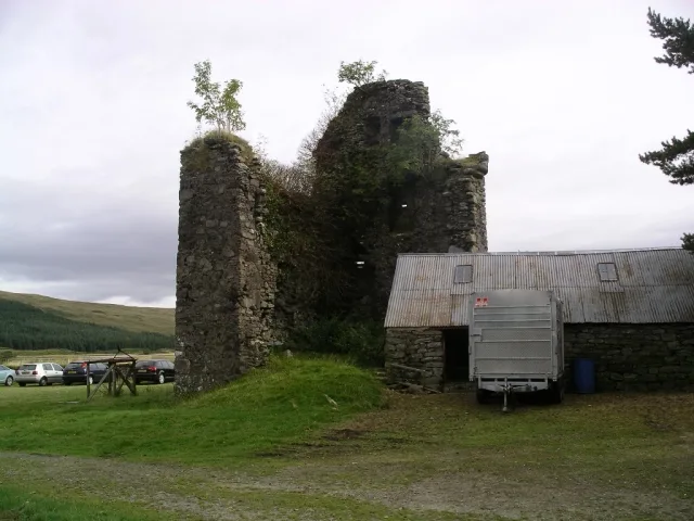 📷 3
📷 3Castles · Central Scotland
Achallader Castle
Achallader Castle — castle in Argyll and Bute, Scotland, UK.
Frequently asked questions
- Where is The Bass?
- The Bass is in central Scotland, United Kingdom.
- What is The Bass?
- The Bass — castle ruin on Bass Rock, East Lothian, Scotland, UK.
- How do I get to The Bass?
- The nearest railway station is North Berwick, about 6.0 km away. The nearest town is North Berwick. Its coordinates are 56.0766°, -2.6419°.
- Who owns The Bass?
- The Bass is owned by | controlledby =.
- Is The Bass a listed building?
- The Bass is officially recognised as scheduled monument listed.
- Does The Bass charge admission?
- The Bass typically charges admission. Check the official site for current ticket prices and opening hours.
- How do I get to The Bass?
- The nearest railway station is North Berwick, about 6.0 km away.