
Natural landmarks · South East England
The Ashcombe School
In or near Betchworth.
The Ashcombe School — a school heritage in england-london, United Kingdom.

Nigel Cox — CC BY-SA 2.0 via Wikimedia Commons licence

Plan your visit
- Typical visit
- 1 h–2 h
- Nearest railway station
- Dorking Deepdene · 0.4 km
- Free entry
- Dog-friendly
About
The Ashcombe School is a school heritage located in england-london, United Kingdom. Catalogued from Wikidata's UK heritage register; see the Wikipedia article for further historical and visitor details.
Photo gallery
Official information
The Ashcombe School is an educational institution located in Surrey, UK. It provides a range of academic programs and extracurricular activities for students.
Protected designations
- Area of Outstanding Natural Beauty: Surrey Hills
Designations sourced from Natural England open data under OGL v3.
Place summary
The Ashcombe School is an educational institution located in London. It is known for its comprehensive curriculum and commitment to academic excellence.
AI-generated from the structured facts on this page (operator, designation, listing, era). Not a substitute for visiting.
Background
History
The Ashcombe School was established in 1976, by the merger of Dorking County Grammar School and Mowbray School. The co-educational Dorking County Grammar School had been founded in 1931 with the Amalgamation of the Dorking High School for Boys (1884–1930) and St.Martin's Church Of England High School for Girls opened in 1903. Mowbray Secondary Modern School for Girls opened on an adjacent site in 1953. The schools were close enough to share the school kitchen. The Ashcombe School became a Specialist Language College in September 1998, allowing it to receive additional funding. It was featured in the Independent and the Guardian as a school that teaches Mandarin. Previously a community…
Sourced from Wikipedia under CC BY-SA 4.0.
- Coordinates
- 51.2387, -0.3295
- County
- Surrey
- District
- Mole Valley
- Parish
- Mole Valley, unparished area
- Postcode
- RH4 1LY
- Parliamentary constituency
- Dorking and Horley
- Established
- 1976
- Nearest railway station
- Dorking Deepdene — 0.4 km
- Official site
- www.ashcombe.surrey.sch.uk
Sources
- wikidata: Q7714656 (CC0)
- wikipedia: The Ashcombe School (CC BY-SA 4.0)
Other places nearby

Pippbrook Mill
Watermills · 0.3 km

Pippbrook House
Historic houses · 0.4 km

Thomas Cubitt
Public art & sculpture · 0.5 km
Ralph Vaughn Williams
Public art & sculpture · 0.5 km

Green Room Theatre
Open-air theatres · 0.5 km

Dorking Mosque
Historic churches · 0.5 km

Dorking Halls
Open-air theatres · 0.5 km
Dorking Halls
Theatres · 0.5 km

The Dorking Cockerel
Public art & sculpture · 0.6 km

Green Room Theatre
Theatres · 0.6 km

Surrey Yeoman House
Historic houses · 0.6 km
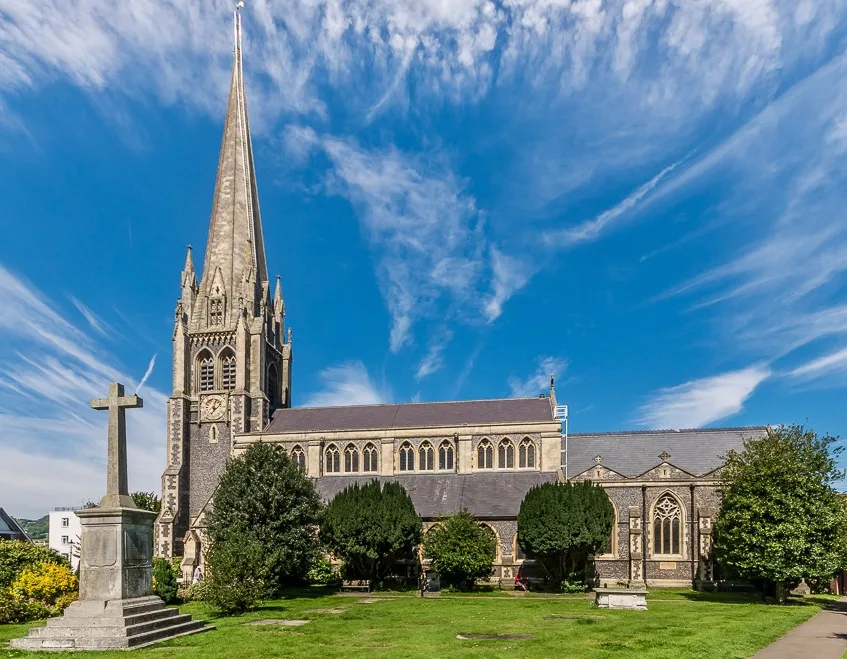
St Martin's Church, Dorking
Historic churches · 0.7 km
Nearby
📷 5Watermills · South East England
Pippbrook Mill
Pippbrook Mill is a watermill in the United Kingdom.
📷 5Historic houses · South East England
Pippbrook House
Pippbrook House — house in Dorking, Surrey, England, UK.
📷 5Public art & sculpture · South East England
Thomas Cubitt
Thomas Cubitt — a public art in england-london, United Kingdom.
📷 5Public art & sculpture · South East England
Ralph Vaughn Williams
Ralph Vaughn Williams — a public art in england-london, United Kingdom.
📷 5Open-air theatres · South East England
Green Room Theatre
Green Room Theatre — a open-air theatre in england london.
📷 5Historic churches · South East England
Dorking Mosque
Dorking Mosque — a church in england-london, United Kingdom.
Where to eat & stay near The Ashcombe School
Places to stay
 📷 5
📷 5Caravan parks · South East England
Conifer Park Caravan Site
Conifer Park Caravan Site — a caravan park in england london.
 📷 5
📷 5Campsites · South East England
Ranmore Common Campsite
Ranmore Common Campsite — a campsite in england london.
 📷 5
📷 5Campsites · South East England
Dorking Scouts Camp Site
Dorking Scouts Camp Site — a campsite in england london.
 📷 5
📷 5 📷 5
📷 5Hotels · South East England
Hartsfield Manor
Hartsfield Manor — a hotel in england london.
 📷 7
📷 7Places to eat & drink
 📷 7
📷 7 📷 7
📷 7Historic pubs · South East England
The Seven Stars Public House
The Seven Stars Public House in England South East, United Kingdom.
 📷 5
📷 5Historic pubs · South East England
The Windsor Castle Public House
The Windsor Castle Public House in England South East, United Kingdom.
 📷 5
📷 5 📷 5
📷 5Historic pubs · South East England
The Skimmington Castle Public House
The Skimmington Castle Public House in England South East, United Kingdom.
 📷 7
📷 7Historic pubs · South East England
Duke Of Wellington Public House
Duke Of Wellington Public House in England South East, United Kingdom.
More natural landmarks in this region
 📷 5
📷 5Natural landmarks · South East England
Queen Victoria Statue
Queen Victoria Statue — Public artwork (statue) by Victor Ferdinand Franz Eugen Gustaf Adolf Constantin Friedrich of Hohenlohe-Langenburg.
 📷 5
📷 5Natural landmarks · South East England
Silent Pool
Silent Pool — lake in the United Kingdom.
 📷 5
📷 5Natural landmarks · South East England
Thomas & Jane Holloway Statue
Thomas & Jane Holloway Statue — Public artwork (statue) by Victor Ferdinand Franz Eugen Gustaf Adolf Constantin Friedrich of Hohenlohe-Langenburg.
 📷 5
📷 5Natural landmarks · South East England
Polesden Lacey
Polesden Lacey — a other in england-london, United Kingdom.
Frequently asked questions
- Where is The Ashcombe School?
- The Ashcombe School is in Surrey, London, United Kingdom (postcode RH4 1LY), in the parish of Mole Valley, unparished area.
- What is The Ashcombe School?
- The Ashcombe School — a school heritage in england-london, United Kingdom.
- How do I get to The Ashcombe School?
- The nearest railway station is Dorking Deepdene, about 0.4 km away. Drivers can use postcode RH4 1LY.
- When was The Ashcombe School built?
- Built or established in 1976.
- Is The Ashcombe School a protected site?
- Yes — The Ashcombe School is part of the Surrey Hills National Landscape (AONB).
- Is The Ashcombe School free to visit?
- Yes, The Ashcombe School is free to enter.
- How do I get to The Ashcombe School?
- The nearest railway station is Dorking Deepdene, about 0.4 km away. Drivers can navigate to postcode RH4 1LY.