
Gardens · South East England
The Abbey, Storrington
In or near Washington.
The Abbey, Storrington — a garden in england-south-east, United Kingdom.

Slbs — CC BY-SA 2.0 via Wikimedia Commons licence

Plan your visit
- Typical visit
- 1 h–2.5 h
- Best time of year
- Spring & summer (Apr–Sep)
- Nearest railway station
- Cragside · 5.7 km
- Free entry
- Dog-friendly
Getting there & planning your visit
The Abbey in Storrington is located at postcode RH20 4LL and is accessible via the nearest railway station, Cragside, which is 5.7 km away. Entry to the garden is free.
About
The Abbey, Storrington is a garden of interest in england-south-east, United Kingdom — drawn from open-data sources for visitor reference. See the linked Wikipedia article for the full description.
Photo gallery
Summary from the official site
The Storrington and District Museum is dedicated to preserving the local history and heritage of the area. Visitors can explore various exhibits that showcase the past of Storrington and its surroundings.
Read more on the official property page.
From the Wikipedia article
St Joseph's Abbey (The Abbey), Storrington at Storrington in Sussex, England, was originally a rectory, later a small country house and then a convent school. It is an irregular five bay, two and three storey house built in 1871-2 by the Rev. George Faithfull in the Victorian Gothic style, reusing material from the 1621 rectory which was demolished at this time. In the 1880s it was the residence of Colonel Walter George Stirling, a baronet who had a pedigree herd of Jersey cattle. Successive tenants altered the house; in 1911 (semi-timbered work) and 1930 (brick range) when Colonel H. V. Ravenscroft added a billiard room and ballroom designed by John Leopold Denman. In 1953 the house became a Dominican convent and boarding school. The school closed in 1999. Inside, the oldest part of the building has the former Dining Room (now Chapel) with good quality 19th- century linenfold panelling and frieze, plastered ceiling with strapwork ribs and stained glass windows. The Drawing Room has early 18th-century panelling and a fireplace with engaged columns; and the former Library (currently Meeting Room) has a 16th-century stone fireplace. There is an elaborate oak main staircase with turned balusters and a painted well staircase with turned balusters and chamfered square newel posts with ball finials.
Excerpt from Wikipedia under CC BY-SA 4.0. See the source article linked in Sources below.
- Coordinates
- 50.9151, -0.4565
- County
- West Sussex
- District
- Horsham
- Parish
- Storrington and Sullington
- Postcode
- RH20 4LL
- Parliamentary constituency
- Arundel and South Downs
- Phone
- +44 190 374 0188
- Nearest railway station
- Cragside — 5.7 km
- Opening
- Wednesday 10am–4pm; Saturday 10am–4pm
- Official site
- storringtonmuseum.com
Sources
- wikidata: Q7712092 (CC0)
- wikipedia: The Abbey, Storrington (CC BY-SA 4.0)
Other places nearby

The Parish Church of St Mary the Virgin
Historic churches · 0.1 km

Storrington and District Museum
Museums · 0.1 km

Storrington
Museums · 0.3 km

The White Horse
Hotels · 0.3 km

Nifty Art Gallery
Galleries · 0.4 km

White Mill's burned remains
Archaeological sites · 1.2 km

Cootham
Museums · 1.3 km
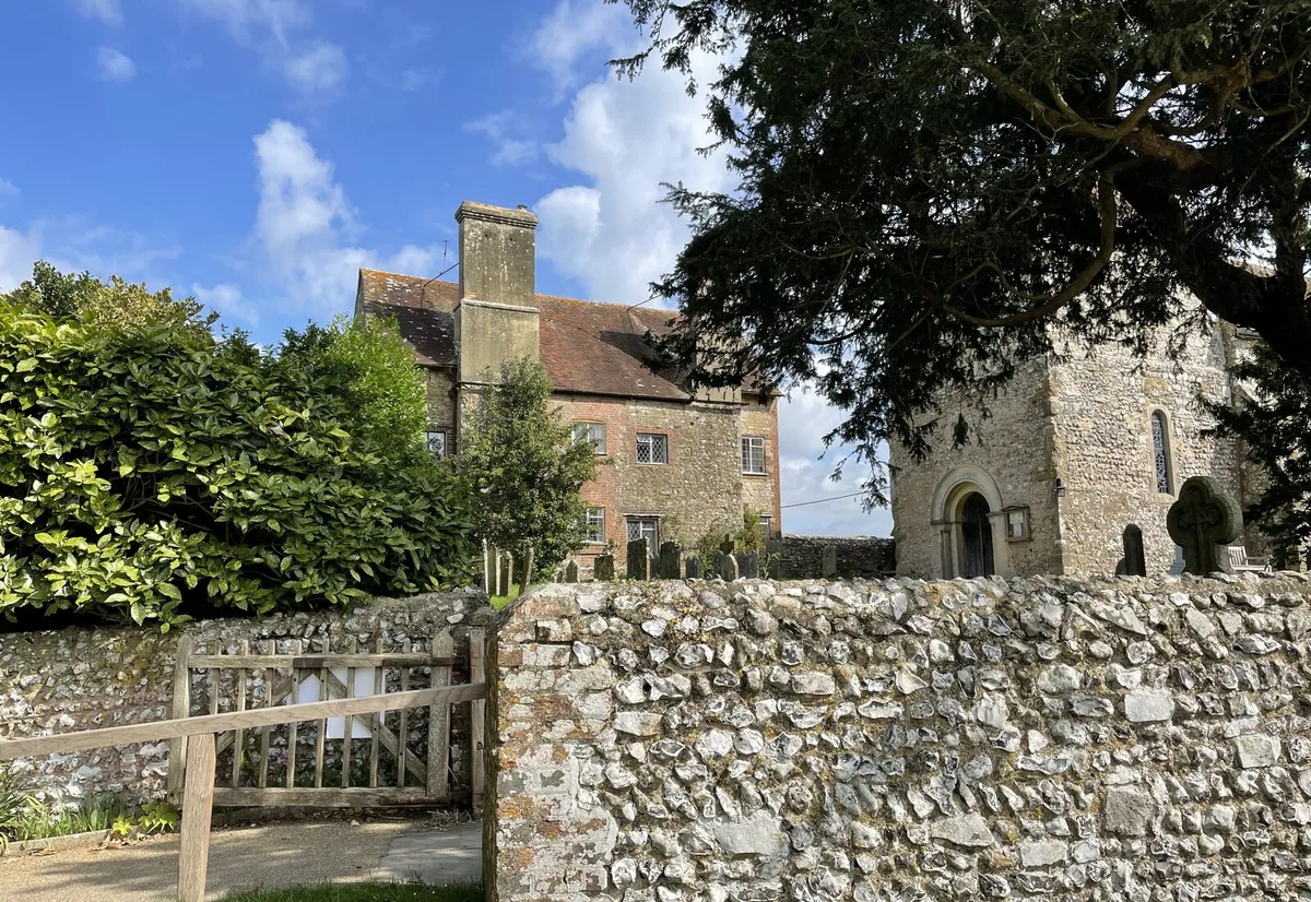
Sullington Manor
Stately homes · 1.5 km

Kithurst Hill
Mountains & hills · 1.5 km
Kithurst Hill
Mountains & hills · 1.5 km

Chantry Hill
Mountains & hills · 2.0 km

Sullington Hill
Mountains & hills · 2.1 km
Nearby
📷 5Historic churches · South East England
The Parish Church of St Mary the Virgin
The Parish Church of St Mary the Virgin — Grade II* listed building-listed church in england-south-east, United Kingdom.
📷 5Museums · South East England
Storrington and District Museum
Storrington and District Museum — a museum in england-south-east, United Kingdom.
📷 5Museums · South East England
Storrington
Storrington — a museum in england-south-east, United Kingdom.
📷 7📷 5Galleries · South East England
Nifty Art Gallery
Nifty Art Gallery — a gallery in england-south-east, United Kingdom.
📷 5Archaeological sites · South East England
White Mill's burned remains
White Mill's burned remains — a archaeological in england-south-east, United Kingdom.
Where to eat & stay near The Abbey, Storrington
Places to stay
📷 7 📷 5
📷 5Caravan parks · South East England
Washington Caravan & Camping Park
Washington Caravan & Camping Park — a caravan park in england south east.
 📷 5
📷 5Caravan parks · South East England
Wild Heart Hill Camp
Wild Heart Hill Camp — a caravan park in england south east.
 📷 6
📷 6 📷 5
📷 5 📷 5
📷 5Places to eat & drink
 📷 5
📷 5Historic pubs · South East England
The Frankland Arms Public House
The Frankland Arms Public House in England South East, United Kingdom.
 📷 5
📷 5Historic pubs · South East England
The Rising Sun Inn
The Rising Sun Inn in England South East, United Kingdom.
 📷 5
📷 5Historic pubs · South East England
The White Hart
The White Hart — Historic pub — listed building or notable heritage status.
 📷 5
📷 5Historic pubs · South East England
The Black Rabbit Public House
The Black Rabbit Public House in England South East, United Kingdom.
 📷 5
📷 5Historic pubs · South East England
The Star Public House
The Star Public House in England South East, United Kingdom.
 📷 7
📷 7Historic pubs · South East England
The Selsey Arms Public House
The Selsey Arms Public House in England South East, United Kingdom.
More gardens in this region
 📷 5
📷 5Gardens · South East England
Emmetts Garden
Emmetts Garden — Edwardian house and gardens at Ide Hill, Kent, England.
 📷 5
📷 5Gardens · South East England
Great Comp Garden
Great Comp Garden — garden in Comp, Kent, England, UK.
.jpg?width=1200) 📷 5
📷 5Gardens · South East England
Muslim Burial Ground, Horsell Common
Muslim Burial Ground, Horsell Common — former cemetery and current peace garden in Woking, Surrey, England, UK.
 📷 5
📷 5Gardens · South East England
Riverhill House
Riverhill House — country house in Sevenoaks Weald, Kent, England, UK.
Frequently asked questions
- Where is The Abbey, Storrington?
- The Abbey, Storrington is in West Sussex, South-East England, United Kingdom (postcode RH20 4LL), in the parish of Storrington and Sullington.
- What is The Abbey, Storrington?
- The Abbey, Storrington — a garden in england-south-east, United Kingdom.
- How do I get to The Abbey, Storrington?
- The nearest railway station is Cragside, about 5.7 km away. Drivers can use postcode RH20 4LL.
- Is The Abbey, Storrington free to visit?
- Yes, The Abbey, Storrington is free to enter.
- How do I get to The Abbey, Storrington?
- The nearest railway station is Cragside, about 5.7 km away. Drivers can navigate to postcode RH20 4LL.