
Forts · Scottish Highlands
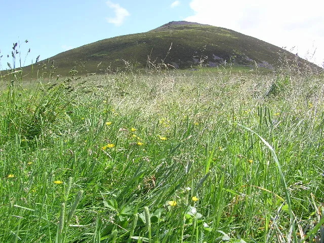
Tap o' Noth hill fort
In or near Kennethmont.
Tap o' Noth hill fort is a fort in the United Kingdom.

Wikimedia Commons contributors — see linked file page for photographer and licence licence

Plan your visit
- Typical visit
- 45 min–1.5 h
- Free entry
About
Tap o' Noth hill fort is a historic fort or fortified site in the United Kingdom. Coordinates: 57.3512°, -2.8584°. This entry is part of The Great Britain Guide, a free, ad-free, open-data tourist directory.
Photo gallery
Official information
Tap o' Noth is an ancient hill fort located in Aberdeenshire, Scotland. Visitors can enjoy a well-maintained path leading to the summit, which offers stunning views of the surrounding landscape and features a significant archaeological site.
From the Wikipedia article
The Tap o' Noth is a hill and the name of a hillfort on its summit, 8 miles south of Huntly in Aberdeenshire, Scotland at grid reference NJ485293. It is the second highest fort in Scotland and its main feature is its well-preserved vitrified wall which encloses an area of approximately 100 m by 30 m, 0.3 hectares. Archaeological finds from the site include a stone axe head dated to between c. 2000 BC– c.800 BC, and a decorated bronze rein-ring dated to the 1st–3rd century AD. The site has been designated a scheduled monument. The vitrified fort is the centre of a settlement within another rampart which encloses a much larger area of some 7 hectares. This outer rampart was constructed in the fifth to sixth centuries AD; large scale settlement within the area may date back as far as the third century AD, contemporary with the Pictish culture. The antiquarian James Macdonald led an archaeological excavation of the vitrified fort on the summit of Tap o' Noth in the 1880s. An archaeological investigation of the summit fort, the rampart of the larger later fort and some of the Pictish period house platforms within it was undertaken by the University of Aberdeen's Northern Picts: Rhynie Environs Project between 2017 and 2022. Drone photographs and lidar surveys suggest that there may have been as many as 800 huts, many in groups with a larger hut at the centre of the group. It has been described as the largest known settlement in early-Medieval (post-Roman) Britain. In the nearby valley, the Pictish image of Rhynie Man on a standing stone has been found on Barflat farm. A post-Roman settlement has been discovered in the valley, with evidence for the consumption of wine from the Mediterranean, the use of glass vessels from western France, and intensive metalwork production. This is interpreted as signs of high social status, possibly with royal connections.
Excerpt from Wikipedia under CC BY-SA 4.0. See the source article linked in Sources below.
- Coordinates
- 57.3512, -2.8584
- District
- Aberdeenshire
- Postcode
- AB54 4HH
- Parliamentary constituency
- Gordon and Buchan
- Official site
- www.hill-bagging.co.uk
Sources
- osm: w27281461 (ODbL)
- wikipedia: Tap o' Noth (CC BY-SA 4.0)
- commons: Tap o' Noth - geograph.org.uk - 93164.jpg (CC BY-SA 4.0)
Other places nearby
Tap o' Noth
Hill forts · 0.0 km
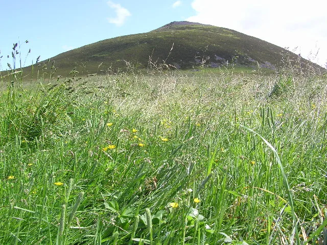
Tap o' Noth
Mountains & hills · 0.1 km

Hill of Noth
Mountains & hills · 1.6 km

Lesmoir Castle
Castles · 1.8 km

Cat Craigs
Mountains & hills · 1.9 km
Hill of Noth
Mountains & hills · 1.9 km

Garrach Knowe
Mountains & hills · 2.1 km

The Peirk
Mountains & hills · 2.2 km

Hill of Oldmerdrum
Mountains & hills · 2.4 km

Mill of Noth, standing stones 150m ENE of
Windmills · 2.4 km

Old Merdrum
Mountains & hills · 2.4 km

Rhynie Parish Church, The Square, Rhynie
Historic churches · 2.5 km
Nearby
📷 3Hill forts · Scottish Highlands
Tap o' Noth
Tap o' Noth — hillfort in Aberdeenshire, Scotland, UK.
📷 3Mountains & hills · Scottish Highlands
Tap o' Noth
Tap o' Noth — Named summit at 562 m.
📷 5Mountains & hills · Scottish Highlands
Hill of Noth
Hill of Noth — a hill or mountain in scotland highlands.
📷 3Castles · Scottish Highlands
Lesmoir Castle
Lesmoir Castle — 16th-century castle near Rhynie, Aberdeenshire, Scotland, UK.
📷 5Mountains & hills · Scottish Highlands
Cat Craigs
Cat Craigs — a hill or mountain in scotland highlands.
📷 5Mountains & hills · Scottish Highlands
Hill of Noth
Hill of Noth — mountain in scotland highlands. Elevation: 523 m.
Where to eat & stay near Tap o' Noth hill fort
Places to stay
 📷 5
📷 5Caravan parks · Scottish Highlands
Huntly Castle Caravan Park
Huntly Castle Caravan Park — a caravan park in scotland highlands.
 📷 5
📷 5Campsites · Scottish Highlands
Haughton House Park Campsite
Haughton House Park Campsite — a campsite in scotland highlands.
 📷 5
📷 5Campsites · Scottish Highlands
Cairgorns Glamping Riverside
Cairgorns Glamping Riverside — a campsite in scotland highlands.
📷 5Campsites · Scottish Highlands
Cairgorns Camping
Cairgorns Camping — a campsite in scotland highlands.
 📷 3
📷 3Campsites · Scottish Highlands
Aberlour Gardens Camping Park
Aberlour Gardens Camping Park — a campsite in scotland highlands.
 📷 5
📷 5Caravan parks · Scottish Highlands
Tarland Camping and Caravanning Club
Tarland Camping and Caravanning Club — a caravan park in scotland highlands.
Places to eat & drink
 📷 5
📷 5Historic pubs · Scottish Highlands
Forbes Arms Hotel, Milltown of Rothiemay
Forbes Arms Hotel, Milltown of Rothiemay in Scotland Highlands, United Kingdom.
 📷 5
📷 5Historic pubs · Scottish Highlands
Seafield Arms Hotel, 84, 86 Mid Street, Keith
Seafield Arms Hotel, 84, 86 Mid Street, Keith in Scotland Highlands, United Kingdom.
 📷 7
📷 7Historic pubs · Scottish Highlands
Grant Arms Hotel, The Square, Monymusk
Grant Arms Hotel, The Square, Monymusk in Scotland Highlands, United Kingdom.
More forts in this region
 📷 3
📷 3 📷 3
📷 3 📷 3
📷 3 📷 5
📷 5Forts · Scottish Highlands
Battle of Alltacoilcachan A.D. 1594
Battle of Alltacoilcachan A.D. 1594 is a fort in the United Kingdom.
Frequently asked questions
- Where is Tap o' Noth hill fort?
- Tap o' Noth hill fort is in the Scottish Highlands, United Kingdom (postcode AB54 4HH).
- What is Tap o' Noth hill fort?
- Tap o' Noth hill fort is a fort in the United Kingdom.
- How do I get to Tap o' Noth hill fort?
- The nearest town is Kennethmont. Drivers can use postcode AB54 4HH.
- Is Tap o' Noth hill fort free to visit?
- Yes, Tap o' Noth hill fort is free to enter.
- How do I get to Tap o' Noth hill fort?
- Drivers can navigate to postcode AB54 4HH. It sits within the Gordon and Buchan parliamentary constituency.