
Historic bridges · East Midlands
Tamworth Road Bridge (Spc6 19)
In or near Sawley.
Tamworth Road Bridge (Spc6 19) — Grade II listed building-listed bridge in england-east-midlands, United Kingdom.

Roy Hughes — CC BY-SA 2.0 via Wikimedia Commons licence

Plan your visit
- Typical visit
- 15 min–30 min
- Nearest railway station
- Long Eaton · 0.1 km
- Free entry
- Dog-friendly
- Limited wheelchair access
Getting there & planning your visit
Tamworth Road Bridge is located in Erewash, Derbyshire, with the postcode NG10 3GL. The nearest railway station is Long Eaton, just 0.1 km away. Entry is free, but wheelchair accessibility is limited.
About
Tamworth Road Bridge (Spc6 19) is a Grade II listed building-listed bridge in england-east-midlands, United Kingdom, registered on the National Heritage List for England (NHLE entry 1417676). Listed status protects buildings and structures of special architectural or historic interest. See the linked Wikipedia article for further details.
Photo gallery
See it from the streetimagery from 2022
Imagery © Mapillary contributors, CC BY-SA 4.0
Heritage listing
Details A single-span skew underbridge, built 1837-38 for the Midland Counties Railway to the design of Charles Blacker Vignoles, with a subsidiary span in the low mileage (east) wing walls, reconstructed in 2005. MATERIALS: coursed and squared sandstone walling with ashlar dressings. DESCRIPTION: Tamworth Road Bridge carries the east-west railway over the north-south Tamworth Road. Due to the skew of the bridge the north-east and south-west wing walls are longer and more pronounced than the one to the north-west (the south-east wing wall does not survive). The bridge has a single segmental arch of rusticated V-channelled punched voussoirs with tooled margins. The soffit is skew set, with V-channelled banded rustication springing from serrated and tooled impost bands. Beneath the impost bands are four rusticated V-channelled punched courses with tooled margins. The imposts curve around to terminate at the abutments, merging with the voussoirs above. The spandrels of the arch are formed of coursed and punched stones with tooled margins. Above is a tooled string course with a chamfered upper edge. The parapet comprises two courses of picked ashlar with tooled margins surmounted by tooled coping stones with a chamfered upper edge. On top of the coping are C20 steel railings. Below the string course, the abutments project with a concave rake. The abutment walling is V-channelled banded rustication, punched with tooled margins. These abutments curve to terminate in projecting piers, which have tooled parapet courses. On the high mileage (west) side of the bridge, the string course carries through to become the coping of the splayed, quarry-faced wing walls. These begin at the projecting piers with slight concave rakes, but straighten out to terminate in low end piers. The lo
From the Historic England List Entry under OGL v3.
Place summary
Tamworth Road Bridge is a Grade II listed bridge located in the East Midlands. It is notable for its architectural significance and historical value within the region.
AI-generated from the structured facts on this page (operator, designation, listing, era). Not a substitute for visiting.
- Coordinates
- 52.8849, -1.2864
- County
- Derbyshire
- District
- Erewash
- Parish
- Sawley
- Postcode
- NG10 3GL
- Parliamentary constituency
- Erewash
- Nearest railway station
- Long Eaton — 0.1 km
Sources
- wikidata: Q26676604 (CC0)
Other places nearby

Long Eaton Canal Bridge
Historic bridges · 0.5 km

The Long Eaton School
Natural landmarks · 0.7 km

Sawley War Memorial
Memorials & monuments · 0.8 km

Sawley
Villages · 1.0 km

The Great War
Memorials & monuments · 1.2 km

Sawley
Towns & cities · 1.2 km
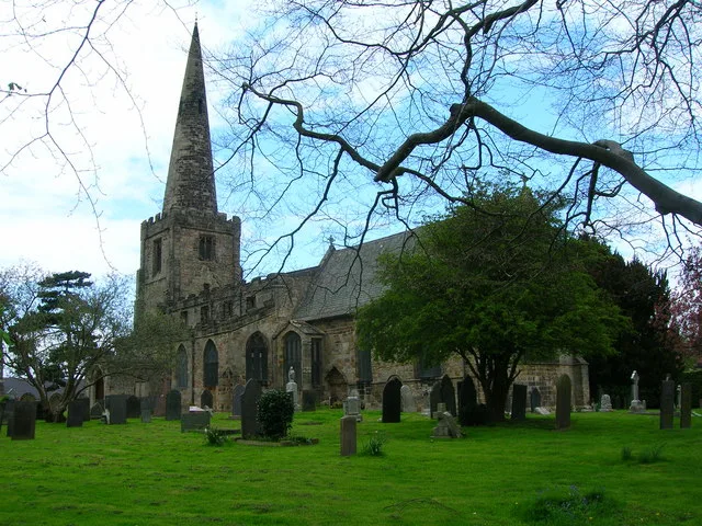
All Saints' Church, Sawley
Abbeys & priories · 1.3 km

All Saints' Church, Sawley
Cathedrals · 1.3 km

Sawley Railway Viaduct
Historic bridges · 1.3 km

Harrington Bridge
Historic bridges · 1.3 km

Dorothy Gee
Memorials & monuments · 1.4 km
Harrington Bridge
Historic bridges · 1.4 km
Nearby
📷 3Historic bridges · East Midlands
Long Eaton Canal Bridge
Long Eaton Canal Bridge is a historic bridge in the United Kingdom.
📷 5Natural landmarks · East Midlands
The Long Eaton School
The Long Eaton School — a school heritage in england-east-midlands, United Kingdom.
📷 3Memorials & monuments · East Midlands
Sawley War Memorial
Sawley War Memorial is a memorial in the United Kingdom.
📷 5📷 3Memorials & monuments · East Midlands
The Great War
The Great War — a memorial in england-east-midlands, United Kingdom.
📷 5Towns & cities · East Midlands
Sawley
Sawley — village and civil parish in Erewash District, Derbyshire, England.
Where to eat & stay near Tamworth Road Bridge (Spc6 19)
Places to stay
 📷 5
📷 5Caravan parks · East Midlands
Manor Farm Caravan Site
Manor Farm Caravan Site — a caravan park in england east midlands.
 📷 5
📷 5Caravan parks · East Midlands
Shardlow Caravan Park
Shardlow Caravan Park — a caravan park in england east midlands.
 📷 5
📷 5Hotels · East Midlands
Hilton East Midlands Airport
Hilton East Midlands Airport — a hotel in england east midlands. 4-star. Brand: Hilton.
 📷 5
📷 5Campsites · East Midlands
Meadow View Glamping
Meadow View Glamping — a campsite in england east midlands.
 📷 7
📷 7Hotels · East Midlands
Donington Manor Hotel
Donington Manor Hotel — a hotel in england east midlands.
 📷 5
📷 5Caravan parks · East Midlands
Beechwood Park
Beechwood Park — a caravan park in england east midlands.
Places to eat & drink
 📷 7
📷 7 📷 5
📷 5Restaurants · East Midlands
Restaurant Sat Bains
Restaurant Sat Bains — a restaurant in england east midlands.
 📷 5
📷 5 📷 7
📷 7 📷 5
📷 5Historic pubs · East Midlands
Hardinge Arms
Hardinge Arms in England East Midlands, United Kingdom.
 📷 7
📷 7Other works by Charles Blacker Vignoles
 📷 3
📷 3Historic bridges · East Midlands
Nooning Lane Bridge (SPC6/12)
Nooning Lane Bridge (SPC6/12) — Grade II listed building-listed bridge in england-east-midlands, United Kingdom.
More bridges in this region
 📷 5
📷 5Historic bridges · East Midlands
Mill Race Bridge To Market Deeping Mill
Mill Race Bridge To Market Deeping Mill — Grade II listed building-listed bridge in england-london, United Kingdom.
 📷 5
📷 5Historic bridges · East Midlands
Bridge Over West Glen River
Bridge Over West Glen River — Grade II listed building-listed bridge in england-london, United Kingdom.
 📷 5
📷 5Historic bridges · East Midlands
Bridge And Sluices
Bridge And Sluices — Grade II listed building-listed bridge in england-london, United Kingdom.
 📷 5
📷 5Historic bridges · East Midlands
Bridge Over River Gwash
Bridge Over River Gwash — Grade II listed building-listed bridge in england-london, United Kingdom.
Frequently asked questions
- Where is Tamworth Road Bridge (Spc6 19)?
- Tamworth Road Bridge (Spc6 19) is in Derbyshire, the East Midlands, United Kingdom (postcode NG10 3GL), in the parish of Sawley.
- What is Tamworth Road Bridge (Spc6 19)?
- Tamworth Road Bridge (Spc6 19) — Grade II listed building-listed bridge in england-east-midlands, United Kingdom.
- How do I get to Tamworth Road Bridge (Spc6 19)?
- The nearest railway station is Long Eaton, about 0.1 km away. Drivers can use postcode NG10 3GL.
- Is Tamworth Road Bridge (Spc6 19) a listed building?
- Tamworth Road Bridge (Spc6 19) is officially recognised as Grade II listed building listed.
- Is Tamworth Road Bridge (Spc6 19) free to visit?
- Yes, Tamworth Road Bridge (Spc6 19) is free to enter.
- How do I get to Tamworth Road Bridge (Spc6 19)?
- The nearest railway station is Long Eaton, about 0.1 km away. Drivers can navigate to postcode NG10 3GL.