
Historic houses · South East England
Synyards
In or near Otham.
Synyards — a Grade I-listed historic house in england-london, United Kingdom.

Michael Dibb — CC BY-SA 2.0 via Wikimedia Commons licence
_-_geograph.org.uk_-_7078464.jpg)
Plan your visit
- Typical visit
- 1 h–2 h
- Nearest railway station
- Bearsted · 3.0 km
- Paid entry
- Family-friendly
- Limited wheelchair access
Getting there & planning your visit
To visit Synyards, the nearest railway station is Bearsted, located 3 km away. The postcode for sat-nav is ME15 8RL. Please note that entry is paid and wheelchair accessibility is limited.
About
Synyards is a Grade I-listed building in england-london, United Kingdom. Grade I status is conferred by Historic England (or Cadw, Historic Environment Scotland or NIEA equivalents) on buildings of exceptional national interest. See the linked Wikipedia article for full historical and architectural details.
Photo gallery
See it from the streetimagery from 2025
Imagery © Mapillary contributors, CC BY-SA 4.0
Summary from the official site
Stoneacre is a beautifully restored medieval yeoman's house from the 15th century, showcasing a great hall and surrounded by attractive gardens and orchards. Visitors can explore the house's historical rooms and enjoy scenic woodland walks in the Otham Valley.
Read more on the official property page.
Protected designations
- Area of Outstanding Natural Beauty: Kent Downs
Designations sourced from Natural England open data under OGL v3.
From the Wikipedia article
Synyards is a late 15th-century house in Otham, Kent. The house was built in the late 15th century with additions in the 16th century and in 1663. It is a mostly two-storey timber-framed hall house with a steeply pitched plain tile hipped roof. The house has a jettied bays on each end of the main western elevation with a gabled dormer bay to the right of the midpoint which is dated 1663. A first floor was inserted at each end of the building in the 16th century and the third floor at the south end was added when the dormer was constructed. A variety of window sizes and types from various periods provide illumination to the interior. The walls on the ground floor have 16th century panelling in some parts and wall paintings of a lion and dragon and merman and mermaid cover the walls of the room in the north end of the first floor. Synyards was restored in 1905 by P. M. Johnston. The house is a Grade I listed building.
Excerpt from Wikipedia under CC BY-SA 4.0. See the source article linked in Sources below.
- Coordinates
- 51.2489, 0.5740
- County
- Kent
- District
- Maidstone
- Parish
- Otham
- Postcode
- ME15 8RL
- Parliamentary constituency
- Faversham and Mid Kent
- Nearest railway station
- Bearsted — 3 km
- Opening
- Select weekends 11 Apr 2026 – 20 Sep 2026; last entry 3:30pm
- Official site
- www.nationaltrust.org.uk
Sources
Other places nearby

Stoneacre
Natural landmarks · 0.4 km
Stoneacre, Kent
Museums · 0.4 km

Otham
Towns & cities · 0.5 km

Senacre Technology College
Natural landmarks · 1.1 km
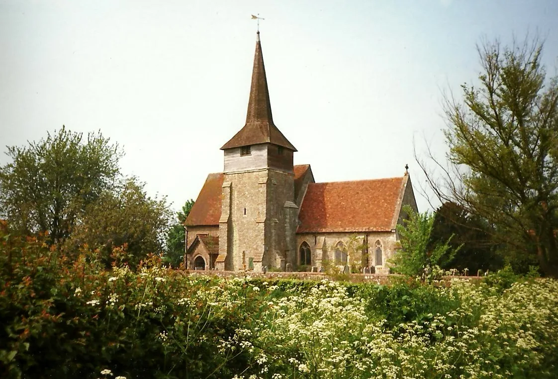
St Nicholas's Church, Otham
Historic churches · 1.3 km

Bridge At Fulling Mill Farm To North West Of Farmhouse
Historic bridges · 1.7 km

Langley
Villages · 1.9 km

Milgate House
Historic houses · 1.9 km

Shepway
Towns & cities · 2.0 km

Leeds, Kent
Museums · 2.3 km

Leeds
Villages · 2.3 km
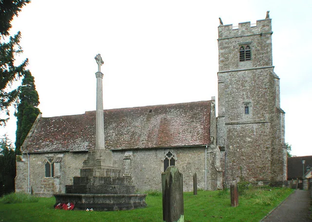
Holy Cross Church, Bearsted
Historic churches · 2.4 km
Nearby
📷 5Natural landmarks · South East England
Stoneacre
Stoneacre — a other in england-london, United Kingdom.
📷 5Museums · South East England
Stoneacre, Kent
Stoneacre, Kent — a museum in england-london, United Kingdom.
📷 5Towns & cities · South East England
Otham
Otham — village in Kent, England, UK.
📷 5Natural landmarks · South East England
Senacre Technology College
Senacre Technology College — a school heritage in england-london, United Kingdom.
📷 5Historic churches · South East England
St Nicholas's Church, Otham
St Nicholas's Church, Otham — Grade I listed church in Otham, Kent, England, UK.
📷 5Historic bridges · South East England
Bridge At Fulling Mill Farm To North West Of Farmhouse
Bridge At Fulling Mill Farm To North West Of Farmhouse — Grade II listed building-listed bridge in england-london, United Kingdom.
Where to eat & stay near Synyards
Places to stay
 📷 5
📷 5Caravan parks · South East England
Bearsted Caravan And Motorhome Club Site
Bearsted Caravan And Motorhome Club Site — a caravan park in england south east.
 📷 5
📷 5Campsites · South East England
Hamlet Wood Scout Campsite
Hamlet Wood Scout Campsite — a campsite in england london. Brand: The Scout Association.
 📷 5
📷 5Campsites · South East England
Coldblow Farm
Coldblow Farm — a campsite in england south east.
 📷 5
📷 5Caravan parks · South East England
Oak View Caravan Park
Oak View Caravan Park — a caravan park in england london.
 📷 5
📷 5Campsites · South East England
Lower Grange Farm Scout Activity Centre
Lower Grange Farm Scout Activity Centre — a campsite in england london.
 📷 5
📷 5Campsites · South East England
Adventurers Sun Club
Adventurers Sun Club — a campsite in england south east.
Places to eat & drink
 📷 7
📷 7Historic pubs · South East England
The Windmill Public House
The Windmill Public House in England South East, United Kingdom.
 📷 7
📷 7Historic pubs · South East England
The Park Gate Inn
The Park Gate Inn in England South East, United Kingdom.
 📷 6
📷 6Historic pubs · South East England
Ye Olde Thirsty Pig
Ye Olde Thirsty Pig in England South East, United Kingdom.
 📷 5
📷 5 📷 5
📷 5Historic pubs · South East England
The Mitre Public House
The Mitre Public House in England South East, United Kingdom.
 📷 5
📷 5Historic pubs · South East England
The Royal Albion Inn
The Royal Albion Inn in England South East, United Kingdom.
More historic houses in this region
 📷 5
📷 5Historic houses · South East England
12 and 14 High Street, Rochester
12 and 14 High Street, Rochester — building in Rochester, Kent, England, UK.
 📷 5
📷 5Historic houses · South East England
Berkeley House
Berkeley House — house in Rochester, Kent, England, UK.
.jpg?width=1200) 📷 5
📷 5Historic houses · South East England
Betchworth House
Betchworth House — house in Betchworth, Mole Valley, England, UK.
 📷 5
📷 5Historic houses · South East England
Bookham Grove
Bookham Grove — building in Mole Valley, Surrey, England, UK.
Frequently asked questions
- Where is Synyards?
- Synyards is in Kent, London, United Kingdom (postcode ME15 8RL), in the parish of Otham.
- What is Synyards?
- Synyards — a Grade I-listed historic house in england-london, United Kingdom.
- How do I get to Synyards?
- The nearest railway station is Bearsted, about 3.0 km away. Drivers can use postcode ME15 8RL.
- Is Synyards a listed building?
- Synyards is officially recognised as Grade I listed.
- Is Synyards a protected site?
- Yes — Synyards is part of the Kent Downs National Landscape (AONB).
- How do I get to Synyards?
- The nearest railway station is Bearsted, about 3.0 km away. Drivers can navigate to postcode ME15 8RL.