
Caves · North West England
Swinsto Hole
In or near Ingleton.
Swinsto Hole is a cave in the United Kingdom.

Wikimedia Commons licence
Plan your visit
- Typical visit
- 45 min–1.5 h
- Nearest railway station
- Ribblehead · 7.3 km
- Free entry
- Dog-friendly
Getting there & planning your visit
Swinsto Hole is located in North West England, approximately 7.3 km from Ribblehead railway station. Admission is free. There are no further details on accessibility provided.
About
Swinsto Hole is a named cave entrance in the United Kingdom. Admission is free. Coordinates: 54.1927°, -2.4707°. This entry is part of The Great Britain Guide, a free, ad-free, open-data tourist directory.
Photo gallery
Protected designations
- Site of Special Scientific Interest: Whernside SSSI
Designations sourced from Natural England open data under OGL v3.
From the Wikipedia article
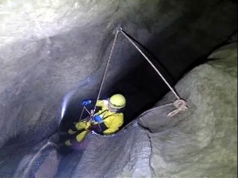
Swinsto Cave is a limestone cave in West Kingsdale, North Yorkshire, England. It leads into Kingsdale Master Cave and it is popular with cavers as it is possible to descend by abseiling down the pitches, retrieving the rope each time, and exiting through Valley Entrance of Kingsdale Master Cave at the base of the hill. It is part of a 27-kilometre (17 mi) long cave system that drains both flanks of Kingsdale.
Excerpt from Wikipedia under CC BY-SA 4.0. See the source article linked in Sources below.
Background
History
The first mention of the cave is by Balderstone in Ingleton Bygone and Present, published in 1890, where he accurately describes how it is possible to traverse the cave for 33 yards before encountering "a deep wide hole, with high vaulted roof, fine cone-like stalactites, and waterfall thirty feet high". In 1908 a party from the Yorkshire Ramblers Club descended the pitch and explored the way on for about 90 m before turning back when the route ahead became low and wet. The baton was not picked up for over 20 years, but in 1930 a party from the Gritstone Club finally reached the bottom after a long siege lasting a year and many trips, the key to their success being the lowering of water…
Description
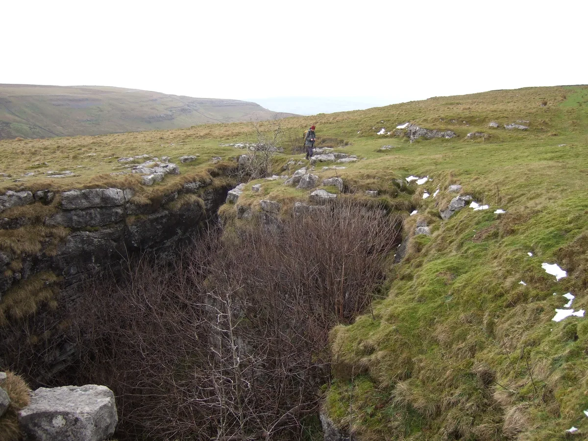
The entrance is in a shakehole, and enters a small active stream passage. This soon enlarges to walking size before reaching a 6 m pitch with water entering from one side. Below a 234 m long passage (The Long Crawl) which has some flat-out wet sections, leads to a short second pitch. Below this a succession of three pitches rapidly descends to a spray-lashed chamber. A little beyond here the 143 m long Turbary Inlet enters from the right. At the end of this an excavated rift leads up into McShea Chamber in Turbary Pot, an alternative entrance. The main passage continues, descending a number of cascades and a further two small pitches, before entering a larger area where the water from…
Sourced from Wikipedia under CC BY-SA 4.0.
- Coordinates
- 54.1927, -2.4707
- Address
- Kingsdale, North Yorkshire
- Nearest railway station
- Ribblehead — 7.3 km
Sources
- osm: n8589168377 (ODbL)
- wikipedia: Swinsto Cave (CC BY-SA 4.0)
Other places nearby

Swinsto South
Caves · 0.1 km

Turbary Pot
Caves · 0.1 km
Turbary Pot
Caves · 0.1 km
Simpson Pot
Mountains & hills · 0.4 km

Simpson Pot
Caves · 0.5 km

Valley Entrance
Caves · 0.5 km

Rowten Cave
Caves · 0.6 km

Rowten Pot (Eyehole Entrance)
Caves · 0.6 km
Rowten Pot
Mountains & hills · 0.6 km

Rowten Pot
Caves · 0.7 km

Kail Pot
Caves · 0.9 km

The Mohole
Caves · 0.9 km
Nearby
📷 5Caves · North West England
Swinsto South
Swinsto South — a cave broad in england-north-west, United Kingdom.
📷 5📷 5Caves · North West England
Turbary Pot
Turbary Pot — a cave broad in england-north-west, United Kingdom.
📷 3Mountains & hills · North West England
Simpson Pot
Simpson Pot — cave in North Yorkshire, England.
📷 3📷 3Where to eat & stay near Swinsto Hole
Places to stay
 📷 5
📷 5Hostels · North West England
Ingleton Youth Hostel
Ingleton Youth Hostel — a hostel in england north west.
 📷 5
📷 5 📷 5
📷 5Campsites · North West England
Meadow Falls
Meadow Falls — a campsite in england north west.
 📷 5
📷 5Caravan parks · North West England
Thornbrook Barn Caravan Site
Thornbrook Barn Caravan Site — a caravan park in england north west.
 📷 5
📷 5Caravan parks · North West England
The Trees Holiday Home Park
The Trees Holiday Home Park — a caravan park in england north west.
 📷 5
📷 5Caravan parks · North West England
Holme Head Caravan Park
Holme Head Caravan Park — a caravan park in england north west.
Places to eat & drink
 📷 5
📷 5Historic pubs · North West England
Punch Bowl Hotel
Punch Bowl Hotel in England North West, United Kingdom.
 📷 5
📷 5Historic pubs · North West England
Horse And Farrier Inn
Horse And Farrier Inn in England North West, United Kingdom.
 📷 5
📷 5 📷 5
📷 5Cafés · North West England
Lakehouse Food & Drink
Lakehouse Food & Drink — a café in england north west.
 📷 5
📷 5Restaurants · North West England
The Game Cock Inn
The Game Cock Inn — a restaurant in england north west. Cuisine: french;english.
 📷 5
📷 5Cafés · North West England
Gun Dog Coffee Shop
Gun Dog Coffee Shop — a café in england north west.
More caves in this region
 📷 3
📷 3 📷 3
📷 3 📷 3
📷 3 📷 3
📷 3Caves · North West England
Austwick Beck Head
Austwick Beck Head is a cave in the United Kingdom.
Frequently asked questions
- Where is Swinsto Hole?
- Swinsto Hole is in North-West England, United Kingdom.
- What is Swinsto Hole?
- Swinsto Hole is a cave in the United Kingdom.
- How do I get to Swinsto Hole?
- The nearest railway station is Ribblehead, about 7.3 km away. Its coordinates are 54.1927°, -2.4707°.
- Is Swinsto Hole a protected site?
- Yes — Swinsto Hole is part of the Whernside SSSI Site of Special Scientific Interest.
- Is Swinsto Hole free to visit?
- Yes, Swinsto Hole is free to enter.
- How do I get to Swinsto Hole?
- The nearest railway station is Ribblehead, about 7.3 km away.