
Historic bridges · South East England
Swing Bridge Over River Ouse
In or near Southease.
Swing Bridge Over River Ouse — Grade II listed building-listed bridge in england-south-east, United Kingdom.

Mat Fascione — CC BY-SA 2.0 via Wikimedia Commons licence

Plan your visit
- Typical visit
- 15 min–30 min
- Nearest railway station
- Southease · 0.3 km
- Free entry
- Dog-friendly
Getting there & planning your visit
To visit the Swing Bridge Over River Ouse, the nearest railway station is Southease, located 0.3 km away. Entry to the bridge is free. The postcode for sat-nav is BN7 3HX.
About
Swing Bridge Over River Ouse is a Grade II listed building-listed bridge in england-south-east, United Kingdom, registered on the National Heritage List for England (NHLE entry 1393389). Listed status protects buildings and structures of special architectural or historic interest. See the linked Wikipedia article for further details.
Photo gallery
Heritage listing
Details SOUTHEASE 946/0/10050 SWING BRIDGE OVER RIVER OUSE 24-JUL-09 II SOUTHEASE 946/0/10050 Swing bridge over River Ouse 24-JUL-09 II Swing bridge. 1880, designed in 1878, by Henry E Wallis (CE) of Westminster, and constructed by Shaw & Co., with C20 timber replacement and safety additions. HISTORY The River Ouse south of Lewes was canalised between 1791 and 1795, to create the Lower Ouse Navigation, designed by William Jessop and supervised by Cater Rand, a Lewes schoolmaster and civil engineer (Brent 1993). This work cut off a lengthy meander of the river between Itford and Durham Farms, and severed farmland, necessitating statutory provision of a bridge across the new canal at Southease. The current structure, which replaces an earlier bridge approximately 10m upstream, dates from 1880 and incorporated a swing span to permit the passage of masted vessels. The bridge was fixed in position in 1988, under parliamentary powers, to prevent large vessels sailing further up river. However, the pivot table is still in position. DESCRIPTION The bridge is a three-span structure, formed of wrought-iron bowstring trusses, 3.62m apart, with a total length between abutments of 43.2m. The western span of 13.8m is fixed and the remaining two spans, of 29.4m, centrally pivot to allow larger vessels passage. The ends of the bridge are carried on brick abutments with curved wing walls having projecting piers in red brick in English bond with stone copings. The embankments, the top of which are 6m wide and with a side profile of 1:1, were constructed at an incline of 1:20. The top of the embankments (and therefore the top of the bridge deck) was designed to be 2.75m above high water. The two intermediate piers, both constructed in the waterway, are formed of groups of cast-iron column
From the Historic England List Entry under OGL v3.
Protected designations
- Site of Special Scientific Interest: Lewes Brooks SSSI
Designations sourced from Natural England open data under OGL v3.
Place summary
The Swing Bridge Over River Ouse is a Grade II listed bridge located in South-East England. It is notable for its functional design and historical significance within the region.
AI-generated from the structured facts on this page (operator, designation, listing, era). Not a substitute for visiting.
- Coordinates
- 50.8300, 0.0261
- County
- East Sussex
- District
- Lewes
- Parish
- Southease
- Postcode
- BN7 3HX
- Parliamentary constituency
- Lewes
- Nearest railway station
- Southease — 0.3 km
Sources
- wikidata: Q26672555 (CC0)
Other places nearby

Southease
Towns & cities · 0.4 km

YHA South Downs
Campsites · 0.5 km

YHA South Downs
Hostels · 0.6 km

Rodmell House
B&Bs · 1.1 km

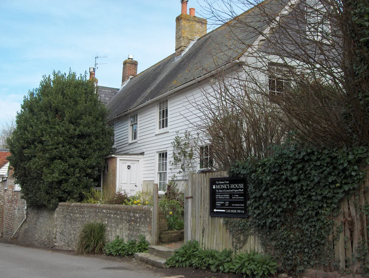
Monk's House
Historic houses · 1.2 km

Itford Hill
Mountains & hills · 1.3 km

Spider Bench
Natural landmarks · 1.5 km

Asham Quarry
Quarries · 1.6 km
Rodmell
Towns & cities · 1.6 km

Mill Hill
Mountains & hills · 1.7 km

Meridian Line
Natural landmarks · 2.0 km

Northease Manor
Manor houses · 2.0 km
Nearby
Flagship📷 10Towns & cities · South East England
Southease
Southease — village and civil parish in East Sussex, England, UK.
📷 5Campsites · South East England
YHA South Downs
YHA South Downs — a campsite in england south east.
📷 5Hostels · South East England
YHA South Downs
YHA South Downs — a hostel in england south east.
📷 5B&Bs · South East England
Rodmell House
Rodmell House — a bed-and-breakfast in england south east.
📷 5Historic houses · South East England
Monk's House
Monk's House — a other in england-south-east, United Kingdom.
📷 5Mountains & hills · South East England
Itford Hill
Itford Hill — mountain in england south east. Elevation: 130 m.
Where to eat & stay near Swing Bridge Over River Ouse
Places to stay
📷 5Campsites · South East England
YHA South Downs
YHA South Downs — a campsite in england south east.
📷 5Hostels · South East England
YHA South Downs
YHA South Downs — a hostel in england south east.
📷 5B&Bs · South East England
Rodmell House
Rodmell House — a bed-and-breakfast in england south east.
 📷 5
📷 5Caravan parks · South East England
Three Ponds Holiday Park and Fishery
Three Ponds Holiday Park and Fishery — a caravan park in england south east.
 📷 5
📷 5Campsites · South East England
Stud Farm Campsite
Stud Farm Campsite — a campsite in england south east.
 📷 5
📷 5Caravan parks · South East England
Rushey Hill Caravan Park
Rushey Hill Caravan Park — a caravan park in england south east.
Places to eat & drink
 📷 5
📷 5Historic pubs · South East England
Gardeners Arms
Gardeners Arms in England South East, United Kingdom.
_(June_2019)_(2).JPG?width=1200) 📷 5
📷 5Historic pubs · South East England
The Black Horse Inn
The Black Horse Inn — Historic pub — listed building or notable heritage status.
 📷 5
📷 5Historic pubs · South East England
Rose Cottage Inn
Rose Cottage Inn in England South East, United Kingdom.
 📷 5
📷 5Historic pubs · South East England
The Rainbow Inn
The Rainbow Inn in England South East, United Kingdom.
 📷 5
📷 5Historic pubs · South East England
The Plough And Harrow Inn
The Plough And Harrow Inn in England South East, United Kingdom.
 📷 5
📷 5Historic pubs · South East England
The Half Moon Inn
The Half Moon Inn in England South East, United Kingdom.
More bridges in this region
 📷 5
📷 5Historic bridges · South East England
Briary Hill Bridge east
Briary Hill Bridge east is a historic bridge in the United Kingdom.
 📷 5
📷 5Historic bridges · South East England
Briary Hill Bridge west
Briary Hill Bridge west is a historic bridge in the United Kingdom.
 📷 5
📷 5Historic bridges · South East England
Bridge 157 VIR (Bath Hard Road)
Bridge 157 VIR (Bath Hard Road) is a historic bridge in the United Kingdom.
 📷 5
📷 5Historic bridges · South East England
Dorking Arch Bridge
Dorking Arch Bridge is a historic bridge in the United Kingdom.
Frequently asked questions
- Where is Swing Bridge Over River Ouse?
- Swing Bridge Over River Ouse is in East Sussex, South-East England, United Kingdom (postcode BN7 3HX), in the parish of Southease.
- What is Swing Bridge Over River Ouse?
- Swing Bridge Over River Ouse — Grade II listed building-listed bridge in england-south-east, United Kingdom.
- How do I get to Swing Bridge Over River Ouse?
- The nearest railway station is Southease, about 0.3 km away. Drivers can use postcode BN7 3HX.
- Is Swing Bridge Over River Ouse a listed building?
- Swing Bridge Over River Ouse is officially recognised as Grade II listed building listed.
- Is Swing Bridge Over River Ouse a protected site?
- Yes — Swing Bridge Over River Ouse is part of the Lewes Brooks SSSI Site of Special Scientific Interest.
- Is Swing Bridge Over River Ouse free to visit?
- Yes, Swing Bridge Over River Ouse is free to enter.
- How do I get to Swing Bridge Over River Ouse?
- The nearest railway station is Southease, about 0.3 km away. Drivers can navigate to postcode BN7 3HX.