
Historic houses · Scottish Lowlands
Swindridgemuir House and estate
In or near Lochwinnoch.
Swindridgemuir House and estate — house in Dalry parish, North Ayrshire, Scotland, UK.

Wikimedia Commons licence
Plan your visit
- Typical visit
- 1 h–2 h
- Nearest railway station
- Dalry · 2.3 km
- Family-friendly
- Limited wheelchair access
Getting there & planning your visit
Swindridgemuir House and estate is located in North Ayrshire, postcode KA24 4HJ. The nearest railway station is Dalry, which is 2.3 km away. Entry is paid, and wheelchair accessibility is limited.
About
Swindridgemuir House and estate is a historic house in the United Kingdom — typically a country seat, manor, or town house with notable architecture or history. Heritage designation: category A listed building. Wikidata describes it as: "house in Dalry parish, North Ayrshire, Scotland, UK". Coordinates: 55.7128°, -4.6764°.
Photo gallery
From the Wikipedia article
Swindridgemuir House and estate were composed of the 'Lands of Swindridgemuir' and the dwelling house about two miles north-east of Dalry in the old Barony of Kersland, about a mile and a half north of the Blair Estate, North Ayrshire, Scotland. The spelling on the family memorials at Ayr Auld Kirk is 'Swindrigemuir'.
Excerpt from Wikipedia under CC BY-SA 4.0. See the source article linked in Sources below.
Background
History
A circa 1604 map shows a 'Swinmikmeur'. The name 'Swanrig' is given on the 1747 Roy's Map In 1821 the name is given as 'Swinerigemoor', 'Swindridgemuir' in 1828, and in 1832 on John Thomson's map as 'Swindridgmuir'. Swans, Swine and Whin are therefore possible elements of the placename at different times. The name 'Swinridgemuir' is used in the 19th century and 'Swindridgemuir' is found on the 20th-century family gravestone at Barnweill Kirk and 'Swindrigemuir' at the family's burial ground at Ayr Auld Kirk.
Sourced from Wikipedia under CC BY-SA 4.0.
- Coordinates
- 55.7128, -4.6764
- District
- North Ayrshire
- Postcode
- KA24 4HJ
- Parliamentary constituency
- North Ayrshire and Arran
- Nearest railway station
- Dalry — 2.3 km
- Official site
- thegreatbritainguide.com
Sources
- wikidata: Q7658460 (CC0)
- wikipedia: Swindridgemuir House and estate (CC BY-SA 4.0)
Other places nearby
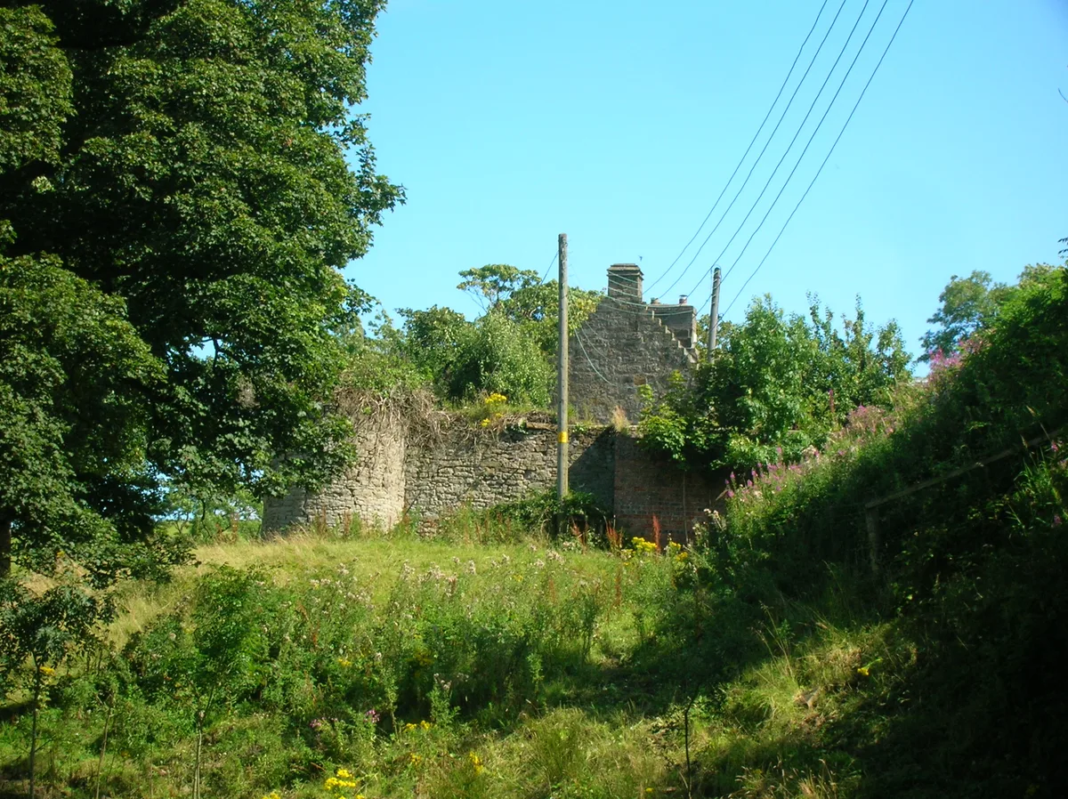
The Barony of Kersland
Castles · 1.6 km

Blair Bridge
Historic bridges · 1.8 km

Carsehead Bridge, River Garnock, Beith Road, Dalry
Historic bridges · 1.9 km

Cleeves Cove
Caves · 2.4 km
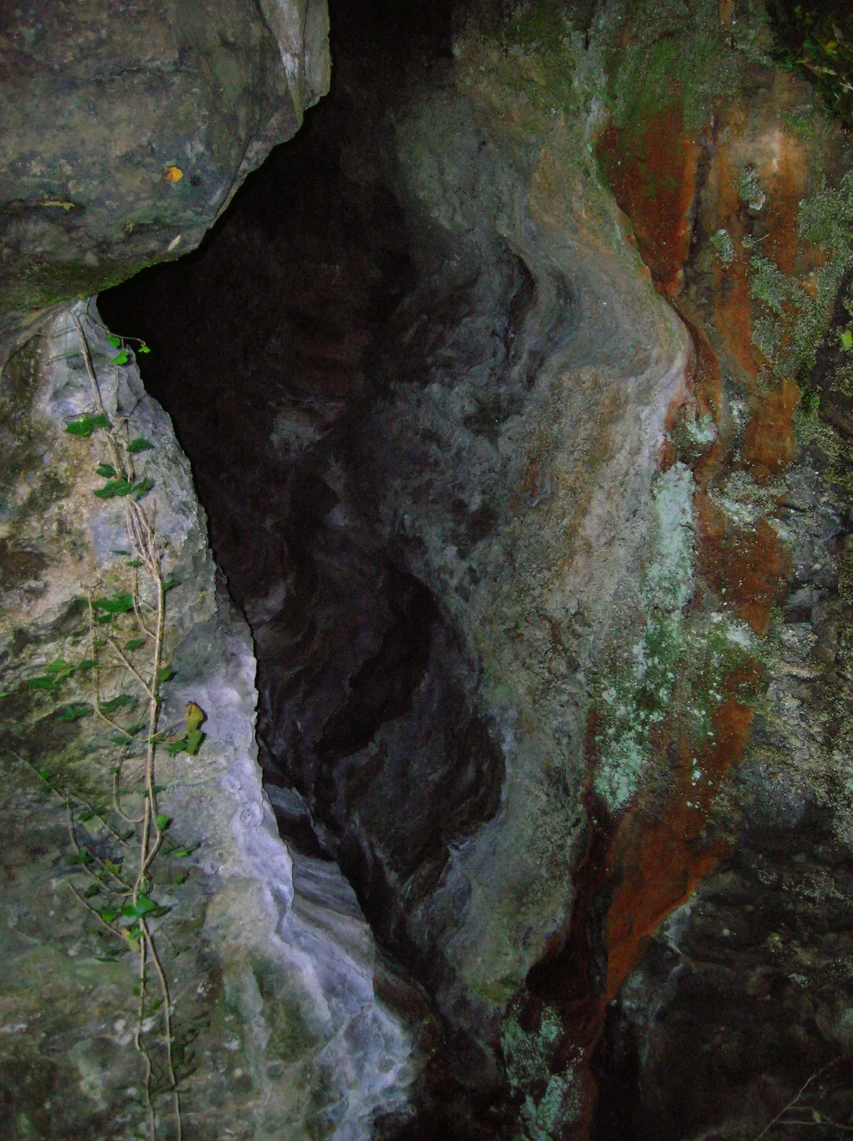
Cleeves Cove
Mountains & hills · 2.4 km

Garnock Bridge
Historic bridges · 2.4 km

St Palladius' Roman Catholic Church, Aitken Street, Dalry
Historic churches · 2.7 km

Dalry War Memorial
Memorials & monuments · 2.8 km

Trinity Church, The Cross, Dalry
Historic churches · 2.8 km

The Auld Hoose Bar, 9 Main Street, Dalry
Historic pubs · 2.8 km

St Margaret's Church, The Cross, Dalry
Historic churches · 2.8 km

Dalry
Villages · 2.9 km
Nearby
📷 5Castles · Scottish Lowlands
The Barony of Kersland
The Barony of Kersland — castle in North Ayrshire, Scotland, UK.
📷 5Historic bridges · Scottish Lowlands
Blair Bridge
Blair Bridge — category C listed building-listed bridge in scotland-highlands, United Kingdom.
📷 5Historic bridges · Scottish Lowlands
Carsehead Bridge, River Garnock, Beith Road, Dalry
Carsehead Bridge, River Garnock, Beith Road, Dalry — category B listed building-listed bridge in scotland-highlands, United Kingdom.
📷 5📷 4Mountains & hills · Scottish Lowlands
Cleeves Cove
Cleeves Cove — cave in North Ayrshire, Scotland, UK.
📷 3Historic bridges · Scottish Lowlands
Garnock Bridge
Garnock Bridge is a historic bridge in the United Kingdom.
Where to eat & stay near Swindridgemuir House and estate
Places to stay
 📷 5
📷 5 📷 5
📷 5Caravan parks · Scottish Lowlands
Viewfield Manor Leisure Park
Viewfield Manor Leisure Park — a caravan park in scotland highlands.
 📷 5
📷 5Campsites · Scottish Lowlands
Eglinton Camping and Touring Site
Eglinton Camping and Touring Site — a campsite in scotland highlands.
 📷 5
📷 5Caravan parks · Scottish Lowlands
Crosbie Towers
Crosbie Towers — a caravan park in scotland highlands.
 📷 5
📷 5Caravan parks · Scottish Lowlands
Sandylands Holiday Park
Sandylands Holiday Park — a caravan park in scotland highlands. Brand: Parkdean Resorts.
 📷 5
📷 5Caravan parks · Scottish Lowlands
Glenview Caravan Park
Glenview Caravan Park — a caravan park in scotland highlands.
Places to eat & drink
📷 5Historic pubs · Scottish Lowlands
The Auld Hoose Bar, 9 Main Street, Dalry
The Auld Hoose Bar, 9 Main Street, Dalry in Scotland Central, United Kingdom.
 📷 5
📷 5Restaurants · Scottish Lowlands
Braidwoods
Braidwoods — a restaurant in scotland highlands.
 📷 5
📷 5Historic pubs · Central Scotland
The Smugglers Tavern, 53, 55 Eglinton Street, Beith
The Smugglers Tavern, 53, 55 Eglinton Street, Beith in Scotland Central, United Kingdom.
 📷 5
📷 5Historic pubs · Scottish Lowlands
Kingsway Bar, 26-28 Main Street, Kilwinning
Kingsway Bar, 26-28 Main Street, Kilwinning in Scotland Central, United Kingdom.
 📷 5
📷 5Historic pubs · Scottish Lowlands
Public House, Lawthorn, Irvine
Public House, Lawthorn, Irvine in Scotland Central, United Kingdom.
 📷 7
📷 7Historic pubs · Scottish Lowlands
Champion Shell Inn, 5 Schoolwell Street, Stevenston
Champion Shell Inn, 5 Schoolwell Street, Stevenston in Scotland Central, United Kingdom.
More historic houses in this region
 📷 4
📷 4Historic houses · Scottish Lowlands
Chesters estate
Chesters estate in England North East, United Kingdom.
 📷 4
📷 4 📷 3
📷 3 📷 3
📷 3Historic houses · Scottish Lowlands
Barnhills Tower
Barnhills Tower in England North East, United Kingdom.
Frequently asked questions
- Where is Swindridgemuir House and estate?
- Swindridgemuir House and estate is in the Scottish Highlands, United Kingdom (postcode KA24 4HJ).
- What is Swindridgemuir House and estate?
- Swindridgemuir House and estate — house in Dalry parish, North Ayrshire, Scotland, UK.
- How do I get to Swindridgemuir House and estate?
- The nearest railway station is Dalry, about 2.3 km away. Drivers can use postcode KA24 4HJ.
- Is Swindridgemuir House and estate a listed building?
- Swindridgemuir House and estate is officially recognised as category A listed building listed.
- How do I get to Swindridgemuir House and estate?
- The nearest railway station is Dalry, about 2.3 km away. Drivers can navigate to postcode KA24 4HJ.