
Islands · Scottish Islands
Stuley
In or near Lochboisdale.
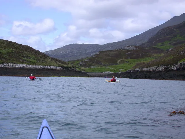
Stuley — island lying to the east of South Uist in the Outer Hebrides, Scotland, UK.

Wikimedia Commons contributors — see linked file page for photographer and licence licence

Plan your visit
- Typical visit
- 4 h–12 h
- Free entry
- Dog-friendly
About
Stuley is a island in the United Kingdom. Part of Outer Hebrides. Wikidata describes it as: "island lying to the east of South Uist in the Outer Hebrides, Scotland, UK". Coordinates: 57.1914°, -7.2498°.
Photo gallery
Official information
Stuley is an uninhabited island located off the eastern coast of South Uist in the Western Isles. It covers an area of 45 hectares and is primarily used as a grazing ground for sheep, separated from the main island by the Sound of Stuley.
From the Wikipedia article
Stuley is an island lying to the east of South Uist in the Outer Hebrides, Scotland. It lies off the section of coastline between Loch Eynort and Loch Boisdale. It is 45 hectares (0.17 sq mi) and 40 metres (131 ft) at its highest point.
Excerpt from Wikipedia under CC BY-SA 4.0. See the source article linked in Sources below.
Background
History
From local placenames such as Creag na h-Oraide (on Stuley), and Creag an t-Sagairt (on nearby Uist), meaning the rocks of the speech/sermon and priest respectively, there is some evidence of ecclesiastical connections, possibly culdee. The island's name is Norse in origin, meaning "Stula's Island". Stula's name can also be found in the name of a mountain on the nearby Uist "mainland", Stulaval. There are no written records of habitation, and it is currently used for sheep grazing. Haswell-Smith however notes the remains of lazybeds, and ruins of shielings (habitations for summer grazing), and suggests that the island was yet another victim of the Highland Clearances.
Sourced from Wikipedia under CC BY-SA 4.0.
- Coordinates
- 57.1914, -7.2498
- Official site
- www.scottish-places.info
Sources
- wikidata: Q2731984 (CC0)
- wikipedia: Stuley (CC BY-SA 4.0)
- commons: Caolas Stulaigh - geograph.org.uk - 1380329.jpg (CC BY-SA 4.0)
Other places nearby

Eliogar
Mountains & hills · 1.6 km
Eliogar
Mountains & hills · 1.6 km

Stulaval
Mountains & hills · 2.4 km
Stùlabhal
Mountains & hills · 2.4 km

Triuiribheinn
Mountains & hills · 2.7 km
Triuirebheinn
Mountains & hills · 2.7 km

Mullach a' Ghlinn Mhòir
Mountains & hills · 2.8 km
Mullach a' Ghlinn Mhoir
Mountains & hills · 2.9 km
Loch Eynort
Mountains & hills · 3.8 km

Loch Eynort
Natural landmarks · 4.1 km
Beinn Ailein
Mountains & hills · 4.2 km
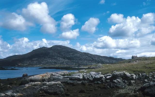
Beinn Ruigh Choinnich
Mountains & hills · 4.4 km
Nearby
📷 5Mountains & hills · Scottish Islands
Eliogar
Eliogar — mountain in scotland highlands. Elevation: 176 m.
📷 5📷 5📷 5Mountains & hills · Scottish Islands
Stùlabhal
Stùlabhal — mountain in scotland highlands. Elevation: 374 m.
📷 5Mountains & hills · Scottish Islands
Triuiribheinn
Triuiribheinn — mountain in scotland highlands. Elevation: 357 m.
📷 5Mountains & hills · Scottish Islands
Triuirebheinn
Triuirebheinn — a hill or mountain in scotland highlands.
Where to eat & stay near Stuley
Places to stay
 📷 5
📷 5Hostels · Scottish Islands
South Uist Hostel
South Uist Hostel — a hostel in scotland highlands.
📷 5Caravan parks · Scottish Islands
(3 pitches - booking advisable)
(3 pitches - booking advisable) — a caravan park in scotland highlands.
 📷 5
📷 5Campsites · Scottish Islands
Kilbride Campsite
Kilbride Campsite — a campsite in scotland highlands.
 📷 5
📷 5Hotels · Scottish Islands
Polochar Inn
Polochar Inn — a hotel in scotland highlands.
 📷 5
📷 5Hostels · Scottish Islands
Osdail Òigridh
Osdail Òigridh — a hostel in scotland highlands.
📷 5More places in this region
 📷 5
📷 5Islands · Scottish Islands
Bac Beag
Bac Beag — Scottish island, part of the Treshnish Isles in the Inner Hebrides.
 📷 5
📷 5Islands · Scottish Islands
Bac Mòr
Bac Mòr — island in Argyll and Bute, Scotland, UK, one of the Treshnish Isles.
 Flagship📷 3
Islands · Scottish Islands
Baleshare
Baleshare — flat tidal island in the Outer Hebrides, Scotland, UK.
 Flagship📷 5
Islands · Scottish Islands
Barra
Barra — island in Outer Hebrides, Scotland, UK.
Frequently asked questions
- Where is Stuley?
- Stuley is in the Scottish Islands, United Kingdom.
- What is Stuley?
- Stuley — island lying to the east of South Uist in the Outer Hebrides, Scotland, UK.
- How do I get to Stuley?
- The nearest town is Lochboisdale. Its coordinates are 57.1914°, -7.2498°.
- Is Stuley free to visit?
- Yes, Stuley is free to enter.