
Cemeteries · West Midlands
Streetly Cemetery
In or near Walsall Wood.
Streetly Cemetery is a cemetery in the United Kingdom.

Adrian Rothery — CC BY-SA 2.0 via Wikimedia Commons licence

Plan your visit
- Typical visit
- 30 min–1 h
- Nearest railway station
- Butlers Lane · 4.5 km
- Free entry
- Dog-friendly
Getting there & planning your visit
To visit Streetly Cemetery, the nearest railway station is Butlers Lane, located 4.5 km away. The postcode for sat-nav is WS9 0SG. Entry to the cemetery is free.
About
Streetly Cemetery is a named cemetery in the United Kingdom. Coordinates: 52.5857°, -1.9039°. This entry is part of The Great Britain Guide, a free, ad-free, open-data tourist directory.
Photo gallery
From the Wikipedia article
Streetly is an area in the county of West Midlands, England which lies around 7 miles (11 km) to the north of Birmingham City Centre. It is uniquely located within the borders of Birmingham, Lichfield and Walsall district authorities, and is part of the West Midlands conurbation. It is adjacent to, New Oscott, Great Barr, Four Oaks, Little Aston and Aldridge. Streetly is a semi-rural district, lying close to many farms and is separated from Walsall by open fields and the North Birmingham green belt. The local area includes Sutton Park of which Streetly has its own dedicated gate. Streetly is part of the Birmingham metropolitan area and the Birmingham Urban Area. Bus services provide links to Birmingham, Walsall and Sutton Coldfield. Most are operated by National Express West Midlands. The area was served by trains on the Sutton Park Line. However while the line remains open for freight, Streetly railway station closed in 1965 and the nearest station now is in Four Oaks railway station on the opposite side of Sutton Park. There are plans to open a new station on the Sutton Park Line in 2027 adjacent to the old Aldridge railway station which will be slightly closer than the Four Oaks railway station. Initially trains will run to Walsall but there are also tentative plans for the Wrexham, Shropshire & Midlands Railway to operate services to London along the Sutton Park Line.
Excerpt from Wikipedia under CC BY-SA 4.0. See the source article linked in Sources below.
Background
History
Streetly is named after Icknield Street, a Roman road, of which parts can still be found in Sutton Park. Streetly was a rural area of Staffordshire until the 1950s when the character of the area became suburban due to the mass construction of modern housing in response to the urbanisation of Birmingham. Streetly was in Aldridge-Brownhills Urban District until the creation of the metropolitan West Midlands county in 1974. The history of Streetly in the 20th century is regularly discussed in a local history Facebook page and the Birmingham History Forum. These resources include links to further online information including the personal recollections of previous residents.
Sourced from Wikipedia under CC BY-SA 4.0.
- Coordinates
- 52.5857, -1.9039
- District
- Walsall
- Parish
- Walsall, unparished area
- Postcode
- WS9 0SG
- Parliamentary constituency
- Aldridge-Brownhills
- Nearest railway station
- Butlers Lane — 4.5 km
- Official site
- www.neighbourhood.statistics.gov.uk
Sources
Other places nearby
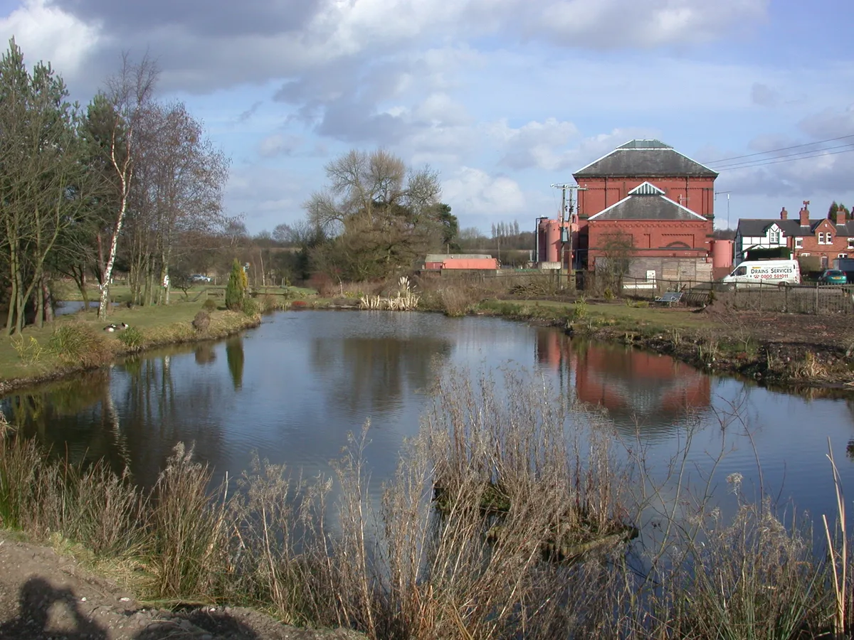
Bourne Pool
Wildlife reserves · 1.4 km

Barr Beacon
Mountains & hills · 1.4 km

Barr Beacon War Memorial
Memorials & monuments · 1.5 km
Blue Plaque: Barr Beacon Beeches
Memorials & monuments · 1.6 km

Streetly War Memorial Cross Outside All Saints' Church
Memorials & monuments · 1.6 km

Eating Area
Natural landmarks · 1.9 km

Streetly Hill
Mountains & hills · 2.1 km

The Paddock Certificated Site
Campsites · 2.1 km

Aldridge Station (disused)
Historic houses · 2.1 km

Aldridge War Memorial
Memorials & monuments · 2.1 km

Cenotaph
Memorials & monuments · 2.1 km
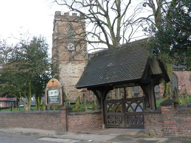
St. Mary's Church, Aldridge
Historic churches · 2.2 km
Nearby
📷 3Wildlife reserves · West Midlands
Bourne Pool
Bourne Pool — former mill pool in Aldridge, West Midlands, England, UK.
📷 5📷 3Memorials & monuments · West Midlands
Barr Beacon War Memorial
Barr Beacon War Memorial — a memorial in england-west-midlands, United Kingdom.
📷 3Memorials & monuments · West Midlands
Blue Plaque: Barr Beacon Beeches
Blue Plaque: Barr Beacon Beeches — a memorial in england-west-midlands, United Kingdom.
📷 3Memorials & monuments · West Midlands
Streetly War Memorial Cross Outside All Saints' Church
Streetly War Memorial Cross Outside All Saints' Church — Grade II listed building-listed memorial in england-west-midlands, United Kingdom.
📷 3Natural landmarks · West Midlands
Eating Area
Eating Area — a other in england-west-midlands, United Kingdom.
Where to eat & stay near Streetly Cemetery
Places to stay
📷 5Campsites · West Midlands
The Paddock Certificated Site
The Paddock Certificated Site — a campsite in england west midlands.
 📷 5
📷 5Hotels · West Midlands
The Royal Hotel
The Royal Hotel — a hotel in england west midlands.
 📷 5
📷 5Hotels · West Midlands
Moor Hall Hotel & Spa
Moor Hall Hotel & Spa — a hotel in england west midlands. 4-star. Brand: Best Western.
 📷 5
📷 5Hotels · West Midlands
New Hall Hotel
New Hall Hotel — a hotel in england west midlands.
 📷 5
📷 5Hotels · West Midlands
Ramada Birmingham Sutton Coldfield
Ramada Birmingham Sutton Coldfield — a hotel in england west midlands. Brand: Ramada.
 📷 5
📷 5Places to eat & drink
 📷 5
📷 5Restaurants · West Midlands
Browns
Browns — a restaurant in england west midlands. Cuisine: british. Brand: Browns.
 📷 5
📷 5Historic pubs · West Midlands
Royal Hotel
Royal Hotel — Historic pub — listed building or notable heritage status.
 📷 6
📷 6Historic pubs · West Midlands
Three Tuns Hotel
Three Tuns Hotel — Historic pub — listed building or notable heritage status.
 📷 4
📷 4Historic pubs · West Midlands
Gate Inn
Gate Inn — Historic pub — listed building or notable heritage status.
 📷 3
📷 3Historic pubs · West Midlands
The Duke Inn
The Duke Inn — Historic pub — listed building or notable heritage status.
 📷 7
📷 7Restaurants · West Midlands
The Boar's Head
The Boar's Head — a restaurant in england west midlands.
More cemeteries in this region
 📷 3
📷 3Cemeteries · West Midlands
Barnetts Lane Cemetery
Barnetts Lane Cemetery is a cemetery in the United Kingdom.
 📷 3
📷 3Cemeteries · West Midlands
Betholom Row Cemetery
Betholom Row Cemetery is a cemetery in the United Kingdom.
 📷 4
📷 4Cemeteries · West Midlands
Bilston Cemetery
Bilston Cemetery is a cemetery in the United Kingdom.
 📷 3
📷 3Cemeteries · West Midlands
Birmingham Hebrew Congregation Cemetery
Birmingham Hebrew Congregation Cemetery is a cemetery in the United Kingdom.
Frequently asked questions
- Where is Streetly Cemetery?
- Streetly Cemetery is in the West Midlands, United Kingdom (postcode WS9 0SG), in the parish of Walsall, unparished area.
- What is Streetly Cemetery?
- Streetly Cemetery is a cemetery in the United Kingdom.
- How do I get to Streetly Cemetery?
- The nearest railway station is Butlers Lane, about 4.5 km away. Drivers can use postcode WS9 0SG.
- Is Streetly Cemetery free to visit?
- Yes, Streetly Cemetery is free to enter.
- How do I get to Streetly Cemetery?
- The nearest railway station is Butlers Lane, about 4.5 km away. Drivers can navigate to postcode WS9 0SG.