Natural landmarks · Northern Ireland
Strathfoyle
Also known as: Srath Feabhail
In or near Maydown.
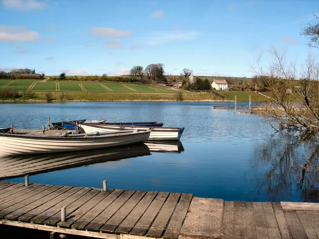
Strathfoyle in Northern Ireland, United Kingdom.

Kay Atherton — CC BY-SA 2.0 via Wikimedia Commons licence
Plan your visit
- Typical visit
- 1 h–2 h
- Nearest railway station
- Derry~Londonderry · 5.4 km
- Free entry
- Dog-friendly
Getting there & planning your visit
To visit Strathfoyle, the nearest railway station is Derry~Londonderry, located 5.4 km away. The postcode for navigation is BT47 6XH, and entry is free.
About
Strathfoyle is a place of interest in Northern Ireland, United Kingdom — drawn from open-data sources for visitor reference. See the linked Wikipedia article for the full description.
Photo gallery
From the Wikipedia article
Strathfoyle (from Irish: Srath Feabhail) is a village in County Londonderry, Northern Ireland It is about 5 miles (8.0 km) north east of Derry. It was newly built in different phases between the late 1950s and the early 1960s, with many new recent additions to the village, including Westlake, Butler's Wharf and Old Fort. In the 2001 Census it had a population of 1,581 people. It is within the Derry Urban Area and the Derry City Council area. The village has a small retail outlet (a pharmacy, a supermarket, a fast food take-away and a beauticians), a Roman Catholic chapel, a library, youth club and a post office. The small retail unit was constructed in 2005 following years of under-investment in the area and pressure by local community leaders to provide more facilities for its residents.
Excerpt from Wikipedia under CC BY-SA 4.0. See the source article linked in Sources below.
Background
History
Professor Robert Lyons Marshall of Magee College suggested "Strathfoyle" (strath of the River Foyle) in response to a request from Londonderry Rural District Council for a name for its new town.
Sourced from Wikipedia under CC BY-SA 4.0.
- Coordinates
- 55.0333, -7.2667
- District
- Derry City and Strabane
- Postcode
- BT47 6XH
- Parliamentary constituency
- Foyle
- Nearest railway station
- Derry~Londonderry — 5.4 km
Sources
- wikidata: Q2405964 (CC0)
- wikipedia: Strathfoyle (CC BY-SA 4.0)
Other places nearby

Foyle Port
Harbours & ports · 1.0 km

Thornhill College
Natural landmarks · 1.1 km
Enagh Lough
Natural landmarks · 1.3 km

Ruins of Old Enagh Church
Historic houses · 1.3 km

Maydown
Towns & cities · 1.4 km

Culmore railway station
Natural landmarks · 1.5 km
Coolkeeragh power station
Natural landmarks · 1.6 km
Oakgrove Integrated College
Natural landmarks · 1.7 km

Culmore
Towns & cities · 1.9 km

Tullyardan
Villages · 1.9 km

RNAS Maydown
Natural landmarks · 1.9 km

Gransha Hospital
Natural landmarks · 2.1 km
Nearby
📷 5Harbours & ports · Northern Ireland
Foyle Port
Foyle Port — dock and shipyards in Northern Ireland.
📷 3Natural landmarks · Northern Ireland
Thornhill College
Thornhill College in Northern Ireland, United Kingdom.
📷 3📷 3Historic houses · Northern Ireland
Ruins of Old Enagh Church
Ruins of Old Enagh Church — a historic house in northern-ireland, United Kingdom.
📷 2Towns & cities · Northern Ireland
Maydown
Maydown — village in County Londonderry, Northern Ireland, UK.
📷 4Natural landmarks · Northern Ireland
Culmore railway station
Culmore railway station in Northern Ireland, United Kingdom.
Where to eat & stay near Strathfoyle
Places to stay
 📷 7
📷 7 📷 5
📷 5 📷 5
📷 5 📷 5
📷 5 📷 5
📷 5Hostels · Northern Ireland
Derry City Independent Hostel (Annexe)
Derry City Independent Hostel (Annexe) — a hostel in northern ireland.
 📷 5
📷 5Hostels · Northern Ireland
Derry City Independent Hostel
Derry City Independent Hostel — a hostel in northern ireland.
More natural landmarks in this region
 Flagship📷 4
Natural landmarks · Northern Ireland
Lough Erne
Lough Erne — lake in County Fermanagh, Northern Ireland, UK.
 Flagship📷 4
Natural landmarks · Northern Ireland
Lough Neagh
Lough Neagh — large lake in Northern Ireland.
 📷 3
📷 3Natural landmarks · Northern Ireland
Ballysaggart Lough
Ballysaggart Lough — lake in the United Kingdom.
 📷 5
📷 5Natural landmarks · Northern Ireland
Belmore Mountain
Belmore Mountain — mountain in the United Kingdom.
Frequently asked questions
- Where is Strathfoyle?
- Strathfoyle is in Northern Ireland, United Kingdom (postcode BT47 6XH).
- What is Strathfoyle?
- Strathfoyle in Northern Ireland, United Kingdom.
- How do I get to Strathfoyle?
- The nearest railway station is Derry~Londonderry, about 5.4 km away. Drivers can use postcode BT47 6XH.
- Is Strathfoyle free to visit?
- Yes, Strathfoyle is free to enter.
- How do I get to Strathfoyle?
- The nearest railway station is Derry~Londonderry, about 5.4 km away. Drivers can navigate to postcode BT47 6XH.