
Natural landmarks · Northern Ireland
Stranmillis
Also known as: An Sruthán Milis
In or near Belfast.
Stranmillis in Northern Ireland, United Kingdom.

Ross — CC BY-SA 2.0 via Wikimedia Commons licence

Plan your visit
- Typical visit
- 1 h–2 h
- Nearest railway station
- Adelaide · 1.6 km
- Free entry
- Dog-friendly
Getting there & planning your visit
To visit Stranmillis, you can take a train to Adelaide station, which is 1.6 km away. The postcode for navigation is BT9 5GS. Entry is free.
About
Stranmillis is a place of interest in Northern Ireland, United Kingdom — drawn from open-data sources for visitor reference. See the linked Wikipedia article for the full description.
Photo gallery
From the Wikipedia article
Stranmillis (from Irish an Sruthán Milis) is an area in south Belfast, Northern Ireland. It is also an electoral ward for Belfast City Council, part of the Laganbank district electoral area. As part of the Queen's Quarter, it is the location for prominent attractions such as the Ulster Museum and Botanic Gardens. The area is located on Stranmillis Road, with Malone Road to the west and the River Lagan to the east. Its name, meaning "the sweet stream" in Irish, refers to the Lagan, whose waters are still fresh at this point, before becoming brackish as the river flows onward toward its mouth in Belfast Lough. Stranmillis Road begins at the junction of University Road, Malone Road and College Gardens, heading uphill and southwards past Friar's Bush Graveyard and a small shopping district, before descending towards the River Lagan. The route then swings to the west around the outside of Stranmillis College and uphill again, before rejoining the Malone Road. The north end of Stranmillis Road contains many shops and restaurants, while the south end of the road is mainly housing. The Malone and Stranmillis Historic Urban Landscape featured on the 2010 tentative list of sites proposed for addition to the List of World Heritage Sites of the United Kingdom, as an area of architectural interest featuring examples of the Arts and Crafts Movement.
Excerpt from Wikipedia under CC BY-SA 4.0. See the source article linked in Sources below.
Background
History
In the 9th or 10th century A.D. a rath was built on the bank of the Lagan. The site is one of Belfast's best surviving ringforts and now lies in the grounds of Stranmillis College. In 1603 Sir Arthur Chichester was granted expansive lands in Ulster, including all of the land west of the Lagan from Carrickfergus to Dunmurry, and the site of the future City of Belfast. In 1606 he leased his Stranmillis lands for 61 years to Moses Hill, who built a plantation castle. This was described in the Report of the Plantation Commissioner around 1611 as being located at a place called "Stranmellis". The castle guarded a crossing point of the Lagan, close to today's King's Bridge. The site of the castle…
Sourced from Wikipedia under CC BY-SA 4.0.
- Coordinates
- 54.5701, -5.9350
- District
- Belfast
- Postcode
- BT9 5GS
- Parliamentary constituency
- Belfast South and Mid Down
- Nearest railway station
- Adelaide — 1.6 km
Sources
- wikidata: Q7621649 (CC0)
- wikipedia: Stranmillis (CC BY-SA 4.0)
Other places nearby

Stranmillis University College
Natural landmarks · 0.3 km

Danesfort
Historic houses · 0.6 km

Governor's Bridge
Historic bridges · 0.6 km

Belfast South
Natural landmarks · 0.6 km
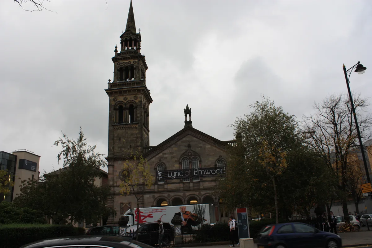
Lyric Theatre
Theatres · 0.8 km

Malone Road
Natural landmarks · 0.8 km
Victoria College, Belfast
Natural landmarks · 0.9 km

King's Bridge
Historic bridges · 0.9 km

Windsor
Villages · 1.0 km

Osborne Park, Belfast
Parks · 1.1 km

Wellington College Belfast
Natural landmarks · 1.1 km

St John's Church Malone
Historic churches · 1.1 km
Nearby
📷 3Natural landmarks · Northern Ireland
Stranmillis University College
Stranmillis University College in Northern Ireland, United Kingdom.
📷 3Historic houses · Northern Ireland
Danesfort
Danesfort — house in Belfast, County Antrim, Northern Ireland.
📷 3Historic bridges · Northern Ireland
Governor's Bridge
Governor's Bridge is a historic bridge in the United Kingdom.
📷 4Natural landmarks · Northern Ireland
Belfast South
Belfast South in Northern Ireland, United Kingdom.
📷 3Theatres · Northern Ireland
Lyric Theatre
Lyric Theatre is a theatre in the United Kingdom.
📷 5Natural landmarks · Northern Ireland
Malone Road
Malone Road in Northern Ireland, United Kingdom.
Where to eat & stay near Stranmillis
Places to stay
 📷 7
📷 7 📷 5
📷 5Hostels · Northern Ireland
Lagan Backpackers
Lagan Backpackers — a hostel in northern ireland.
 📷 6
📷 6 📷 5
📷 5Hostels · Northern Ireland
Botanical Backpackers
Botanical Backpackers — a hostel in northern ireland.
📷 5Hostels · Northern Ireland
Paddy's Palace Belfast
Paddy's Palace Belfast — a hostel in northern ireland.
 📷 5
📷 5Places to eat & drink
 📷 5
📷 5 📷 3
📷 3Historic pubs · Northern Ireland
Red Lion Pub bombing
Red Lion Pub bombing in Northern Ireland, United Kingdom.
 📷 7
📷 7Historic pubs · Northern Ireland
Crown Liquor Saloon
Crown Liquor Saloon in Northern Ireland, United Kingdom.
 📷 5
📷 5 📷 7
📷 7Historic pubs · Northern Ireland
Kelly's Cellars
Kelly's Cellars in Northern Ireland, United Kingdom.
 📷 5
📷 5More natural landmarks in this region
 Flagship📷 4
Natural landmarks · Northern Ireland
Lough Erne
Lough Erne — lake in County Fermanagh, Northern Ireland, UK.
 Flagship📷 4
Natural landmarks · Northern Ireland
Lough Neagh
Lough Neagh — large lake in Northern Ireland.
 📷 3
📷 3Natural landmarks · Northern Ireland
Ballysaggart Lough
Ballysaggart Lough — lake in the United Kingdom.
 📷 5
📷 5Natural landmarks · Northern Ireland
Belmore Mountain
Belmore Mountain — mountain in the United Kingdom.
Frequently asked questions
- Where is Stranmillis?
- Stranmillis is in Northern Ireland, United Kingdom (postcode BT9 5GS).
- What is Stranmillis?
- Stranmillis in Northern Ireland, United Kingdom.
- How do I get to Stranmillis?
- The nearest railway station is Adelaide, about 1.6 km away. Drivers can use postcode BT9 5GS.
- Is Stranmillis free to visit?
- Yes, Stranmillis is free to enter.
- How do I get to Stranmillis?
- The nearest railway station is Adelaide, about 1.6 km away. Drivers can navigate to postcode BT9 5GS.