Archaeological sites · South West England
Stone row, cairn and enclosures near Hook Lane, Erme Valley
In or near Cornwood.
Stone row, cairn and enclosures near Hook Lane, Erme Valley — archaeological site in Harford, South Hams, England, UK.

Wikimedia Commons contributors — see linked file page for photographer and licence licence
Plan your visit
- Typical visit
- 45 min–1.5 h
- Nearest railway station
- Ivybridge · 8.7 km
- Free entry
- Dog-friendly
About
Stone row, cairn and enclosures near Hook Lane, Erme Valley is a place of interest in South-West England. Officially recognised as scheduled monument. The site is a designated Site of Special Scientific Interest. The nearest railway station is Ivybridge, about 8.7 km away.
Photo gallery
Protected designations
- Site of Special Scientific Interest: South Dartmoor SSSI
Designations sourced from Natural England open data under OGL v3.
Place summary
The Stone row, cairn and enclosures near Hook Lane in the Erme Valley is an archaeological site located in South-West England. It is designated as a scheduled monument and is part of the South Dartmoor SSSI, highlighting its significance within the region's historical landscape.
AI-generated from the structured facts on this page (operator, designation, listing, era). Not a substitute for visiting.
- Coordinates
- 50.4716, -3.9169
- Nearest railway station
- Ivybridge — 8.7 km
Sources
- wikidata: Q17648591 (CC0)
- commons: Cairn with stone circle - geograph.org.uk - 3418179.jpg (CC BY-SA 4.0)
Other places nearby

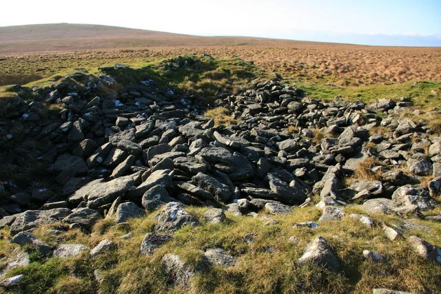
Erme Pound
Archaeological sites · 0.5 km

Redlake China Clay Settlement Ponds and pipework
Historic houses · 1.0 km

Stall Moor stone circle
Stone circles · 1.0 km

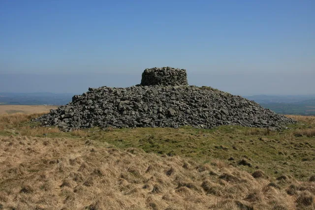
Western White Barrow
Archaeological sites · 1.3 km

Petre's Cross
Memorials & monuments · 1.3 km

Hostel
Historic houses · 1.5 km
Engine house
Historic houses · 1.6 km

Huntingdon Clapper Bridge
Historic bridges · 1.9 km

Warrens (Pillow Mounds)
Historic houses · 2.0 km
Knatta Barrow
Archaeological sites · 2.2 km

Erme Pits
Historic houses · 2.3 km
Eastern White Barrow
Archaeological sites · 2.5 km
Nearby
📷 3Archaeological sites · South West England
Erme Pound
Erme Pound — a archaeological in england-south-west, United Kingdom.
📷 3Historic houses · South West England
Redlake China Clay Settlement Ponds and pipework
Redlake China Clay Settlement Ponds and pipework — a historic house in england-south-west, United Kingdom.
📷 3Stone circles · South West England
Stall Moor stone circle
Stall Moor stone circle — a stone circle in england-south-west, United Kingdom.
📷 3Archaeological sites · South West England
Western White Barrow
Western White Barrow — archaeological site in Dartmoor Forest, West Devon, England, UK.
📷 3Memorials & monuments · South West England
Petre's Cross
Petre's Cross — a memorial in england-south-west, United Kingdom.
📷 3Historic houses · South West England
Hostel
Hostel — a historic house in england-south-west, United Kingdom.
Where to eat & stay near Stone row, cairn and enclosures near Hook Lane, Erme Valley
Places to stay
 📷 5📷 5
Hostels · South West England
Harford Bunkhouse
Harford Bunkhouse — a hostel in england south west.
 📷 7
📷 7B&Bs · South West England
The Pack Horse Inn
The Pack Horse Inn — a bed-and-breakfast in england south west.
 📷 5
📷 5B&Bs · South West England
Tor Royal B&B
Tor Royal B&B — a bed-and-breakfast in england south west.
 📷 5
📷 5 📷 5
📷 5Campsites · South West England
Plume of Feathers Campsite
Plume of Feathers Campsite — a campsite in england south west.
Places to eat & drink
 📷 5
📷 5Cafés · South West England
Station House
Station House — a café in england south west.
 📷 5
📷 5Restaurants · South West England
Furzeleigh Mill
Furzeleigh Mill — a restaurant in england south west.
 📷 5
📷 5Historic pubs · South West England
Church House Inn
Church House Inn in England South West, United Kingdom.
 📷 7
📷 7 📷 5
📷 5Historic pubs · South West England
The Victoria Inn
The Victoria Inn in England South West, United Kingdom.
 📷 7
📷 7Historic pubs · South West England
Royal Oak Public House
Royal Oak Public House in England South West, United Kingdom.
More archaeological sites in this region
 📷 5
📷 5Archaeological sites · South West England
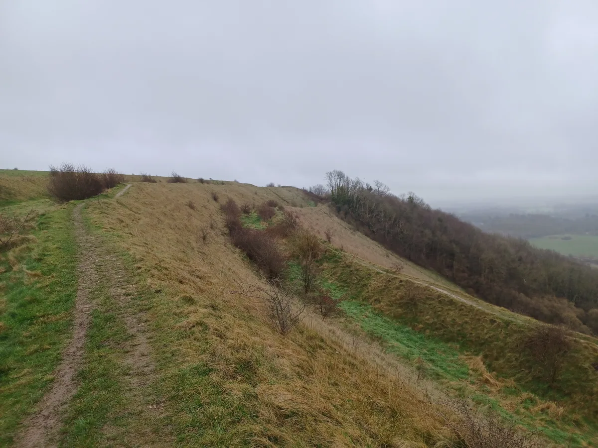
Battlesbury Camp Monuments: hillfort, settlement, cemetery, barrows, enclosure, and field systems
Battlesbury Camp Monuments: hillfort, settlement, cemetery, barrows, enclosure, and field systems — archaeological site in Warminster, Wiltshire, England, UK.
 📷 2
📷 2Archaeological sites · South West England
Blandford Forest
Blandford Forest — forest in Blandford Forum, England.
 📷 5
📷 5Archaeological sites · South West England
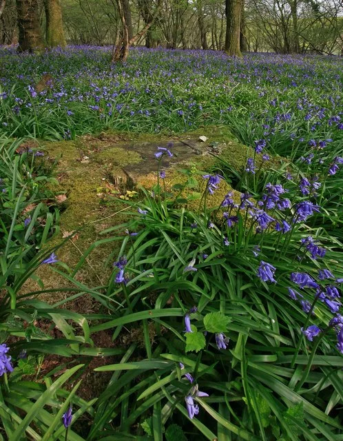
Boulsbury Wood
Boulsbury Wood — protected area in Dorset and Hampshire, England.
.jpg?width=1200) 📷 5
📷 5Archaeological sites · South West England
Cranborne Chase
Cranborne Chase — Plateau in southern England.
Frequently asked questions
- Where is Stone row, cairn and enclosures near Hook Lane, Erme Valley?
- Stone row, cairn and enclosures near Hook Lane, Erme Valley is in South-West England, United Kingdom.
- What is Stone row, cairn and enclosures near Hook Lane, Erme Valley?
- Stone row, cairn and enclosures near Hook Lane, Erme Valley — archaeological site in Harford, South Hams, England, UK.
- How do I get to Stone row, cairn and enclosures near Hook Lane, Erme Valley?
- The nearest railway station is Ivybridge, about 8.7 km away. Its coordinates are 50.4716°, -3.9169°.
- Is Stone row, cairn and enclosures near Hook Lane, Erme Valley a listed building?
- Stone row, cairn and enclosures near Hook Lane, Erme Valley is officially recognised as scheduled monument listed.
- Is Stone row, cairn and enclosures near Hook Lane, Erme Valley a protected site?
- Yes — Stone row, cairn and enclosures near Hook Lane, Erme Valley is part of the South Dartmoor SSSI Site of Special Scientific Interest.
- Is Stone row, cairn and enclosures near Hook Lane, Erme Valley free to visit?
- Yes, Stone row, cairn and enclosures near Hook Lane, Erme Valley is free to enter.