
Memorials & monuments · North East England
Stone circle and stone alignment 370m west of Threestoneburn House
In or near Ingram.
Stone circle and stone alignment 370m west of Threestoneburn House in England North East, United Kingdom.

James T M Towill — CC BY-SA 2.0 via Wikimedia Commons licence

Plan your visit
- Typical visit
- 15 min–45 min
- Free entry
- Dog-friendly
About
Stone circle and stone alignment 370m west of Threestoneburn House is a place of interest in England North East, United Kingdom — drawn from open-data sources for visitor reference. See the linked Wikipedia article for the full description.
Photo gallery
Protected designations
- Site of Special Scientific Interest: The Cheviot SSSI
- Site of Special Scientific Interest: Tweed Catchment Rivers - England: Till Catchment SSSI
Designations sourced from Natural England open data under OGL v3.
From the Wikipedia article
Threestoneburn Stone Circle is an archaeological site, a stone circle near the village of Ilderton and about 5 miles (8 km) south of Wooler, in Northumberland, England. It is a scheduled monument.
Excerpt from Wikipedia under CC BY-SA 4.0. See the source article linked in Sources below.
Background
Description
The circle, of the late Neolithic or early Bronze Age, is situated in a large clearing in the modern afforestation of Threestoneburn Wood, formerly overlooking a spacious valley to the east. It is on a slight promontory near the confluence of Threestone Burn and one of its tributaries. Its dimensions are 36 m north-west to south-east by 30 m north-east to south-west. There are 16 stones of local pink granite, set about 5.5 m apart; a larger gap on the east side is thought to be an original entrance. Four of these are upright, with heights 0.7 to; the rest are recumbent. About 28 m to the north are two granite stones, one of which is recumbent; immediately to their east is an alignment of…
Sourced from Wikipedia under CC BY-SA 4.0.
- Coordinates
- 55.4783, -2.0469
- District
- Northumberland
- Parish
- Ilderton
- Postcode
- NE66 4JN
- Parliamentary constituency
- North Northumberland
Sources
- wikidata: Q17664993 (CC0)
- wikipedia: Threestoneburn Stone Circle (CC BY-SA 4.0)
Other places nearby

Threestoneburn Stone Circle
Stone circles · 0.0 km

Langlee Crags
Mountains & hills · 1.7 km

Dunmoor Hill
Mountains & hills · 2.3 km

Dunmoor Hill
Mountains & hills · 2.3 km
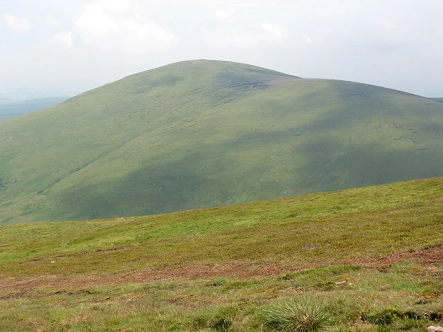
Hedgehope Hill
Mountains & hills · 2.8 km
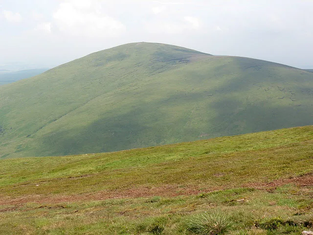
Hedgehope Hill
Natural landmarks · 2.8 km

South Middleton Moor
Castles · 3.0 km

The Ringles defended settlement 1025m north west of Middleton Dean
Vineyards · 3.1 km

Defended settlement 900m west of Calder
Vineyards · 3.2 km

Settlement S of Hare Law
Archaeological sites · 3.2 km

Heddon Hill
Mountains & hills · 3.3 km
Heddon Hill
Mountains & hills · 3.3 km
Nearby
📷 3Stone circles · North East England
Threestoneburn Stone Circle
Threestoneburn Stone Circle — a stone circle in scotland-lowlands, United Kingdom.
📷 5Mountains & hills · North East England
Langlee Crags
Langlee Crags — mountain in scotland lowlands. Elevation: 424 m.
📷 5Mountains & hills · North East England
Dunmoor Hill
Dunmoor Hill — mountain in scotland lowlands. Elevation: 569 m.
📷 5Mountains & hills · North East England
Dunmoor Hill
Dunmoor Hill — a hill or mountain in scotland lowlands.
📷 3📷 3Natural landmarks · North East England
Hedgehope Hill
Hedgehope Hill — mountain in United Kingdom.
Where to eat & stay near Stone circle and stone alignment 370m west of Threestoneburn House
Places to stay
 📷 5
📷 5Caravan parks · North East England
Riverside Leisure Park
Riverside Leisure Park — a caravan park in scotland central.
📷 5Caravan parks · North East England
Bridgend Park
Bridgend Park — a caravan park in scotland central.
 📷 5
📷 5Hostels · North East England
Wooler Hostel
Wooler Hostel — a hostel in scotland central.
 📷 5
📷 5Hotels · North East England
No 1 Hotel
No 1 Hotel — a hotel in scotland central.
 📷 7
📷 7Hotels · North East England
The Black Bull
The Black Bull — a hotel in scotland central.
 📷 5
📷 5Caravan parks · North East England
Highburn House Country Holiday Park
Highburn House Country Holiday Park — a caravan park in scotland central.
Places to eat & drink
 📷 7
📷 7 📷 7
📷 7Historic pubs · North East England
Plough Inn With Outbuilding To North
Plough Inn With Outbuilding To North in Scotland Lowlands, United Kingdom.
 📷 7
📷 7Historic pubs · North East England
Bridge Of Aln Hotel
Bridge Of Aln Hotel in Scotland Lowlands, United Kingdom.
 📷 7
📷 7Historic pubs · North East England
Black Swan Public House
Black Swan Public House in Scotland Lowlands, United Kingdom.
 📷 7
📷 7 📷 5
📷 5More memorials in this region
 📷 3
📷 3Memorials & monuments · North East England
Hurworth and Neasham War Memorial
Hurworth and Neasham War Memorial — Grade II listed building-listed memorial in england-yorkshire, United Kingdom.
 📷 3
📷 3Memorials & monuments · North East England
Fryingpan Stone
Fryingpan Stone — a memorial in england-yorkshire, United Kingdom.
 📷 3
📷 3Memorials & monuments · North East England
Yoak Stone
Yoak Stone — a memorial in england-yorkshire, United Kingdom.
 📷 3
📷 3Memorials & monuments · North East England
Pump Cottage 1680
Pump Cottage 1680 — a memorial in england-yorkshire, United Kingdom.
Frequently asked questions
- Where is Stone circle and stone alignment 370m west of Threestoneburn House?
- Stone circle and stone alignment 370m west of Threestoneburn House is in North-East England, United Kingdom (postcode NE66 4JN), in the parish of Ilderton.
- What is Stone circle and stone alignment 370m west of Threestoneburn House?
- Stone circle and stone alignment 370m west of Threestoneburn House in England North East, United Kingdom.
- How do I get to Stone circle and stone alignment 370m west of Threestoneburn House?
- Drivers can use postcode NE66 4JN.
- Is Stone circle and stone alignment 370m west of Threestoneburn House a protected site?
- Yes — Stone circle and stone alignment 370m west of Threestoneburn House is part of the The Cheviot SSSI Site of Special Scientific Interest and the Tweed Catchment Rivers - England: Till Catchment SSSI Site of Special Scientific Interest.
- Is Stone circle and stone alignment 370m west of Threestoneburn House free to visit?
- Yes, Stone circle and stone alignment 370m west of Threestoneburn House is free to enter.
- How do I get to Stone circle and stone alignment 370m west of Threestoneburn House?
- Drivers can navigate to postcode NE66 4JN. It sits within the North Northumberland parliamentary constituency.