Mountains & hills · Scottish Highlands
Stob Coir'an Albannaich
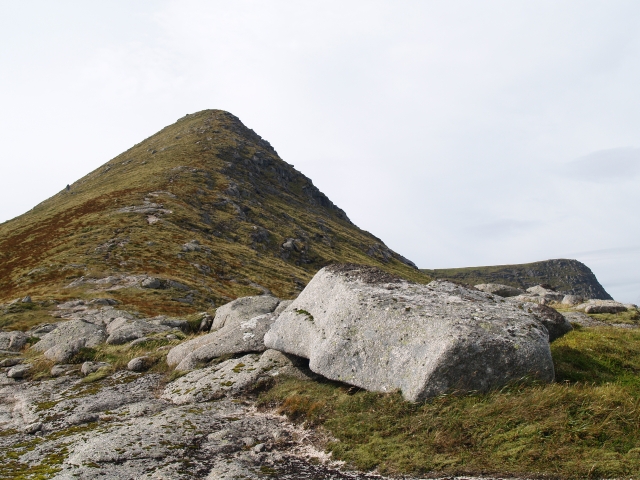
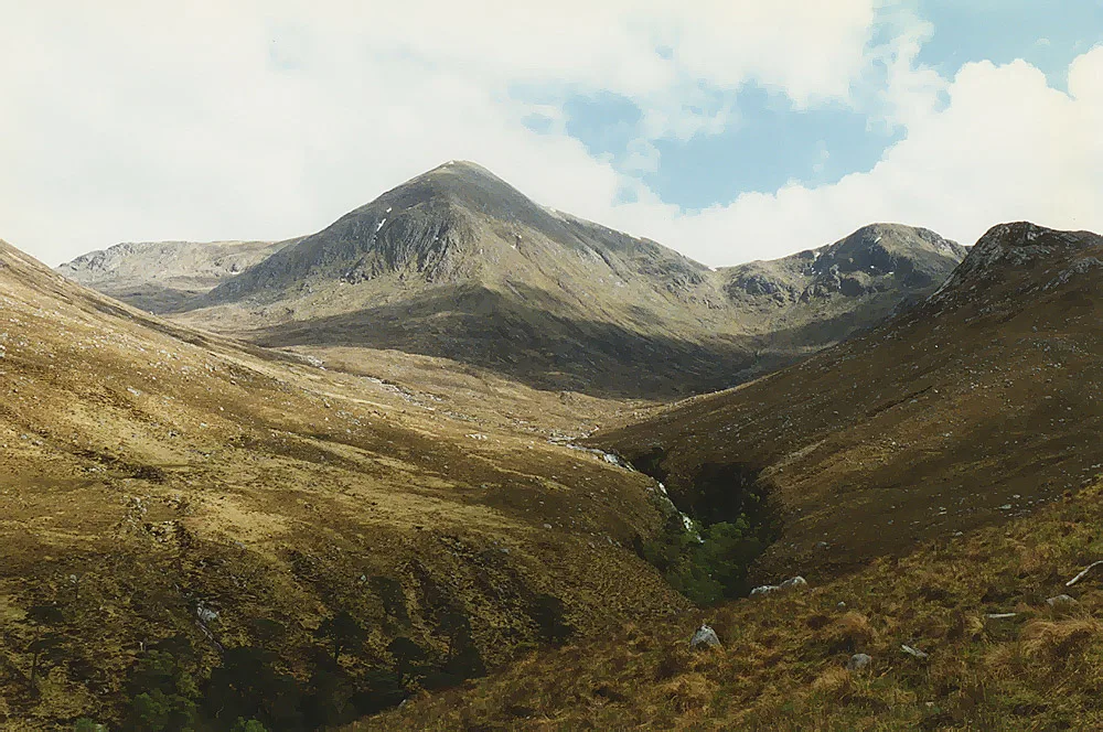
Stob Coir'an Albannaich — Named summit at 1044 m.

Wikimedia Commons contributors — see linked file page for photographer and licence licence
Plan your visit
- Typical visit
- 3 h–8 h
- Best time of year
- Late spring – early autumn (May–Oct)
- Free entry
- Dog-friendly
About
Stob Coir'an Albannaich is a named summit in the United Kingdom. Wikidata describes it as: "Named summit at 1044 m.". Coordinates: 56.5549°, -4.9798°.
Photo gallery
From the Wikipedia article
Stob Coir' an Albannaich (1,044 m) is a mountain in the Grampian Mountains of Scotland. It lies on the border of Argyll and Bute and the Highlands area, south of Glen Etive. The mountain makes for a fine traverse. The closest village is Taynuilt to the south.
Excerpt from Wikipedia under CC BY-SA 4.0. See the source article linked in Sources below.
- Coordinates
- 56.5549, -4.9798
- Address
- Argyll and Bute / Highland, Scotland
- Official site
- www.hill-bagging.co.uk
Sources
- osm: n259451745 (ODbL)
- wikipedia: Stob Coir' an Albannaich (CC BY-SA 4.0)
- commons: Stob Coir' an Albannaich - geograph.org.uk - 928461.jpg (CC BY-SA 4.0)
Other places nearby
Loading nearby places…
Nearby
 📷 5
📷 5Mountains & hills · Scottish Highlands
Stob Coir' an Albannaich
Stob Coir' an Albannaich — a hill or mountain in scotland highlands.
📷 5Mountains & hills · Scottish Highlands
Meall Tarsuinn
Meall Tarsuinn — a hill or mountain in scotland highlands.
📷 5Mountains & hills · Scottish Highlands
Meall Tarsuinn
Meall Tarsuinn — mountain in scotland highlands. Elevation: 875 m.
 📷 5
📷 5Mountains & hills · Scottish Highlands
Beinn Chaorach
Beinn Chaorach — mountain in scotland highlands. Elevation: 825 m.
 📷 5
📷 5Mountains & hills · Scottish Highlands
Meall Dubh
Meall Dubh — mountain in scotland highlands. Elevation: 682 m.
 📷 3
📷 3Mountains & hills · Scottish Highlands
Glas Bheinn Mhòr
Glas Bheinn Mhòr — Named summit at 997 m.
Where to eat & stay near Stob Coir'an Albannaich
Places to stay
 📷 5
📷 5Campsites · Scottish Highlands
Glencoe Mountain Resort
Glencoe Mountain Resort — a campsite in scotland highlands.
 📷 5
📷 5Hostels · Scottish Highlands
West Highland Way Sleeper
West Highland Way Sleeper — a hostel in scotland highlands.
 📷 5
📷 5Campsites · Scottish Highlands
Red Squirrel Campsite
Red Squirrel Campsite — a campsite in scotland highlands.
📷 5Hostels · Scottish Highlands
Glencoe Youth Hostel
Glencoe Youth Hostel — a hostel in scotland highlands.
 📷 5
📷 5Hostels · Scottish Highlands
Glencoe Independent Hostel
Glencoe Independent Hostel — a hostel in scotland highlands.
 📷 5
📷 5Campsites · Scottish Highlands
Glencoe Camping & Caravanning Club
Glencoe Camping & Caravanning Club — a campsite in scotland highlands.

More mountains in this region
 📷 3
📷 3Mountains & hills · Scottish Highlands
A' Bhuidheanach Bheag
A' Bhuidheanach Bheag — Named summit at 936 m.
 📷 3
📷 3Mountains & hills · Scottish Highlands
A' Chailleach
A' Chailleach — Named summit at 997 m.
 📷 3
📷 3Mountains & hills · Scottish Highlands
A' Chailleach
A' Chailleach — Named summit at 930 m.
 📷 3
📷 3Mountains & hills · Scottish Highlands
A' Chaoirnich
A' Chaoirnich — Named summit at 875 m.
Frequently asked questions
- Where is Stob Coir'an Albannaich?
- Stob Coir'an Albannaich is in the Scottish Highlands, United Kingdom.
- What is Stob Coir'an Albannaich?
- Stob Coir'an Albannaich — Named summit at 1044 m.
- How do I get to Stob Coir'an Albannaich?
- Its coordinates are 56.5549°, -4.9798°.
- Is Stob Coir'an Albannaich free to visit?
- Yes, Stob Coir'an Albannaich is free to enter.