
Mountains & hills · Central Scotland
Stob a' Choire Odhair
In or near Bridge of Orchy.
Stob a' Choire Odhair — Named summit at 945 m.

Wikimedia Commons contributors — see linked file page for photographer and licence licence

Plan your visit
- Typical visit
- 3 h–8 h
- Best time of year
- Late spring – early autumn (May–Oct)
- Nearest railway station
- Bridge of Orchy · 7.8 km
- Free entry
- Dog-friendly
About
Stob a' Choire Odhair is a named summit in the United Kingdom. Wikidata describes it as: "Named summit at 945 m.". Coordinates: 56.5733°, -4.8382°.
Photo gallery
Official information
Stob a' Choire Odhair is a prominent dome-shaped mountain located in Argyll, offering stunning views of Rannoch Moor. It is part of a popular hiking route that includes several Munros, making it a favored destination for walkers and climbers.
From the Wikipedia article
Stob a' Choire Odhair is a Scottish mountain situated eight kilometres north west of Bridge of Orchy on the border of the Argyll and Bute and Highland council areas.
Excerpt from Wikipedia under CC BY-SA 4.0. See the source article linked in Sources below.
Background
History
The lower eastern slopes of Stob a' Choire Odhair carries two old roads which were important historical links to the north of Scotland. An old military road built by Major William Caulfeild was constructed in the early 1750s as part of the pacification of the Highlands after the 1745 Jacobite rising. Slightly further east is the line of an ancient drovers' road used to herd cattle to market, this road was improved by Thomas Telford in 1803 and carried the main road down Glen Coe to Fort William until 1933 when the present road was built further east. Telford's road now carries the route of the West Highland Way.
Description
Stob a' Choire Odhair reaches a height of 945 m and is classed as a Munro and a Marilyn is an unpretentious mountain that is overshadowed by its near neighbour Stob Ghabhar, one of the finest mountains in the southern highlands. It stands in the Black Mount deer forest, an area that derives its name from the dark peat hags of the moorland that surround the mountain. Stob a' Choire Odhair along with Stob Ghabhar are well seen from the A82 road as it crosses the western end of Rannoch Moor and they are often climbed together and make a natural days walk. The hills name translates from the Gaelic as "Peak of the dun-coloured corrie".
Sourced from Wikipedia under CC BY-SA 4.0.
- Coordinates
- 56.5733, -4.8382
- Address
- Argyll, Scotland
- Nearest railway station
- Bridge of Orchy — 7.8 km
- Official site
- www.walkhighlands.co.uk
Sources
- osm: n259451142 (ODbL)
- wikipedia: Stob a' Choire Odhair (CC BY-SA 4.0)
- commons: Stob a Choire Odhair from the SE.jpg (CC BY-SA 4.0)
Other places nearby
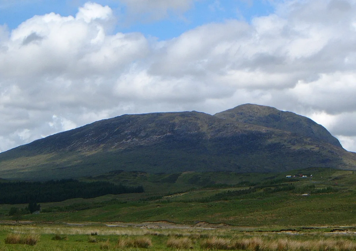
Stob a' Choire Odhair
Natural landmarks · 0.0 km

Beinn Toaig
Mountains & hills · 0.7 km
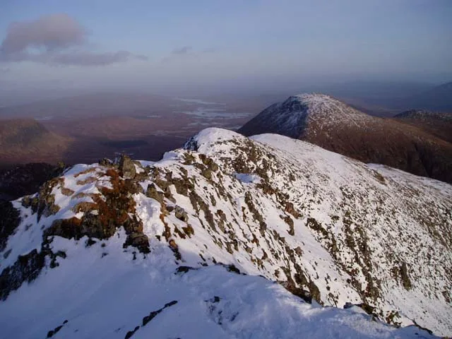
Aonach Eagach
Mountains & hills · 2.1 km

Meall Tionail
Mountains & hills · 2.3 km

Stob Ghabhar - Aonach Eagach
Mountains & hills · 2.3 km

Stob Ghabhar - Sron nan Giubhas
Mountains & hills · 2.7 km
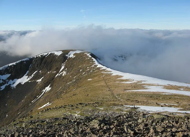
Stob Ghabhar
Mountains & hills · 2.7 km
Stob Ghabhar
Natural landmarks · 2.8 km

Stob Ghabhar - Creag a'Bhealaich
Mountains & hills · 3.6 km

Stob Ghabhar - Sron a' Ghearrain
Mountains & hills · 3.6 km

Clach Leathad
Mountains & hills · 3.8 km

Meall Beag
Mountains & hills · 4.0 km
Nearby
📷 3Natural landmarks · Central Scotland
Stob a' Choire Odhair
Stob a' Choire Odhair — 945m high mountain on the Argyll and Bute/Highland boundary, Scotland, UK.
📷 3Mountains & hills · Central Scotland
Beinn Toaig
Beinn Toaig — a mountain in scotland-highlands, United Kingdom.
📷 3📷 5Mountains & hills · Central Scotland
Meall Tionail
Meall Tionail — mountain in scotland highlands. Elevation: 582 m.
📷 3Mountains & hills · Central Scotland
Stob Ghabhar - Aonach Eagach
Stob Ghabhar - Aonach Eagach — a mountain in scotland-highlands, United Kingdom.
📷 3Mountains & hills · Central Scotland
Stob Ghabhar - Sron nan Giubhas
Stob Ghabhar - Sron nan Giubhas — a mountain in scotland-highlands, United Kingdom.
Where to eat & stay near Stob a' Choire Odhair
Places to stay
 📷 5
📷 5Campsites · Scottish Highlands
Glencoe Mountain Resort
Glencoe Mountain Resort — a campsite in scotland highlands.
 📷 5
📷 5Hostels · Central Scotland
West Highland Way Sleeper
West Highland Way Sleeper — a hostel in scotland highlands.
 📷 5
📷 5Hostels · Scottish Highlands
West Highland Lodge
West Highland Lodge — a hostel in scotland highlands.
 📷 5📷 5📷 5
Places to eat & drink
 📷 4
📷 4Historic pubs · Scottish Highlands
Clachaig Inn
Clachaig Inn in Scotland Islands, United Kingdom.
More mountains in this region
 📷 3
📷 3 📷 3
📷 3 📷 3
📷 3Mountains & hills · Central Scotland
An Caisteal
An Caisteal — Named summit at 995 m.
 📷 5
📷 5Frequently asked questions
- Where is Stob a' Choire Odhair?
- Stob a' Choire Odhair is in the Scottish Highlands, United Kingdom.
- What is Stob a' Choire Odhair?
- Stob a' Choire Odhair — Named summit at 945 m.
- How do I get to Stob a' Choire Odhair?
- The nearest railway station is Bridge of Orchy, about 7.8 km away. Its coordinates are 56.5733°, -4.8382°.
- Is Stob a' Choire Odhair free to visit?
- Yes, Stob a' Choire Odhair is free to enter.
- How do I get to Stob a' Choire Odhair?
- The nearest railway station is Bridge of Orchy, about 7.8 km away.