Mountains & hills · West Midlands
Steepness Hill
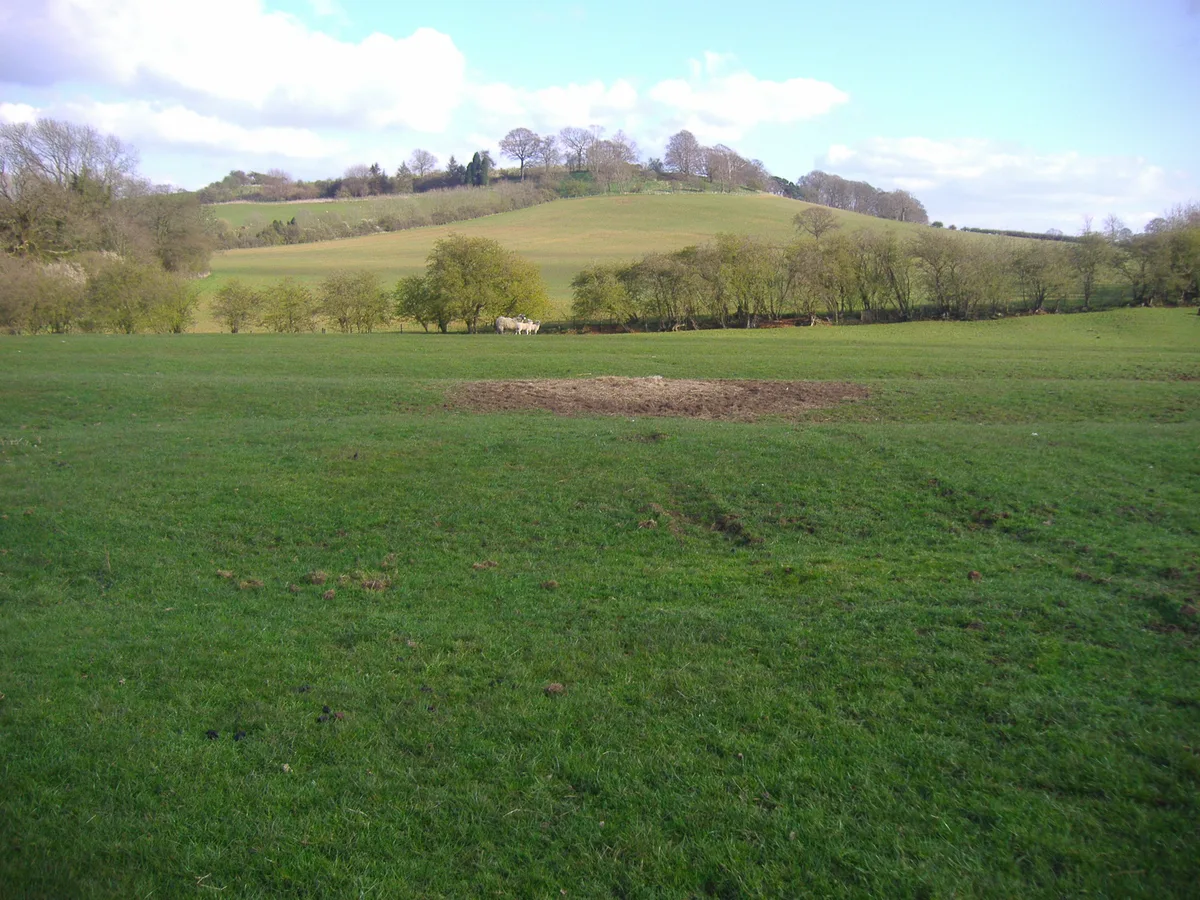
Steepness Hill — a hill or mountain in england west midlands.

Steve Daniels — CC BY-SA 2.0 via Wikimedia Commons licence
Plan your visit
- Typical visit
- 3 h–8 h
- Best time of year
- Late spring – early autumn (May–Oct)
About
A British hill or mountain, named on Ordnance Survey maps and walked by hill-baggers. Steepness Hill is a named hill or mountain in england west midlands, recorded in the GeoNames UK gazetteer. British landmarks of this type are typically marked on Ordnance Survey maps and recorded in the national gazetteer for cartographic and navigational reference. Coordinates and feature classification are sourced from the GeoNames open dataset.
Photo gallery
Place summary
Steepness Hill is a mountain located in the West Midlands. It is characterised by its significant elevation and steep gradients, making it a notable feature of the local landscape. The area is suitable for outdoor activities, offering various walking trails and opportunities for exploration. Visitors can expect a rugged terrain typical of mountainous regions.
AI-generated from the structured facts on this page (operator, designation, listing, era). Not a substitute for visiting.
- Coordinates
- 51.9824, -1.3645
Sources
- manual: geonames-12615860 (CC BY 4.0)
Other places nearby
Loading nearby places…
Nearby
 📷 5
📷 5Towns & cities · West Midlands
Barford St. Michael
Barford St. Michael — village in Oxfordshire, England, UK.
 📷 3
📷 3Historic bridges · West Midlands
Bridge Over River Swere
Bridge Over River Swere — Grade II listed building-listed bridge in england-west-midlands, United Kingdom.
 📷 4
📷 4Vineyards · West Midlands
Ilbury Camp hillfort
Ilbury Camp hillfort — a UK vineyard in england west midlands, producing English or Welsh wine from cool-climate grape varieties.
 📷 5
📷 5Campsites · West Midlands
Cheyney Manor House Campsite
Cheyney Manor House Campsite — a campsite in england west midlands.
 📷 5
📷 5Villages · West Midlands
Over Worton
Over Worton — a village in england west midlands.
 📷 4
📷 4Castles · West Midlands
Worton
Worton — a castle in england west midlands.
Where to eat & stay near Steepness Hill
Places to stay
📷 5Campsites · West Midlands
Cheyney Manor House Campsite
Cheyney Manor House Campsite — a campsite in england west midlands.
 📷 5
📷 5Caravan parks · West Midlands
Newton Grove CL
Newton Grove CL — a caravan park in england west midlands.
 📷 5
📷 5Campsites · West Midlands
Bo Peep Caravan Park
Bo Peep Caravan Park — a campsite in england west midlands.
 📷 5
📷 5Caravan parks · West Midlands
Bo Peep Caravan Park
Bo Peep Caravan Park — a caravan park in england west midlands.
 📷 5
📷 5Campsites · West Midlands
The Pig Place
The Pig Place — a campsite in england west midlands.
 📷 5
📷 5Hotels · West Midlands
Hopcrofts Holt
Hopcrofts Holt — a hotel in england west midlands.
Places to eat & drink
 📷 5
📷 5Historic pubs · South East England
Crown And Tuns Public House
Crown And Tuns Public House in England South East, United Kingdom.
 📷 5
📷 5Historic pubs · West Midlands
Elephant And Castle Public House
Elephant And Castle Public House in England West Midlands, United Kingdom.
 📷 5
📷 5Cafés · West Midlands
Quince and Clover at Great Tew
Quince and Clover at Great Tew — a café in england west midlands.
📷 5Historic pubs · South East England
The Falkland Arms Public House
The Falkland Arms Public House in England South East, United Kingdom.
 📷 5
📷 5Historic pubs · South East England
Duke Of Cumberlands Head Public House
Duke Of Cumberlands Head Public House in England South East, United Kingdom.
 📷 5
📷 5Restaurants · West Midlands
The Cinnamon Stick
The Cinnamon Stick — a restaurant in england west midlands.
More mountains in this region
 📷 5
📷 5Mountains & hills · West Midlands
Arbury Hill
Arbury Hill — Named summit at 224.3 m.
Mountains & hills · West Midlands
Barr Beacon
Barr Beacon — Named summit at 227 m.
 📷 3
📷 3Mountains & hills · West Midlands
Barrow Hill
Barrow Hill — Named summit at 179 m.
Mountains & hills · West Midlands
Beacon Hill
Beacon Hill — Named summit at 237 m.
Frequently asked questions
- Where is Steepness Hill?
- Steepness Hill is in the West Midlands, United Kingdom.
- What is Steepness Hill?
- Steepness Hill — a hill or mountain in england west midlands.
- How do I get to Steepness Hill?
- Its coordinates are 51.9824°, -1.3645°.