
Windmills · South West England
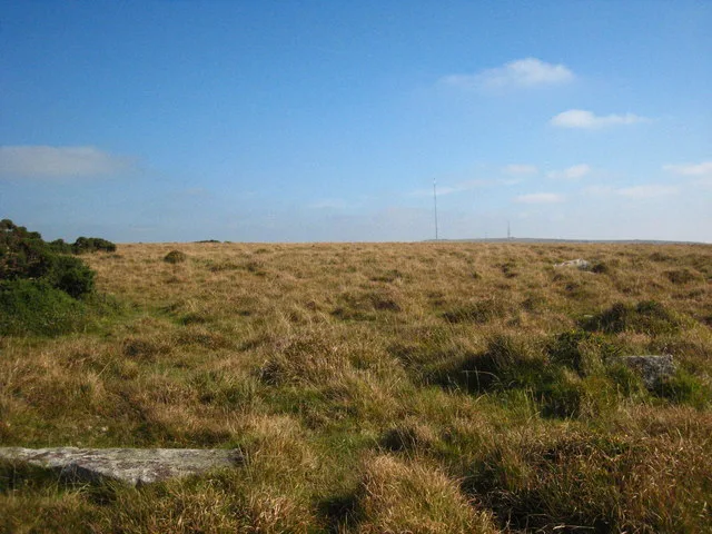
Standing stone and surrounding cairn 725m west of Trewalla Farm
In or near Upton Cross.
Standing stone and surrounding cairn 725m west of Trewalla Farm — a post mill in england-south-west, United Kingdom.

Derek Harper — CC BY-SA 2.0 via Wikimedia Commons licence

Plan your visit
- Typical visit
- 30 min–1 h
- Nearest railway station
- Liskeard · 7.5 km
- Free entry
- Family-friendly
- Dog-friendly
About
Standing stone and surrounding cairn 725m west of Trewalla Farm is a post mill located in england-south-west, United Kingdom. Catalogued from Wikidata's UK heritage register; see the linked Wikipedia article for further details on its history, architecture and visiting information.
Photo gallery
Protected designations
- Area of Outstanding Natural Beauty: Cornwall
Designations sourced from Natural England open data under OGL v3.
Place summary
The Standing stone and surrounding cairn, located 725m west of Trewalla Farm in South-West England, is a significant prehistoric site. This structure is designated as a scheduled monument, highlighting its archaeological importance in the region.
AI-generated from the structured facts on this page (operator, designation, listing, era). Not a substitute for visiting.
- Coordinates
- 50.5135, -4.4852
- District
- Cornwall
- Parish
- St. Cleer
- Postcode
- PL14 6ED
- Parliamentary constituency
- South East Cornwall
- Nearest railway station
- Liskeard — 7.5 km
Sources
- wikidata: Q17646253 (CC0)
Other places nearby

Tregarrick Tor
Mountains & hills · 0.2 km

Siblyback Lake Campsite
Campsites · 0.4 km

Siblyback Lake
Reservoirs & lochs · 0.6 km

Crylla Cross
Memorials & monuments · 0.7 km
Craddock Moor stone circle
Hill forts · 1.2 km

Craddock Moor Mine Engine House
Historic houses · 1.4 km

Mine Ruins
Historic houses · 1.6 km

1846 RIL 6
Memorials & monuments · 1.8 km

The Hurlers Pipers
Archaeological sites · 1.8 km

The Hurlers: Southern circle
Archaeological sites · 1.9 km
The Hurlers: Central Circle
Archaeological sites · 1.9 km
A Hurler
Archaeological sites · 1.9 km
Nearby
📷 5Mountains & hills · South West England
Tregarrick Tor
Tregarrick Tor — mountain in england south west. Elevation: 316.4 m.
📷 5Campsites · South West England
Siblyback Lake Campsite
Siblyback Lake Campsite — a campsite in england south west.
📷 3Reservoirs & lochs · South West England
Siblyback Lake
Siblyback Lake — Reservoir in Cornwall, England.
📷 3Memorials & monuments · South West England
Crylla Cross
Crylla Cross — a memorial in england-south-west, United Kingdom.
📷 5Hill forts · South West England
Craddock Moor stone circle
Craddock Moor stone circle — stone circle on Bodmin Moor, Cornwall, England.
📷 3Historic houses · South West England
Craddock Moor Mine Engine House
Craddock Moor Mine Engine House — a historic house in england-south-west, United Kingdom.
Where to eat & stay near Standing stone and surrounding cairn 725m west of Trewalla Farm
Places to stay
📷 5Campsites · South West England
Siblyback Lake Campsite
Siblyback Lake Campsite — a campsite in england south west.
 📷 5
📷 5Campsites · South West England
Cheesewring Farm Campsite
Cheesewring Farm Campsite — a campsite in england south west.
📷 5Caravan parks · South West England
Cheesewring Farm Caravan site
Cheesewring Farm Caravan site — a caravan park in england south west.
 📷 5
📷 5Campsites · South West England
Colliford Tavern Camp Site
Colliford Tavern Camp Site — a campsite in england south west.
 📷 5
📷 5Caravan parks · South West England
Pine Green Caravan & Camping Park
Pine Green Caravan & Camping Park — a caravan park in england south west.
 📷 5
📷 5Places to eat & drink
 📷 7
📷 7Restaurants · South West England
Himalayan Spice
Himalayan Spice — a restaurant in england south west.
 📷 7
📷 7Historic pubs · South West England
The Albion Public House
The Albion Public House in England South West, United Kingdom.
 📷 7
📷 7Historic pubs · South West England
The Barley Sheaf Public House
The Barley Sheaf Public House in England South West, United Kingdom.
 📷 7
📷 7Historic pubs · South West England
Tavernan Carow Public House
Tavernan Carow Public House in England South West, United Kingdom.
 📷 5
📷 5Historic pubs · South West England
Bakers Arms Public House
Bakers Arms Public House in England South West, United Kingdom.
 📷 7
📷 7Historic pubs · South West England
The Bell Inn And Attached Wall And Coach House
The Bell Inn And Attached Wall And Coach House in England South West, United Kingdom.
More windmills in this region
 📷 5
📷 5Windmills · South West England
Windmill Hill Neolithic Causewayed Enclosure
Windmill Hill Neolithic Causewayed Enclosure — a windmill in england-south-east, United Kingdom.
 📷 5
📷 5Windmills · South West England
East Knoyle Windmill
East Knoyle Windmill — Grade II listed building-listed windmill in england-south-east, United Kingdom.
 📷 5
📷 5Windmills · South West England
Windmill At Ngr Sy 69087138
Windmill At Ngr Sy 69087138 — Grade II listed building-listed windmill in england-south-east, United Kingdom.
 📷 5
📷 5Windmills · South West England
Windmill At Ngr Sy 69077128
Windmill At Ngr Sy 69077128 — Grade II listed building-listed windmill in england-south-east, United Kingdom.
Frequently asked questions
- Where is Standing stone and surrounding cairn 725m west of Trewalla Farm?
- Standing stone and surrounding cairn 725m west of Trewalla Farm is in South-West England, United Kingdom (postcode PL14 6ED), in the parish of St. Cleer.
- What is Standing stone and surrounding cairn 725m west of Trewalla Farm?
- Standing stone and surrounding cairn 725m west of Trewalla Farm — a post mill in england-south-west, United Kingdom.
- How do I get to Standing stone and surrounding cairn 725m west of Trewalla Farm?
- The nearest railway station is Liskeard, about 7.5 km away. Drivers can use postcode PL14 6ED.
- Is Standing stone and surrounding cairn 725m west of Trewalla Farm a protected site?
- Yes — Standing stone and surrounding cairn 725m west of Trewalla Farm is part of the Cornwall National Landscape (AONB).
- Is Standing stone and surrounding cairn 725m west of Trewalla Farm free to visit?
- Yes, Standing stone and surrounding cairn 725m west of Trewalla Farm is free to enter.
- How do I get to Standing stone and surrounding cairn 725m west of Trewalla Farm?
- The nearest railway station is Liskeard, about 7.5 km away. Drivers can navigate to postcode PL14 6ED.