
Windmills · North East England
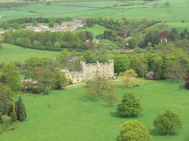
Standing stone, 770m south-east of Swinburne Castle
In or near Birtley.
Standing stone, 770m south-east of Swinburne Castle — a post mill in scotland-lowlands, United Kingdom.

Oliver Dixon — CC BY-SA 2.0 via Wikimedia Commons licence

Plan your visit
- Typical visit
- 30 min–1 h
- Free entry
- Family-friendly
- Dog-friendly
About
Standing stone, 770m south-east of Swinburne Castle is a post mill located in scotland-lowlands, United Kingdom. Catalogued from Wikidata's UK heritage register; see the linked Wikipedia article for further details on its history, architecture and visiting information.
Photo gallery
Place summary
The standing stone, located 770 metres south-east of Swinburne Castle in the Scottish Lowlands, is a prehistoric monument. Its significance lies in its age and the cultural context of the region, reflecting ancient practices.
AI-generated from the structured facts on this page (operator, designation, listing, era). Not a substitute for visiting.
- Coordinates
- 55.0653, -2.0993
- District
- Northumberland
- Parish
- Chollerton
- Postcode
- NE48 4DB
- Parliamentary constituency
- Hexham
Sources
- wikidata: Q17657204 (CC0)
Other places nearby
Great Swinburn
Villages · 0.2 km

Univallate hillfort in Oxhill Plantation, 450m north-east of Great Swinburne
Vineyards · 1.2 km
.jpg?width=1200)
Dunn Crags farmstead and irregular enclosed field system, 950m north-west of Colwell
Archaeological sites · 1.9 km

Colwell
Other places · 2.0 km

Well House CAMC CL
Caravan parks · 2.0 km

Barrasford railway station
Heritage railway stations · 2.1 km
Colwell
Villages · 2.1 km

Chollerton
Cemeteries · 2.2 km

Dere Street
Long-distance walking trails · 2.4 km

Gunnerton Crag camps
Vineyards · 2.4 km

Barrasford
Castles · 2.5 km
Haughton Castle
Castles · 2.5 km
Nearby
📷 5📷 5Vineyards · North East England
Univallate hillfort in Oxhill Plantation, 450m north-east of Great Swinburne
Univallate hillfort in Oxhill Plantation, 450m north-east of Great Swinburne — a UK vineyard in scotland lowlands, producing English or Welsh wine from cool-climate grape varieties.
📷 3Archaeological sites · North East England
Dunn Crags farmstead and irregular enclosed field system, 950m north-west of Colwell
Dunn Crags farmstead and irregular enclosed field system, 950m north-west of Colwell — archaeological site in Chollerton, Northumberland, England, UK.
📷 5📷 5Caravan parks · North East England
Well House CAMC CL
Well House CAMC CL — a caravan park in scotland lowlands.
📷 4Heritage railway stations · North East England
Barrasford railway station
Barrasford railway station in England North East, United Kingdom.
Where to eat & stay near Standing stone, 770m south-east of Swinburne Castle
Places to stay
📷 5Caravan parks · North East England
Well House CAMC CL
Well House CAMC CL — a caravan park in scotland lowlands.
 📷 5
📷 5Campsites · North East England
Barrasford Park Camping Site
Barrasford Park Camping Site — a campsite in scotland lowlands.
📷 5Caravan parks · North East England
Barrasford Park Caravan Site
Barrasford Park Caravan Site — a caravan park in scotland lowlands.
 📷 7
📷 7Hotels · North East England
George Hotel
George Hotel — a hotel in scotland lowlands.
 📷 5
📷 5Campsites · North East England
Greencarts Campsite
Greencarts Campsite — a campsite in scotland lowlands.
 📷 5
📷 5Campsites · North East England
Fallowfield Caravan Park
Fallowfield Caravan Park — a campsite in scotland lowlands.
Places to eat & drink
 📷 6
📷 6 📷 5
📷 5 📷 7
📷 7Historic pubs · North East England
The Vicars Pele
The Vicars Pele in Scotland Lowlands, United Kingdom.
 📷 7
📷 7 📷 7
📷 7Historic pubs · North East England
Anchor Hotel
Anchor Hotel in Scotland Lowlands, United Kingdom.
 📷 5
📷 5More windmills in this region
 📷 5
📷 5Windmills · North East England
Standing stone on Brockrigg known as Wade's Stone, 420m south east of Brockrigg Farm
Standing stone on Brockrigg known as Wade's Stone, 420m south east of Brockrigg Farm — a post mill in england-north-east, United Kingdom.
 📷 5
📷 5Windmills · North East England
Standing stone 470m north east of High Farm, known as Wade's Stone
Standing stone 470m north east of High Farm, known as Wade's Stone — a post mill in england-north-east, United Kingdom.
 📷 5
📷 5Windmills · North East England
Standing Stone (Six Stoups) Circa 340 Centimetres South West Of Ridge Farmhouse
Standing Stone (Six Stoups) Circa 340 Centimetres South West Of Ridge Farmhouse — a post mill in england-north-east, United Kingdom.
 📷 3
📷 3Windmills · North East England
Birney Hill Windmill
Birney Hill Windmill is a windmill in the United Kingdom.
Frequently asked questions
- Where is Standing stone, 770m south-east of Swinburne Castle?
- Standing stone, 770m south-east of Swinburne Castle is in the Scottish Lowlands, United Kingdom (postcode NE48 4DB), in the parish of Chollerton.
- What is Standing stone, 770m south-east of Swinburne Castle?
- Standing stone, 770m south-east of Swinburne Castle — a post mill in scotland-lowlands, United Kingdom.
- How do I get to Standing stone, 770m south-east of Swinburne Castle?
- Drivers can use postcode NE48 4DB.
- Is Standing stone, 770m south-east of Swinburne Castle free to visit?
- Yes, Standing stone, 770m south-east of Swinburne Castle is free to enter.
- How do I get to Standing stone, 770m south-east of Swinburne Castle?
- Drivers can navigate to postcode NE48 4DB. It sits within the Hexham parliamentary constituency.