
Windmills · North West England
standing stone 1140m NE of Killumpha
standing stone 1140m NE of Killumpha — a post mill in scotland-lowlands, United Kingdom.

Billy McCrorie — CC BY-SA 2.0 via Wikimedia Commons licence

Plan your visit
- Typical visit
- 30 min–1 h
- Free entry
- Family-friendly
- Dog-friendly
About
standing stone 1140m NE of Killumpha is a post mill located in scotland-lowlands, United Kingdom. Catalogued from Wikidata's UK heritage register; see the linked Wikipedia article for further details on its history, architecture and visiting information.
Photo gallery
See it from the streetimagery from 2022
Imagery © Mapillary contributors, CC BY-SA 4.0
Place summary
Standing stone 1140m NE of Killumpha is located in the Scottish Lowlands. This site features a distinctive standing stone, which is an example of prehistoric monumentation in the region.
AI-generated from the structured facts on this page (operator, designation, listing, era). Not a substitute for visiting.
- Coordinates
- 54.7314, -4.9168
- District
- Dumfries and Galloway
- Postcode
- DG9 9NS
- Parliamentary constituency
- Dumfries and Galloway
Sources
- wikidata: Q56661369 (CC0)
Other places nearby

Terally Bay
Natural landmarks · 0.3 km

New England Bay
Natural landmarks · 0.8 km

Dungamen Bay
Natural landmarks · 1.1 km

New England Bay
Caravan parks · 1.1 km

Inchmulloch Hill
Mountains & hills · 2.3 km

St Agnes' Former Church, Killingeane
Historic churches · 2.6 km

Logan Windmill
Windmills · 2.6 km

Port Logan
Villages · 2.6 km
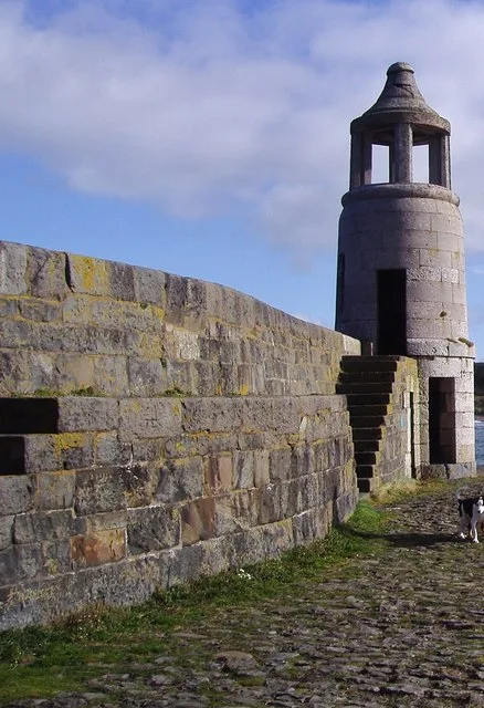
Port Logan Lighthouse
Lighthouses · 2.9 km

Kilstay Bay
Natural landmarks · 3.0 km

Logan Botanic Gardens
Gardens · 3.0 km

Logan Botanic Garden
Gardens · 3.0 km
Nearby
📷 5Natural landmarks · North West England
Terally Bay
Terally Bay — a natural feature in scotland lowlands.
📷 5Natural landmarks · North West England
New England Bay
New England Bay — a natural feature in scotland lowlands.
📷 5Natural landmarks · North West England
Dungamen Bay
Dungamen Bay — a natural feature in scotland lowlands.
📷 5Caravan parks · North West England
New England Bay
New England Bay — a caravan park in scotland lowlands.
📷 5Mountains & hills · North West England
Inchmulloch Hill
Inchmulloch Hill — a hill or mountain in scotland lowlands.
📷 5Historic churches · North West England
St Agnes' Former Church, Killingeane
St Agnes' Former Church, Killingeane — category B listed building-listed church in scotland-lowlands, United Kingdom.
Where to eat & stay near standing stone 1140m NE of Killumpha
Places to stay
📷 5Caravan parks · North West England
New England Bay
New England Bay — a caravan park in scotland lowlands.
 📷 5
📷 5 📷 5
📷 5Campsites · North West England
Clashwhannon Holiday Park
Clashwhannon Holiday Park — a campsite in scotland lowlands.
 📷 5
📷 5Caravan parks · North West England
Ardwell Caravan Park
Ardwell Caravan Park — a caravan park in scotland lowlands.
 📷 5
📷 5Campsites · North West England
Ardwell Chalets
Ardwell Chalets — a campsite in scotland lowlands.
 📷 5
📷 5Campsites · North West England
Maryport Holiday Park
Maryport Holiday Park — a campsite in scotland lowlands.
Places to eat & drink
 📷 5
📷 5Historic pubs · North West England
Stranraer Tandoori
Stranraer Tandoori in Scotland Lowlands, United Kingdom.
More windmills in this region
 📷 4
📷 4Windmills · North West England
Ravensmoor Windmill
Ravensmoor Windmill — a Grade II-listed windmill in england-west-midlands, United Kingdom.
 📷 3
📷 3Windmills · North West England
Buerton Old Windmill
Buerton Old Windmill — Grade II listed building-listed windmill in england-west-midlands, United Kingdom.
 📷 3
📷 3Windmills · North West England
Cragg's Row Windmill
Cragg's Row Windmill — Windmill, dating to early C19.
 📷 3
📷 3Windmills · North West England
Haigh Windmill
Haigh Windmill is a windmill in the United Kingdom.
Frequently asked questions
- Where is standing stone 1140m NE of Killumpha?
- standing stone 1140m NE of Killumpha is in North-West England, United Kingdom (postcode DG9 9NS).
- What is standing stone 1140m NE of Killumpha?
- standing stone 1140m NE of Killumpha — a post mill in scotland-lowlands, United Kingdom.
- How do I get to standing stone 1140m NE of Killumpha?
- Drivers can use postcode DG9 9NS.
- Is standing stone 1140m NE of Killumpha free to visit?
- Yes, standing stone 1140m NE of Killumpha is free to enter.
- How do I get to standing stone 1140m NE of Killumpha?
- Drivers can navigate to postcode DG9 9NS. It sits within the Dumfries and Galloway parliamentary constituency.