Islands · Scottish Islands
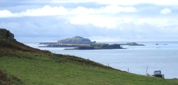
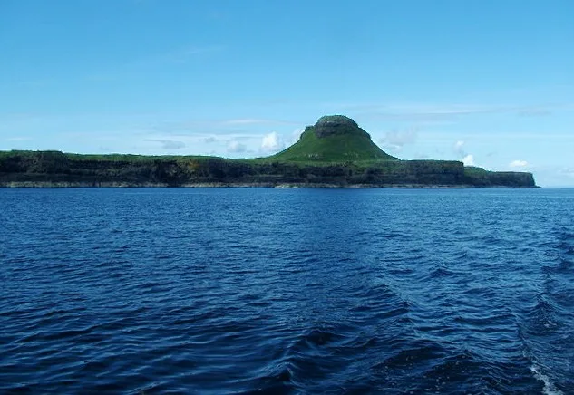
Staffa
Also known as: Stafa
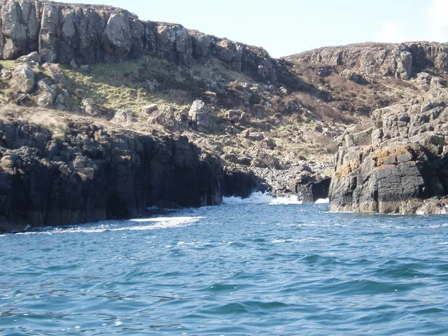
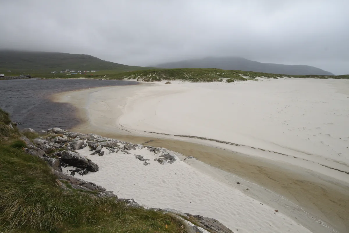
Staffa — island of the Inner Hebrides in Argyll and Bute, Scotland, UK.

Wikimedia Commons contributors — see linked file page for photographer and licence licence
Plan your visit
- Typical visit
- 4 h–12 h
- Free entry
- Family-friendly
- Dog-friendly
- Limited wheelchair access
Getting there & planning your visit
Staffa is an island located in the Scottish Highlands, with coordinates 56.4361° N latitude and 6.3403° W longitude. Entry to the island is free, but accessibility is limited for wheelchair users. There is no nearest railway station or postcode available for direct access.
About
Staffa is a island in the United Kingdom. It covers approximately 33 km². Owned by National Trust for Scotland. Managed by National Trust for Scotland. Part of Inner Hebrides. Wikidata describes it as: "island of the Inner Hebrides in Argyll and Bute, Scotland, UK". Coordinates: 56.4361°, -6.3403°.
Photo gallery
Summary from the official site
Staffa is a small island known for its stunning volcanic rock formations, including the famous Fingal's Cave. Visitors can explore the island's unique geology, spot various seabirds, and enjoy panoramic views of the surrounding Hebridean islands.
Read more on the official property page.
From the Wikipedia article
Staffa (Scottish Gaelic: Stafa, pronounced [ˈs̪t̪afa], from the Old Norse word for a stave or pillar, is an island of the Inner Hebrides in Argyll and Bute, Scotland. The Vikings gave it the name because its columnar basalt reminded them of their houses, which were constructed using vertical logs. Staffa lies about 10 kilometres (6 miles) west of the Isle of Mull. It is 33 hectares (82 acres) in area and the highest point is 42 metres (138 feet) above sea level. The island came to prominence in the late 18th century after a visit by Sir Joseph Banks. He and his fellow-travellers extolled the natural beauty of the basalt columns and of the island's main sea cavern, which Banks renamed "Fingal's Cave". Their visit was followed by those of many other prominent people during the next two centuries, including Queen Victoria and Felix Mendelssohn. The latter's Hebrides Overture brought further fame to the island, which was by then uninhabited. It is now in the care of the National Trust for Scotland.
Excerpt from Wikipedia under CC BY-SA 4.0. See the source article linked in Sources below.
Background
Visiting
Boat trips from Tiree, Tobermory, Oban, Ulva Ferry, and Fionnphort on Mull, and Iona run from April to September, allowing visitors to view the caves and the puffins that nest on the island between April and early August. There is a landing place used by the tourist boats just north of Am Buachaille, but disembarkation is only possible in calm conditions. The island lacks a genuine anchorage.
Sourced from Wikipedia under CC BY-SA 4.0.
- Coordinates
- 56.4361, -6.3403
- Opening
- Open daily
- Official site
- www.nts.org.uk
Sources
- wikidata: Q250117 (CC0)
- wikipedia: Staffa (CC BY-SA 4.0)
- commons: Fingals Cave, Staffa - geograph.org.uk - 30215.jpg (CC BY-SA 4.0)
Featured in these 3 guides
Itinerary
Britain's most-visitable islands
Skye, Mull, Anglesey, the Scillies, the Channel Islands — fifteen islands worth the ferry.
Itinerary
Britain's wild islands: 7 days in the Hebrides
Skye, Mull, Iona, Staffa — a slow island-hopping itinerary.
Itinerary
Britain's tiniest villages with disproportionate fame
Hamlets that punch above their weight.
Other places nearby

Goat Cave
Caves · 0.2 km

Clamshell Cave, Staffa
Caves · 0.4 km

Clamshell Cave
Caves · 0.4 km

McKinnons's Cave
Caves · 0.5 km

Cormorant's Cave, Staffa
Caves · 0.5 km

Meall nan Gamhna
Mountains & hills · 0.5 km

Boat Cave
Caves · 0.5 km

Boat Cave, Staffa
Caves · 0.5 km

Fingals Cave
Caves · 0.5 km

Fingal's Cave
Caves · 0.5 km
Little Colonsay
Islands · 5.0 km

Torr Mor
Mountains & hills · 6.2 km
Nearby
📷 5📷 5Caves · Scottish Islands
Clamshell Cave, Staffa
Clamshell Cave, Staffa — a cave broad in scotland-highlands, United Kingdom.
📷 5📷 3Caves · Scottish Islands
McKinnons's Cave
McKinnons's Cave is a cave in the United Kingdom.
📷 5Caves · Scottish Islands
Cormorant's Cave, Staffa
Cormorant's Cave, Staffa — a cave broad in scotland-highlands, United Kingdom.
📷 5Mountains & hills · Scottish Islands
Meall nan Gamhna
Meall nan Gamhna — mountain in scotland highlands. Elevation: 42 m.
Where to eat & stay near Staffa
Places to stay
 📷 5
📷 5 📷 5
📷 5 📷 5
📷 5Hostels · Central Scotland
Ulva Hostel
Ulva Hostel — a hostel in scotland highlands.
 📷 5
📷 5Campsites · Scottish Islands
Iona Campsite
Iona Campsite — a campsite in scotland highlands.
 📷 5
📷 5Campsites · Scottish Islands
Fidden Farm
Fidden Farm — a campsite in scotland highlands.
 📷 5
📷 5Places to eat & drink
 📷 5
📷 5Restaurants · Central Scotland
The Boathouse
The Boathouse — a restaurant in scotland highlands.
More places run by National Trust for Scotland
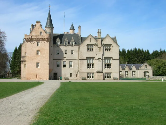
 📷 3
📷 3Gardens · North West England
Threave Gardens
Threave Gardens is a garden in the United Kingdom.
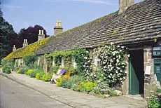 📷 3
📷 3Museums · Scottish Highlands
Angus Folk Museum
Angus Folk Museum — centre for agricultural history and rural life located near Forfar, Angus, Scotland, UK.
 📷 3
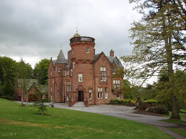
📷 3Castles · Scottish Highlands
Brodie Castle
Brodie Castle — castle in Moray, Scotland, UK.
 📷 5
📷 5More places in this region
 📷 5
📷 5Islands · Scottish Islands
Bac Beag
Bac Beag — Scottish island, part of the Treshnish Isles in the Inner Hebrides.
 📷 5
📷 5Islands · Scottish Islands
Bac Mòr
Bac Mòr — island in Argyll and Bute, Scotland, UK, one of the Treshnish Isles.
 Flagship📷 3
Islands · Scottish Islands
Baleshare
Baleshare — flat tidal island in the Outer Hebrides, Scotland, UK.
 Flagship📷 5
Islands · Scottish Islands
Barra
Barra — island in Outer Hebrides, Scotland, UK.
Frequently asked questions
- Where is Staffa?
- Staffa is in the Scottish Highlands, United Kingdom.
- What is Staffa?
- Staffa — island of the Inner Hebrides in Argyll and Bute, Scotland, UK.
- How do I get to Staffa?
- Its coordinates are 56.4361°, -6.3403°.
- Who runs Staffa?
- Staffa is operated by National Trust for Scotland.
- Is Staffa free to visit?
- Yes, Staffa is free to enter.