
Historic churches · South Wales
St Tyfei's Church, Llandyfeisant
In or near Llanfynydd.
St Tyfei's Church, Llandyfeisant — a Grade II*-listed church in wales-south, United Kingdom.

Alan Richards — CC BY-SA 2.0 via Wikimedia Commons licence

Plan your visit
- Typical visit
- 30 min–1 h
- Nearest railway station
- Ffairfach · 1.1 km
- Free entry
Getting there & planning your visit
To visit St Tyfei's Church in Llandyfeisant, the nearest railway station is Ffairfach, located 1.1 km away. The postcode for sat-nav is SA19 6RP, and entry to the church is free.
About
St Tyfei's Church, Llandyfeisant is a Grade II*-listed building in wales-south, United Kingdom. Grade II* status is conferred by Historic England (or Cadw, Historic Environment Scotland or NIEA equivalents) on buildings of exceptional national interest. See the linked Wikipedia article for full historical and architectural details.
Photo gallery
Heritage listing
St Tyfi's Church is the former parish church of Llandyfeisant, near Llandeilo and part of the Dinefwr Park estate in Carmarthenshire, Wales. It was dedicated to the Welsh saint Tyfei, nephew of Saint Teilo. As of May 2026, St Tyfi's church is in the process of being transferred to the care of the national charity, the Friends of Friendless Churches.
From Cadw under OGL v3.
From the Wikipedia article
St Tyfi's Church is the former parish church of Llandyfeisant, near Llandeilo and part of the Dinefwr Park estate in Carmarthenshire, Wales. It was dedicated to the Welsh saint Tyfei, nephew of Saint Teilo. As of May 2026, St Tyfi's church is in the process of being transferred to the care of the national charity, the Friends of Friendless Churches.
Excerpt from Wikipedia under CC BY-SA 4.0. See the source article linked in Sources below.
Background
History
The history of the site may stretch back to pre-Christian times. The small stone church was first constructed in medieval times. It was first mentioned in the Ecclesiastical Taxation of 1291. By 1324, it was assigned to Talley Abbey. The building may have been replaced or enlarged in the late thirteenth or early fourteenth century.
Architecture
The church was almost entirely rebuilt in the second half of the nineteenth century. The architect was likely R. Kyrke Pearson from Oswestry, who redesigned Newton House for Lord Dynefwr. The exterior has rubble-stone facings, gable parapets and a stone slate roof. The interior has an open, arched-brace roof with collar-beams and stone corbels, and a window in the south wall from the 13th century from the previous structure. The building is no longer used for religious purposes. In 1961, the font and stained-glass window war memorial were removed to nearby St Teilo Church for safekeeping. The building was used as a visitor's information centre by The Welsh Wildlife Trust in the late 1980s…
Sourced from Wikipedia under CC BY-SA 4.0.
- Coordinates
- 51.8810, -4.0024
- District
- Carmarthenshire
- Parish
- Llandeilo
- Postcode
- SA19 6RP
- Parliamentary constituency
- Caerfyrddin
- Nearest railway station
- Ffairfach — 1.1 km
Sources
- wikidata: Q18028102 (CC0)
- wikipedia: St Tyfi's Church, Llandyfeisant (CC BY-SA 4.0)
Other places nearby

Llandeilo Bridge
Historic bridges · 0.5 km

Roman Fort Complex
Archaeological sites · 0.6 km

St Teilo's Church, Llandeilo
Historic churches · 0.7 km

Ysgol Bro Dinefwr
Natural landmarks · 0.7 km

Llandeilo Literary Institute
Historic libraries · 0.7 km

Llandeilo
Villages · 0.8 km

Dinefwr Castle Museum
Museums · 0.9 km

Dinefwr Park
Parks · 0.9 km

Dinefwr Castle hillfort
Vineyards · 1.1 km

Dynevor Castle
Mountains & hills · 1.2 km
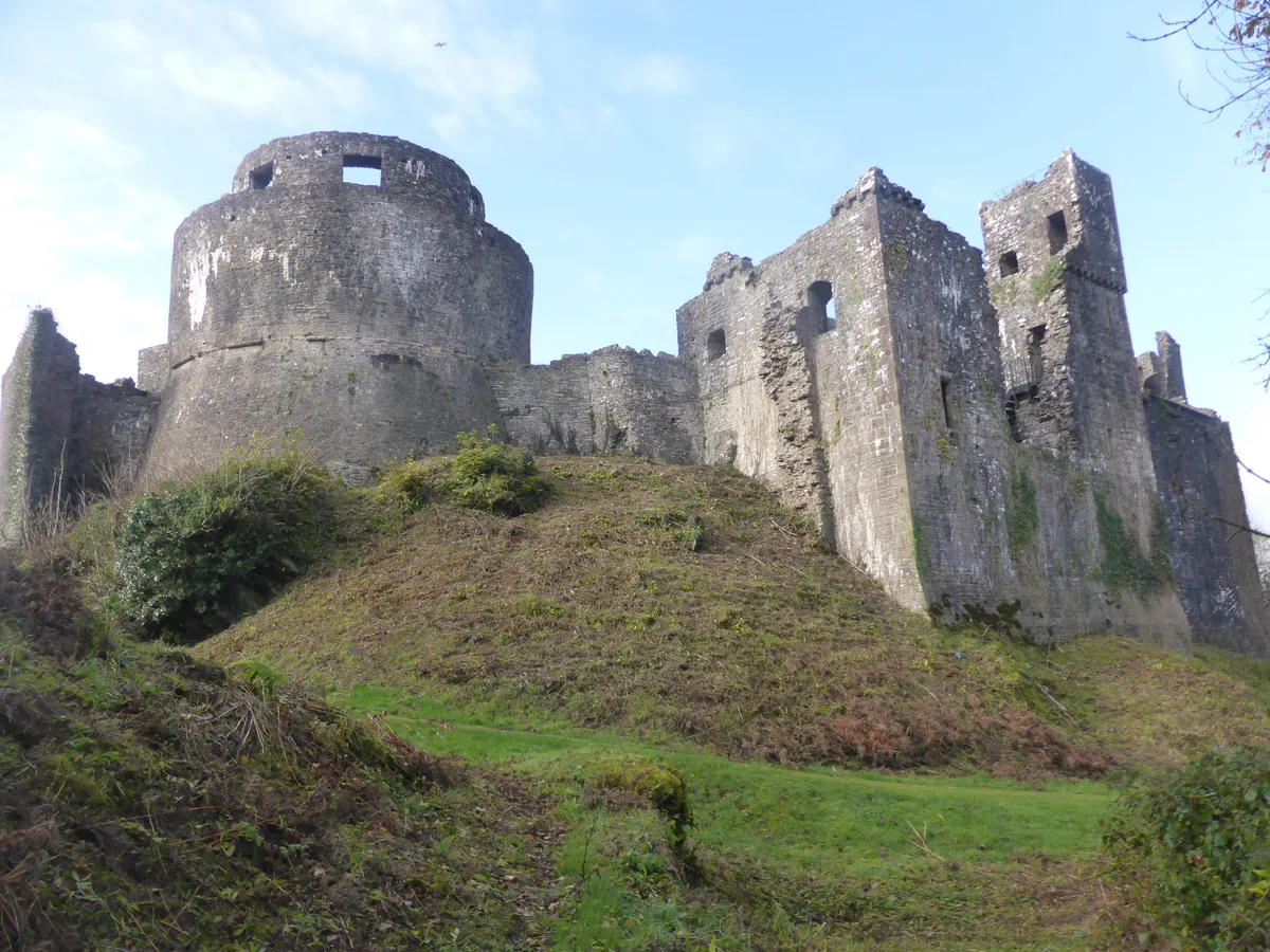
Dinefwr Castle
Castles · 1.2 km

The Rookery
Mountains & hills · 1.2 km
Nearby
📷 5Historic bridges · South Wales
Llandeilo Bridge
Llandeilo Bridge — Grade II* listed building-listed bridge in wales-south, United Kingdom.
📷 3Archaeological sites · South Wales
Roman Fort Complex
Roman Fort Complex — a archaeological in wales-south, United Kingdom.
📷 5Historic churches · South Wales
St Teilo's Church, Llandeilo
St Teilo's Church, Llandeilo — Grade II listed building-listed church in wales-south, United Kingdom.
📷 5Natural landmarks · South Wales
Ysgol Bro Dinefwr
Ysgol Bro Dinefwr — a school heritage in wales-south, United Kingdom.
📷 3Historic libraries · South Wales
Llandeilo Literary Institute
Llandeilo Literary Institute — former reading room & library of Llandeilo Literary Institute.
📷 5Where to eat & stay near St Tyfei's Church, Llandyfeisant
Places to stay
 📷 7
📷 7 📷 5
📷 5 📷 5
📷 5Campsites · South Wales
Towy Valley Caravan Park
Towy Valley Caravan Park — a campsite in wales south.
 📷 5
📷 5Campsites · South Wales
Black Mountain Fishing and Camping
Black Mountain Fishing and Camping — a campsite in wales south.
 📷 5
📷 5 📷 5
📷 5Caravan parks · Mid Wales
Abermarlais Camping and Caravan
Abermarlais Camping and Caravan — a caravan park in wales south.
Places to eat & drink
 📷 5
📷 5 📷 3
📷 3
Restaurants · South Wales
The Bridge
The Bridge — a restaurant in wales south.
 📷 5
📷 5 📷 5
📷 5Restaurants · South Wales
The Cockleshell
The Cockleshell — a restaurant in wales south. Cuisine: british. Brand: Toby Carvery.
 📷 5
📷 5More places in this region
 📷 3
📷 3Historic churches · South Wales
All Saints Church, Wraxall
All Saints Church, Wraxall — church in Wraxall, North Somerset, England, UK.
 📷 4
📷 4Historic churches · South Wales
All Saints' Church
All Saints' Church — church in Oystermouth, Swansea, Wales.
 📷 3
📷 3Historic churches · South Wales
Bethania Presbyterian Church
Bethania Presbyterian Church — Calvinistic Methodist chapel in Aberdare.
 📷 3
📷 3Historic churches · South Wales
Bethel, Abernant
Bethel, Abernant — church in Rhondda Cynon Taf, UK.
Frequently asked questions
- Where is St Tyfei's Church, Llandyfeisant?
- St Tyfei's Church, Llandyfeisant is in South Wales, United Kingdom (postcode SA19 6RP), in the parish of Llandeilo.
- What is St Tyfei's Church, Llandyfeisant?
- St Tyfei's Church, Llandyfeisant — a Grade II*-listed church in wales-south, United Kingdom.
- How do I get to St Tyfei's Church, Llandyfeisant?
- The nearest railway station is Ffairfach, about 1.1 km away. Drivers can use postcode SA19 6RP.
- Is St Tyfei's Church, Llandyfeisant a listed building?
- St Tyfei's Church, Llandyfeisant is officially recognised as Grade II* listed.
- Is St Tyfei's Church, Llandyfeisant free to visit?
- Yes, St Tyfei's Church, Llandyfeisant is free to enter.
- How do I get to St Tyfei's Church, Llandyfeisant?
- The nearest railway station is Ffairfach, about 1.1 km away. Drivers can navigate to postcode SA19 6RP.