Historic churches · London
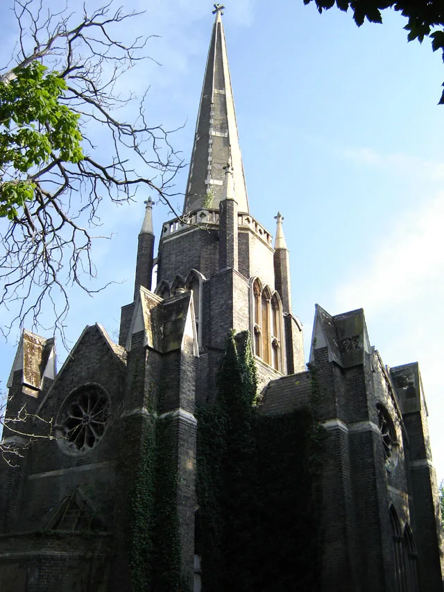
St Thomas's Church, Oakwood
St Thomas's Church, Oakwood — church in Oakwood, London.

Wikimedia Commons contributors — see linked file page for photographer and licence licence
Plan your visit
- Typical visit
- 30 min–1 h
- Nearest railway station
- Oakwood · 0.4 km
- Free entry
About
St Thomas's Church, Oakwood is a historic church in the United Kingdom. Affiliated with Anglicanism. Wikidata describes it as: "church in Oakwood, London". Coordinates: 51.6456°, -0.1268°.
Photo gallery
From the Wikipedia article
St Thomas's Church, Oakwood is an Anglican church in the Enfield Deanery of the Diocese of London. It is located in Prince George Avenue in the Oakwood area of the London Borough of Enfield, England.
Excerpt from Wikipedia under CC BY-SA 4.0. See the source article linked in Sources below.
Background
History
St Thomas's is a modern Anglican church established in the 1930s as the suburb of Oakwood grew with the extension of the Piccadilly underground line to Cockfosters. Building stopped with the outbreak of the Second World War, and the church was not finished until the 1950s. The architect was Romilly Craze. Later a parish hall was added, and a distinctive tall green spire. There is a guide hut on the grounds across the car park from the main building. Late in 2010 the spire was found to be unsafe and removed, however this was replaced at the beginning of 2012.
Visiting
The church holds weekly services on Sundays. St Thomas's is within the Conservative Evangelical tradition of the Church of England. As a parish that supports complementary gender roles, it receives alternative episcopal oversight from the Bishop of Ebbsfleet. From May 2017 to 2018, St. Thomas' Oakwood was in interregnum; this followed the move of the previous vicar, Christopher Hobbs (1997-2017), to St Andrew's Church, Cheadle Hulme. On 16 April 2018, the next vicar, Rich Alldritt, was inducted at the church. The current musical director is David Reavley.
Sourced from Wikipedia under CC BY-SA 4.0.
- Coordinates
- 51.6456, -0.1268
- District
- Enfield
- Parish
- Enfield, unparished area
- Postcode
- N14 4UA
- Parliamentary constituency
- Southgate and Wood Green
- Nearest railway station
- Oakwood — 0.4 km
- Official site
- www.st-toms.org.uk
Sources
- wikidata: Q7595544 (CC0)
- wikipedia: St Thomas's Church, Oakwood (CC BY-SA 4.0)
- commons: St Thomas's Church, Oakwood - geograph.org.uk - 42076.jpg (CC BY-SA 4.0)
Other places nearby
Loading nearby places…
Nearby
 📷 5
📷 5Chapels · London
Oakwood
Oakwood — a methodist chapel in england-london, United Kingdom.
 📷 5
📷 5Historic churches · London
Southgate Progressive Synagogue
Southgate Progressive Synagogue — a church in england-london, United Kingdom.
 📷 5
📷 5Natural landmarks · London
Southgate School
Southgate School — a school heritage in england-london, United Kingdom.
 📷 5
📷 5Natural landmarks · London
Salcombe School
Salcombe School — a school heritage in england-london, United Kingdom.
 📷 5
📷 5Theatres · London
Chickenshed
Chickenshed is a theatre in the United Kingdom.
 📷 5
📷 5Historic houses · London
Southgate tube station
Southgate tube station — a Grade II*-listed historic house in england-london, United Kingdom.
More places in this region
 📷 5
📷 5Historic churches · London
Abney Park Chapel
Abney Park Chapel — grade II listed church in the London Borough of Hackney, England,UK.
 📷 5
📷 5Historic churches · London
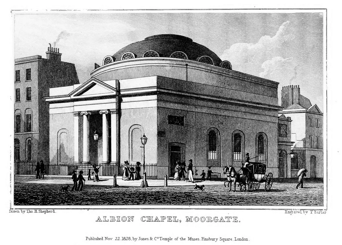
Albion Chapel
Albion Chapel — church in London, UK.
 📷 5
📷 5Historic churches · London
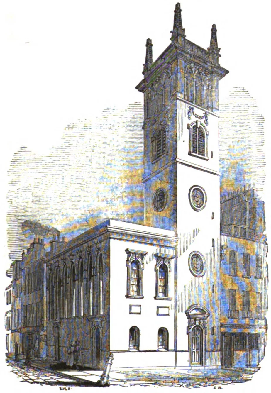
All Hallows Bread Street
All Hallows Bread Street — church in City of London, UK.
 📷 5
📷 5Historic churches · London
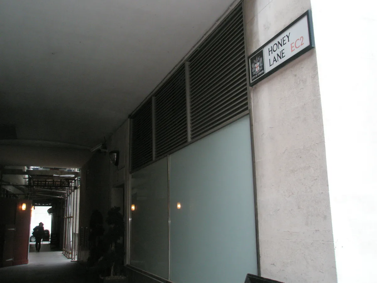
All Hallows Honey Lane
All Hallows Honey Lane — church in City of London, UK.
Frequently asked questions
- Where is St Thomas's Church, Oakwood?
- St Thomas's Church, Oakwood is in London, United Kingdom (postcode N14 4UA), in the parish of Enfield, unparished area.
- Is St Thomas's Church, Oakwood free to visit?
- Yes, St Thomas's Church, Oakwood is free to enter.
- How do I get to St Thomas's Church, Oakwood?
- The nearest railway station is Oakwood, about 0.4 km away. Drivers can navigate to postcode N14 4UA.