
Viewpoints · South East England
St. Roche's Hill
In or near Boxgrove.
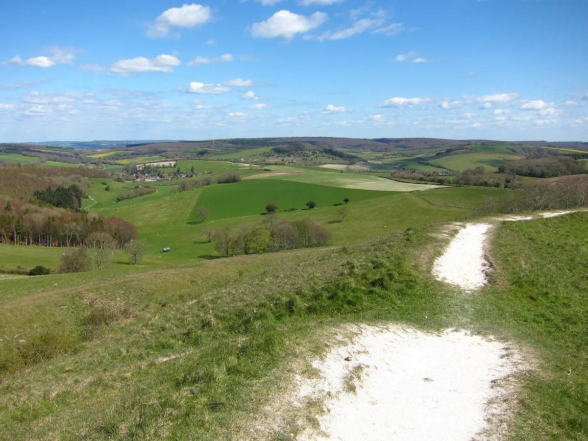
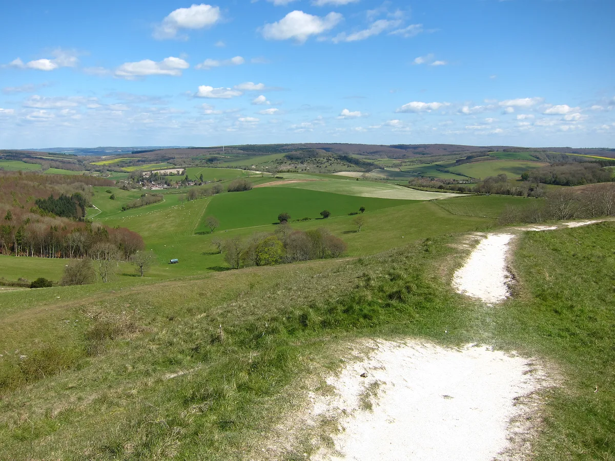
St. Roche's Hill is a viewpoint in the United Kingdom.

Shazz — CC BY-SA 2.0 via Wikimedia Commons licence

Plan your visit
- Typical visit
- 20 min–45 min
- Best time of year
- Clear days year-round
- Nearest railway station
- Chichester · 6.8 km
- Free entry
- Dog-friendly
Getting there & planning your visit
To visit St. Roche's Hill, the nearest railway station is Chichester, which is 6.8 km away. The postcode for navigation is PO18 0SP, and entry to the viewpoint is free.
About
St. Roche's Hill is a named viewpoint in West Sussex, South-East England, marked on Ordnance Survey maps for its outlook. It sits within the Chichester parliamentary constituency. The nearest railway station is Chichester, about 6.8 km away. Postcode area PO18.
Photo gallery
From the Wikipedia article
The Trundle is a hillfort on St Roche's Hill about 4 miles (6 km) north of Chichester, West Sussex, England. It was built in the Iron Age on the site of a causewayed enclosure, a form of early Neolithic earthwork found in northwestern Europe. A chapel dedicated to St Roche was built on the hill around the end of the 14th century; it was in ruins by 1570. A windmill and a beacon were subsequently built on the hill. The site was occasionally used as a meeting place in the post-medieval period. Causewayed enclosures were built in England from shortly before 3700 BC until at least 3500 BC; they are characterized by the full or partial enclosure of an area with ditches that are interrupted by gaps, or causeways. Their purpose is not known; they may have been settlements, meeting places, or ritual sites. Hillforts were built as early as 1000 BC, in the Late Bronze Age, and continued to be built through the Iron Age until shortly before the Roman occupation. The hillfort is still a substantial earthwork, but the Neolithic site was unknown until 1925 when archaeologist O.G.S. Crawford obtained an aerial photograph of the Trundle, clearly showing additional structures inside the ramparts of the hillfort. Causewayed enclosures were new to archaeology at the time, with only five known by 1930, and the photograph persuaded archaeologist E. Cecil Curwen to excavate the site in 1928 and 1930. These early digs established a construction date of about 500 BC to 100 BC for the hillfort and proved the existence of the Neolithic site. In 2011, the Gathering Time project published an analysis of radiocarbon dates from almost forty British causewayed enclosures, including some from the Trundle. The conclusion was that the Neolithic part of the site was probably constructed no earlier than the mid-fourth millennium BC. A review of the site in 1995 by Alastair Oswald noted the presence of fifteen possible Iron Age house platforms within the hillfort's ramparts.
Excerpt from Wikipedia under CC BY-SA 4.0. See the source article linked in Sources below.
- Coordinates
- 50.8917, -0.7619
- County
- West Sussex
- District
- Chichester
- Parish
- Lavant
- Postcode
- PO18 0SP
- Parliamentary constituency
- Chichester
- Nearest railway station
- Chichester — 6.8 km
Sources
- osm: n2435249105 (ODbL)
- wikipedia: St. Roche's Hill (CC BY-SA 4.0)
Other places nearby
John Green Memorial
Memorials & monuments · 0.0 km
Trundle
Hill forts · 0.6 km
The Trundle
Mountains & hills · 0.6 km

St Roche's Hill
Mountains & hills · 0.6 km

West Dean Gardens
Gardens · 1.1 km

Goodwood Racecourse
Racecourses · 1.2 km

Weald & Downland Open Air Museum
Museums · 1.7 km
Weald and Downland Gridshell
Museums · 1.7 km
.jpg?width=1200)
West Dean College
Ironworks & forges · 1.9 km

Weald and Downland Living Museum
Museums · 1.9 km

West Dean House
Gardens · 1.9 km

Pevensey Windpump
Windmills · 1.9 km
Nearby
📷 5Memorials & monuments · South East England
John Green Memorial
John Green Memorial — a memorial in england-south-east, United Kingdom.
📷 5📷 5📷 5Mountains & hills · South East England
St Roche's Hill
St Roche's Hill — a hill or mountain in england south east.
📷 5Gardens · South East England
West Dean Gardens
West Dean Gardens — a garden in england-south-east, United Kingdom.
📷 5Racecourses · South East England
Goodwood Racecourse
Goodwood Racecourse — a other in england-south-east, United Kingdom.
Where to eat & stay near St. Roche's Hill
Places to stay
 📷 5
📷 5Campsites · South East England
West Dean Campsite
West Dean Campsite — a campsite in england south east.
 📷 7
📷 7Hotels · South East England
Woodstock House Hotel
Woodstock House Hotel — a hotel in england south east.
 📷 5
📷 5Hotels · South East England
The Goodwood Hotel
The Goodwood Hotel — a hotel in england south east.
 📷 5
📷 5Caravan parks · South East England
New House Farm
New House Farm — a caravan park in england south east.
 📷 5
📷 5Hotels · South East England
The Ship Hotel
The Ship Hotel — a hotel in england south east.
 📷 7
📷 7B&Bs · South East England
Horse & Groom
Horse & Groom — a bed-and-breakfast in england south east.
Places to eat & drink
 📷 5
📷 5Historic pubs · South East England
The Partridge Inn
The Partridge Inn in England South East, United Kingdom.
 📷 5
📷 5Historic pubs · South East England
The Earl Of March Public House
The Earl Of March Public House in England South East, United Kingdom.
 📷 5
📷 5Historic pubs · South East England
The Coach And Horses Public House
The Coach And Horses Public House in England South East, United Kingdom.
 📷 5
📷 5Historic pubs · South East England
Prince Arthur Public House
Prince Arthur Public House in England South East, United Kingdom.
 📷 5
📷 5Historic pubs · South East England
The East Gate Public House
The East Gate Public House in England South East, United Kingdom.
 📷 5
📷 5Historic pubs · South East England
The Royal Arms Public House
The Royal Arms Public House in England South East, United Kingdom.
More viewpoints in this region
 📷 5
📷 5Viewpoints · South East England
Bird Watching
Bird Watching is a viewpoint in the United Kingdom.
 📷 5
📷 5Viewpoints · South East England
Blatchford Down
Blatchford Down is a viewpoint in the United Kingdom.
 📷 5
📷 5Viewpoints · South East England
Box Hill Viewpoint
Box Hill Viewpoint is a viewpoint in the United Kingdom.
 📷 5
📷 5Frequently asked questions
- Where is St. Roche's Hill?
- St. Roche's Hill is in West Sussex, South-East England, United Kingdom (postcode PO18 0SP), in the parish of Lavant.
- What is St. Roche's Hill?
- St. Roche's Hill is a viewpoint in the United Kingdom.
- How do I get to St. Roche's Hill?
- The nearest railway station is Chichester, about 6.8 km away. The nearest town is Boxgrove. Drivers can use postcode PO18 0SP.
- Is St. Roche's Hill free to visit?
- Yes, St. Roche's Hill is free to enter.
- How do I get to St. Roche's Hill?
- The nearest railway station is Chichester, about 6.8 km away. Drivers can navigate to postcode PO18 0SP.