
Historic churches · South West England
St Mary the Virgin, Gillingham, Dorset
In or near Silton.
St Mary the Virgin, Gillingham, Dorset — Grade I listed church in Gillingham, Dorset, England, UK.

Wikimedia Commons contributors — see linked file page for photographer and licence licence

Plan your visit
- Typical visit
- 30 min–1 h
- Nearest railway station
- Gillingham · 0.6 km
- Free entry
Getting there & planning your visit
To visit St Mary the Virgin in Gillingham, Dorset, the nearest railway station is Gillingham, located 0.6 km away. The postcode for sat-nav is SP8 4AW, and entry to the church is free.
About
St Mary the Virgin, Gillingham, Dorset is a historic church in the United Kingdom. Records date its origin to 1350. Heritage designation: Grade I listed building. Affiliated with Anglicanism. Wikidata describes it as: "Grade I listed church in Gillingham, Dorset, England, UK". Coordinates: 51.0381°, -2.2775°.
Photo gallery
See it from the streetimagery from 2025
Imagery © Mapillary contributors, CC BY-SA 4.0
Heritage listing
St Mary's Church is the parish church for the town of Gillingham in the Blackmore Vale in the north of Dorset. The church is in the Diocese of Salisbury in the Church of England, and part of the Anglican Communion. There is believed to have been a Christian presence in the area since Anglo-Saxon days, evidence being a stone with a complicated interlaced pattern, now in the museum, which is believed to be the remains of a 9th-century cross – either a preaching cross or a grave marker. But most of the current building, particularly the nave, dates from an early Victorian rebuild.
From the Historic England List Entry under OGL v3.
Protected designations
- Area of Outstanding Natural Beauty: Cranborne Chase & West Wiltshire Downs
Designations sourced from Natural England open data under OGL v3.
From the Wikipedia article
St Mary's Church is the parish church for the town of Gillingham in the Blackmore Vale in the north of Dorset. The church is in the Diocese of Salisbury in the Church of England, and part of the Anglican Communion. There is believed to have been a Christian presence in the area since Anglo-Saxon days, evidence being a stone with a complicated interlaced pattern, now in the museum, which is believed to be the remains of a 9th-century cross – either a preaching cross or a grave marker. But most of the current building, particularly the nave, dates from an early Victorian rebuild. The chancel (choir and sanctuary) however, is older; the five great pointed windows with their trefoil heads, which stand on the south side of the chancel, show that it was built in the Decorated Gothic style popular in the 14th century. On the north wall of the chancel, only two feet above the floor, can be seen the archway of an Easter Sepulchre. Some bench ends, a screen at the east end of the north aisle, and the font, are in the Perpendicular Gothic style of the 15th and 16th centuries. The Chapel of the Good Shepherd was given by Mr and Mrs Carlton Cross in memory of their son who was killed in France during the First World War while carrying in some of the wounded men from his regiment. W. D. Caroe, the architect who designed the chapel, went on to create many other fine works, including the east end of the Lady Chapel in Sherborne Abbey. The reredos beneath the east window in the main chancel is another reminder of the tragedy of the First World War. It was given in 1925 by Mr and Mrs Matthews of Wyke House in memory of two of their sons who were both killed in the war. Further examples of the work of Nathaniel Hitch (1846–1938), the sculptor responsible for the reredos, may be seen in Westminster Abbey and Truro and Bristol Cathedrals. Memorials to those who died in the First World War can be seen hanging above the Jacobean communion table in St. Catherine's Chapel. The Book of…
Excerpt from Wikipedia under CC BY-SA 4.0. See the source article linked in Sources below.
- Coordinates
- 51.0381, -2.2775
- District
- Dorset
- Parish
- Gillingham
- Postcode
- SP8 4AW
- Parliamentary constituency
- North Dorset
- Established
- 1350
- Nearest railway station
- Gillingham — 0.6 km
- Official site
- www.gillinghamanglican.co.uk
Sources
- wikidata: Q7594657 (CC0)
- wikipedia: St Mary the Virgin, Gillingham, Dorset (CC BY-SA 4.0)
- commons: St. Mary the Virgin, Gillingham - geograph.org.uk - 6085.jpg (CC BY-SA 4.0)
Other places nearby

Gillingham
Villages · 0.1 km

Bridge Carrying Wyke Street Over The River Stour
Historic bridges · 0.2 km

Gillingham Museum
Museums · 0.3 km

Kings Court Palace
Palaces · 1.2 km

Kings Court Palace
Literary houses · 1.2 km

Leela Fields Caravan & Camping Park
Campsites · 1.4 km

East Stour
Villages · 3.4 km

Silton
Towns & cities · 3.5 km

Two Counties Farm
Campsites · 4.0 km

Shaftesbury Country Touring Park
Caravan parks · 4.2 km

Motcombe
Villages · 4.4 km
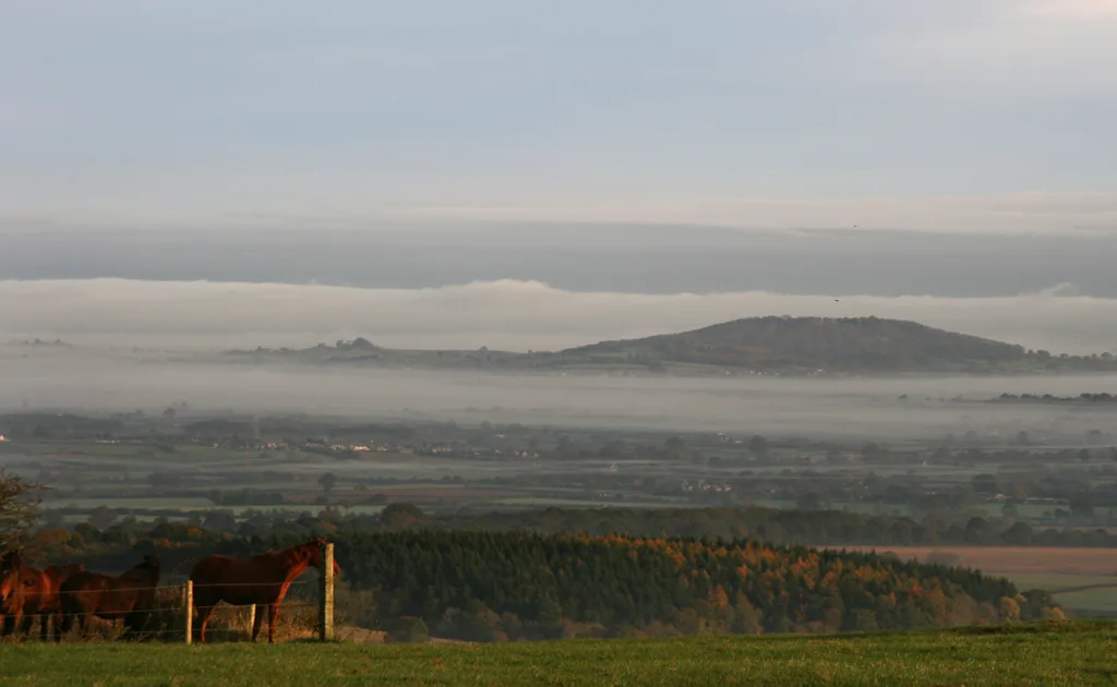
Duncliffe Hill
Mountains & hills · 4.4 km
Nearby
📷 5📷 5Historic bridges · South West England
Bridge Carrying Wyke Street Over The River Stour
Bridge Carrying Wyke Street Over The River Stour — Grade II listed building-listed bridge in england-south-east, United Kingdom.
📷 5Museums · South West England
Gillingham Museum
Gillingham Museum — a museum in england-south-east, United Kingdom.
📷 5Palaces · South West England
Kings Court Palace
Kings Court Palace — a palace in england-south-east, United Kingdom.
📷 5Literary houses · South West England
Kings Court Palace
Kings Court Palace — a literary house museum in england south east.
📷 5Campsites · South West England
Leela Fields Caravan & Camping Park
Leela Fields Caravan & Camping Park — a campsite in england south east.
Where to eat & stay near St Mary the Virgin, Gillingham, Dorset
Places to stay
📷 5Campsites · South West England
Leela Fields Caravan & Camping Park
Leela Fields Caravan & Camping Park — a campsite in england south east.
📷 5Campsites · South West England
Two Counties Farm
Two Counties Farm — a campsite in england south east.
📷 5Caravan parks · South West England
Shaftesbury Country Touring Park
Shaftesbury Country Touring Park — a caravan park in england south east.
 📷 5
📷 5Campsites · South West England
Caalm Camp
Caalm Camp — a campsite in england south east.
 📷 5
📷 5Campsites · South West England
Bush Farm Bison Centre
Bush Farm Bison Centre — a campsite in england south east.
 📷 5
📷 5Caravan parks · South West England
Coking Farm Caravan Site
Coking Farm Caravan Site — a caravan park in england south east.
Places to eat & drink
 📷 7
📷 7 📷 5
📷 5Historic pubs · South West England
Fox And Hounds Public House
Fox And Hounds Public House in England South West, United Kingdom.
 📷 7
📷 7Historic pubs · South West England
The Mitre Inn
The Mitre Inn in England South West, United Kingdom.
 📷 7
📷 7Historic pubs · South West England
The Benett Arms
The Benett Arms in England South West, United Kingdom.
 📷 5
📷 5 📷 5
📷 5Historic pubs · South West England
Stalbridge Arms Public House
Stalbridge Arms Public House in England South West, United Kingdom.
Other places from this era
 📷 5
📷 5Historic churches · London
All Hallows Staining
All Hallows Staining — church in City of London, UK.
 📷 5
📷 5Historic churches · London
All Hallows' Church, Tottenham
All Hallows' Church, Tottenham — church in Tottenham, London.
 📷 5
📷 5Historic churches · London
All Saints Church, Kingston upon Thames
All Saints Church, Kingston upon Thames — church in Kingston upon Thames, London.
 📷 5
📷 5Historic churches · London
All Saints' Church, Edmonton
All Saints' Church, Edmonton — church in Edmonton, London.
More places in this region
 📷 5
📷 5Historic churches · South West England
Abbey Church of St Gregory the Great, Downside Abbey
Abbey Church of St Gregory the Great, Downside Abbey — church in Stratton-on-the-Fosse, Somerset, England, UK.
 📷 5
📷 5Historic churches · South West England
All Saints Church
All Saints Church — Grade I listed church in Woolley, Somerset, England, UK.
 📷 5
📷 5Historic churches · South West England
All Saints Church, Hampreston
All Saints Church, Hampreston — church in Hampreston, Dorset, England, UK.
 📷 5
📷 5Historic churches · South West England
All Saints Church, Nether Cerne
All Saints Church, Nether Cerne — church in Nether Cerne, Dorset, England, UK.
Frequently asked questions
- Where is St Mary the Virgin, Gillingham, Dorset?
- St Mary the Virgin, Gillingham, Dorset is in South-West England, United Kingdom (postcode SP8 4AW), in the parish of Gillingham.
- What is St Mary the Virgin, Gillingham, Dorset?
- St Mary the Virgin, Gillingham, Dorset — Grade I listed church in Gillingham, Dorset, England, UK.
- How do I get to St Mary the Virgin, Gillingham, Dorset?
- The nearest railway station is Gillingham, about 0.6 km away. The nearest town is Silton. Drivers can use postcode SP8 4AW.
- When was St Mary the Virgin, Gillingham, Dorset built?
- Built or established in 1350.
- Is St Mary the Virgin, Gillingham, Dorset a listed building?
- St Mary the Virgin, Gillingham, Dorset is officially recognised as Grade I listed building listed.
- Is St Mary the Virgin, Gillingham, Dorset a protected site?
- Yes — St Mary the Virgin, Gillingham, Dorset is part of the Cranborne Chase & West Wiltshire Downs National Landscape (AONB).
- Is St Mary the Virgin, Gillingham, Dorset free to visit?
- Yes, St Mary the Virgin, Gillingham, Dorset is free to enter.
- How do I get to St Mary the Virgin, Gillingham, Dorset?
- The nearest railway station is Gillingham, about 0.6 km away. Drivers can navigate to postcode SP8 4AW.