
Historic churches · East of England
St Mark
In or near Belstead.
St Mark — church in Ipswich, Suffolk, UK.

Wikimedia Commons contributors — see linked file page for photographer and licence licence

Plan your visit
- Typical visit
- 30 min–1 h
- Nearest railway station
- Ipswich · 1.5 km
- Free entry
Getting there & planning your visit
To visit St Mark in Ipswich, the nearest railway station is Ipswich, located 1.5 km away. The postcode for navigation is IP2 0QQ, and entry to the church is free.
About
St Mark is a historic church in the United Kingdom. Affiliated with Catholicism. Wikidata describes it as: "church in Ipswich, Suffolk, UK". Coordinates: 52.0468°, 1.1229°.
Photo gallery
Official information
St. Mark's is a Roman Catholic parish that includes two churches: St. Mark’s in Ipswich and Holy Family in Brantham. It serves as a vibrant community of faith, offering various sacraments and community events.
Protected designations
- Area of Outstanding Natural Beauty: Suffolk Coast & Heaths
Designations sourced from Natural England open data under OGL v3.
From the Wikipedia article
St. Mark's Roman Catholic Church is a Catholic church on the Chantry Estate in Ipswich. It is part of the Roman Catholic Diocese of East Anglia. It opened in May 1959. Prior to the establishment of St. Mark's, the area was within the parish of St Pancras Church, Ipswich. Initially it was served by the Franciscans at East Bergholt, who also ministered at Brantham. Around 1973 most of the friars moved from East Bergholt to Canterbury, while a few set up small friary at Ipswich. The Franciscans withdrew in 1994. There is also a Roman Catholic Primary School attached to the parish, also called St Mark's, which opened in 1967. In 2018, St. Mark's School won the Suffolk Junior Schools Mock Trial Competition. The Catholic Church of the Holy Family in the village of Brantham is served from St Mark’s.
Excerpt from Wikipedia under CC BY-SA 4.0. See the source article linked in Sources below.
- Coordinates
- 52.0468, 1.1229
- County
- Suffolk
- District
- Ipswich
- Parish
- Ipswich, unparished area
- Postcode
- IP2 0QQ
- Parliamentary constituency
- Ipswich
- Established
- 1959
- Nearest railway station
- Ipswich — 1.5 km
- Official site
- www.stmarksparish.org.uk
Sources
- wikidata: Q7594169 (CC0)
- wikipedia: St Mark, Ipswich (CC BY-SA 4.0)
- commons: St Mark's catholic church - geograph.org.uk - 1115433.jpg (CC BY-SA 4.0)
Other places nearby
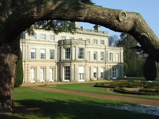
Chantry Park
Parks · 0.8 km

Chantry Walled Garden
Gardens · 0.9 km

Gippeswyk Park
Parks · 1.0 km

Red Rose Chain
Theatres · 1.1 km

Avenue Theatre
Open-air theatres · 1.1 km

Gippeswyk Hall
Historic houses · 1.1 km

Belstead Brook Hotel
Hotels · 1.3 km

Chequers Hotel
Hostels · 1.3 km

10 Reavell Place
Gardens · 1.4 km

The Navigator
Public art & sculpture · 1.4 km

Bridge School
Historic bridges · 1.4 km

Belstead House Adult Education Centre
Historic houses · 1.6 km
Nearby
📷 5Parks · East of England
Chantry Park
Chantry Park — park in Ipswich, Suffolk, England, UK.
📷 3Gardens · East of England
Chantry Walled Garden
Chantry Walled Garden — a garden in East of England, United Kingdom.
📷 3Parks · East of England
Gippeswyk Park
Gippeswyk Park — park in Ipswich, United Kingdom.
📷 3Theatres · East of England
Red Rose Chain
Red Rose Chain is a theatre in the United Kingdom.
📷 5Open-air theatres · East of England
Avenue Theatre
Avenue Theatre — a open-air theatre in england east.
📷 3Historic houses · East of England
Gippeswyk Hall
Gippeswyk Hall — house in Ipswich, Suffolk, England, UK.
Where to eat & stay near St Mark
Places to stay
📷 7Hotels · East of England
Belstead Brook Hotel
Belstead Brook Hotel — a hotel in england east.
📷 5 📷 5
📷 5Hotels · East of England
Ipswich Hotel
Ipswich Hotel — a hotel in england east.
 📷 5
📷 5Campsites · East of England
Tomcat Farm Caravan Services
Tomcat Farm Caravan Services — a campsite in england east.
 📷 5📷 5
Campsites · East of England
Hallowtree Scout Activity Centre
Hallowtree Scout Activity Centre — a campsite in england east.
Places to eat & drink
 📷 7
📷 7Historic pubs · East of England
Half Moon and Star
Half Moon and Star in England East, United Kingdom.
 📷 5
📷 5Historic pubs · East of England
16, St Nicholas Street
16, St Nicholas Street in England East, United Kingdom.
 📷 7
📷 7 📷 5
📷 5 📷 5
📷 5Historic pubs · East of England
The Suffolk Punch
The Suffolk Punch in England East, United Kingdom.
 📷 7
📷 7Historic pubs · East of England
The Margaret Catchpole Public House
The Margaret Catchpole Public House in England East, United Kingdom.
More places in this region
 📷 5
📷 5Historic churches · East of England
All Saints Church
All Saints Church — church on Jesus Lane in central Cambridge, England.
 📷 5
📷 5Historic churches · East of England
All Saints Church, Conington
All Saints Church, Conington — church in Conington, Huntingdonshire, Cambridgeshire, England, UK.
 📷 5
📷 5Historic churches · East of England
All Saints Church, Vange
All Saints Church, Vange — church in Basildon, Essex, England, UK.
 📷 5
📷 5Historic churches · East of England
All Saints Parish Church, Kirtling
All Saints Parish Church, Kirtling — church in East Cambridgeshire, England, UK.
Frequently asked questions
- Where is St Mark?
- St Mark is in Suffolk, East of England, United Kingdom (postcode IP2 0QQ), in the parish of Ipswich, unparished area.
- What is St Mark?
- St Mark — church in Ipswich, Suffolk, UK.
- How do I get to St Mark?
- The nearest railway station is Ipswich, about 1.5 km away. The nearest town is Belstead. Drivers can use postcode IP2 0QQ.
- When was St Mark built?
- Built or established in 1959.
- Is St Mark a protected site?
- Yes — St Mark is part of the Suffolk Coast & Heaths National Landscape (AONB).
- Is St Mark free to visit?
- Yes, St Mark is free to enter.
- How do I get to St Mark?
- The nearest railway station is Ipswich, about 1.5 km away. Drivers can navigate to postcode IP2 0QQ.