
Historic houses · South East England
St Leonards-Mayfield School
In or near Rotherfield.
St Leonards-Mayfield School — a Grade I-listed historic house in england-south-east, United Kingdom.

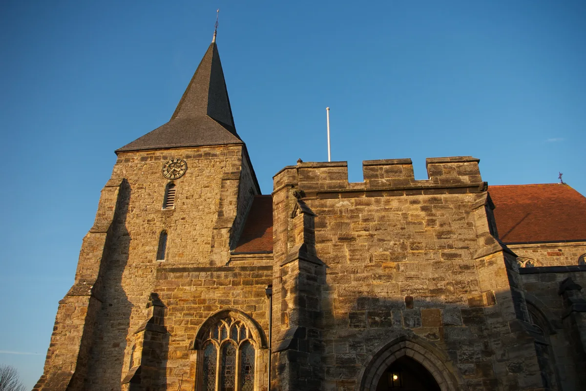
Dave Spicer — CC BY-SA 2.0 via Wikimedia Commons licence

Plan your visit
- Typical visit
- 1 h–2 h
- Nearest railway station
- Hadlow Down · 5.6 km
- Family-friendly
- Limited wheelchair access
Getting there & planning your visit
To visit St Leonards-Mayfield School, the nearest railway station is Hadlow Down, located 5.6 km away. The postcode for your sat-nav is TN20 6PH. Please note that wheelchair accessibility is limited.
About
St Leonards-Mayfield School is a Grade I-listed building in england-south-east, United Kingdom. Grade I status is conferred by Historic England (or Cadw, Historic Environment Scotland or NIEA equivalents) on buildings of exceptional national interest. See the linked Wikipedia article for full historical and architectural details.
Photo gallery
Summary from the official site
St Leonards-Mayfield School is an independent day and boarding school for girls aged 11-18, focusing on academic excellence and personal growth. The school offers a diverse curriculum and a wide range of extracurricular activities, fostering a supportive community and encouraging students to develop their unique talents.
Read more on the official property page.
Protected designations
- Area of Outstanding Natural Beauty: High Weald
Designations sourced from Natural England open data under OGL v3.
From the Wikipedia article
Mayfield School, previously St Leonards-Mayfield School, is an independent Catholic boarding and day school for girls aged 11 to 18. It is in the village of Mayfield in East Sussex. The school was founded by Mother Cornelia Connelly, S.H.C.J., in 1872, with the oldest buildings dating from the 14th century.
Excerpt from Wikipedia under CC BY-SA 4.0. See the source article linked in Sources below.
Background
History
Mayfield School has its origins in the Convent of the Holy Child Jesus school at St Leonards-on-Sea. Mother Cornelia Connelly of the Society of the Holy Child Jesus chanced upon the Old Palace at the village of Mayfield. At that time Louisa Caton, the Duchess of Leeds (widow of Francis D'Arcy-Osborne, 7th Duke of Leeds) had requested Mother Connelly to take her in as a nun. Despite her efforts Mother Connelly remained unimpressed. The Duchess then turned her attention to setting up orphanages. She purchased the Mayfield estate which included the Old Palace and presented it to the Society. On the morning of 18 November 1863 Mass was celebrated at Mayfield for the first time since the…
Sourced from Wikipedia under CC BY-SA 4.0.
- Coordinates
- 51.0215, 0.2617
- County
- East Sussex
- District
- Wealden
- Parish
- Mayfield and Five Ashes
- Postcode
- TN20 6PH
- Parliamentary constituency
- Sussex Weald
- Phone
- 01435 874600
- Established
- 1872
- Nearest railway station
- Hadlow Down — 5.6 km
- Official site
- www.mayfieldgirls.org
Sources
- wikidata: Q7594011 (CC0)
- wikipedia: Mayfield School, East Sussex (CC BY-SA 4.0)
Other places nearby
.jpg?width=1200)
Stone House
Historic houses · 0.1 km
Church of St. Dunstan, Mayfield
Historic churches · 0.1 km

The Middle House
Hotels · 0.1 km

Mayfield War Memorial
Memorials & monuments · 0.1 km

Mayfield
Villages · 0.3 km

The Rose And Crown Inn
Historic pubs · 0.5 km

Argos Hill Mill, Mayfield
Windmills · 2.0 km
Argos Hill Windmill
Memorials & monuments · 2.1 km

Old Sharnden Manor
Manor houses · 2.3 km

Lakestreet Manor
Manor houses · 2.4 km
.jpg?width=1200)
Old Mill House
Historic houses · 2.6 km

Skippers Hill Manor School
Manor houses · 3.4 km
Nearby
📷 5📷 5Historic churches · South East England
Church of St. Dunstan, Mayfield
Church of St. Dunstan, Mayfield — church in Mayfield, East Sussex, England, UK.
📷 5📷 5Memorials & monuments · South East England
Mayfield War Memorial
Mayfield War Memorial — Grade II listed building-listed memorial in england-south-east, United Kingdom.
📷 5📷 5Historic pubs · South East England
The Rose And Crown Inn
The Rose And Crown Inn in England South East, United Kingdom.
Where to eat & stay near St Leonards-Mayfield School
Places to stay
📷 5 📷 5
📷 5Caravan parks · South East England
Crowborough Camping And Caravanning Club Site
Crowborough Camping And Caravanning Club Site — a caravan park in england south east.
 📷 5
📷 5Campsites · South East England
Caird's Camping and Caravan Site
Caird's Camping and Caravan Site — a campsite in england south east.
 📷 5
📷 5Campsites · South East England
Horam Manor Touring Park
Horam Manor Touring Park — a campsite in england south east.

Campsites · South East England
Dernwood Farm Campsite
Dernwood Farm Campsite — a campsite in england south east.
 📷 5
📷 5Hotels · South East England
Buxted Park Hotel
Buxted Park Hotel — a hotel in england south east.
Places to eat & drink
📷 5Historic pubs · South East England
The Rose And Crown Inn
The Rose And Crown Inn in England South East, United Kingdom.
 📷 5
📷 5Historic pubs · South East England
The Five Ashes Inn
The Five Ashes Inn in England South East, United Kingdom.
 📷 5
📷 5Historic pubs · South East England
The Boars Head Inn
The Boars Head Inn in England South East, United Kingdom.
 📷 5
📷 5Historic pubs · South East England
The Crowborough Cross
The Crowborough Cross in England South East, United Kingdom.
 📷 5
📷 5Historic pubs · South East England
The George
The George — Historic pub — listed building or notable heritage status.
.jpg?width=1200) 📷 5
📷 5Historic pubs · South East England
Nevill Crest and Gun
Nevill Crest and Gun — Historic pub — listed building or notable heritage status.
More historic houses in this region
 📷 5
📷 5Historic houses · South East England
12 and 14 High Street, Rochester
12 and 14 High Street, Rochester — building in Rochester, Kent, England, UK.
 📷 5
📷 5Historic houses · South East England
Berkeley House
Berkeley House — house in Rochester, Kent, England, UK.
.jpg?width=1200) 📷 5
📷 5Historic houses · South East England
Betchworth House
Betchworth House — house in Betchworth, Mole Valley, England, UK.
 📷 5
📷 5Historic houses · South East England
Bookham Grove
Bookham Grove — building in Mole Valley, Surrey, England, UK.
Frequently asked questions
- Where is St Leonards-Mayfield School?
- St Leonards-Mayfield School is in East Sussex, South-East England, United Kingdom (postcode TN20 6PH), in the parish of Mayfield and Five Ashes.
- What is St Leonards-Mayfield School?
- St Leonards-Mayfield School — a Grade I-listed historic house in england-south-east, United Kingdom.
- How do I get to St Leonards-Mayfield School?
- The nearest railway station is Hadlow Down, about 5.6 km away. Drivers can use postcode TN20 6PH.
- When was St Leonards-Mayfield School built?
- Built or established in 1872.
- Is St Leonards-Mayfield School a listed building?
- St Leonards-Mayfield School is officially recognised as Grade I listed.
- Is St Leonards-Mayfield School a protected site?
- Yes — St Leonards-Mayfield School is part of the High Weald National Landscape (AONB).
- How do I get to St Leonards-Mayfield School?
- The nearest railway station is Hadlow Down, about 5.6 km away. Drivers can navigate to postcode TN20 6PH.