
Historic churches · South Wales
St Ffraed's Church
St Ffraed's Church — Grade II listed building-listed church in wales-south, United Kingdom.

Derek Harper — CC BY-SA 2.0 via Wikimedia Commons licence

Plan your visit
- Typical visit
- 30 min–1 h
- Nearest railway station
- Torpantau · 10.0 km
- Free entry
Getting there & planning your visit
St Ffraed's Church is located in South Wales with the postcode LD3 7YF. The nearest railway station is Torpantau, which is 10 km away. Entry to the church is free.
About
St Ffraed's Church is a Grade II listed building-listed church in wales-south, United Kingdom, registered on the Cadw register of listed buildings (Wales) (entry 21144). Listed status protects buildings and structures of special architectural or historic interest. See the linked Wikipedia article for further details.
Photo gallery
See it from the streetimagery from 2018
Imagery © Mapillary contributors, CC BY-SA 4.0
Heritage listing
Reason for designation: Listed for its special interest as a later C19 church with fine spire and monuments and for its important historical associations. Group value with the churchyard monuments to Gwynne Holford and Henry Vaughan, and with Llansantffraed House. History: A medieval church rebuilt in 1690 preceded the current building, constructed 1884-5 by Stephen Williams of Rhayader. Dedication stone laid 1884 by J P Gwynne Holford of Buckland, responsible for the rebuilding. Henry Vaughan the metaphysical poet who died 1695 and lived at nearby Newton is buried in the churchyard and his brother Thomas was rector here; further commemorated by later wall plaque in church. Theophilus Jones provides a description of the older church and the later Glanusk edition of the reconstruction in 1884. Exterior: Gothic Revival church built of snecked rockfaced stone with red sandstone dressings and tiled roof with bracketed eaves, decorative iron guttering and apex crosses. Plan of nave with S porch, slighly lower chancel, N and S choir transepts and in the angle between S transept and nave a slender attached spire. Nave has single trefoil headed lancets with voussoirs to sides, Decorated windows to W, also to chancel and transepts; stepped buttresses with offsets at most corners; moulded kneelers. All openings have hoodmoulds, most with foliage stops, face stops to larger windows. Steeply gabled S porch with pointed arched doorway, retains old stoup. The spire is the most unusual feature: octagonal, 3 tapered storeys, and of contrasting stone, the top storey of red sandstone ashlar and the lower storeys separated by red ashlar offsets. Narrow ground floor pointed arched entrance is flanked by small trefoil headed lights; above are regularly spaced rectangular stair lights; the b
From Cadw under OGL v3.
Place summary
St Ffraed's Church is a Grade II listed church located in South Wales. It is recognised for its architectural significance and historical value.
AI-generated from the structured facts on this page (operator, designation, listing, era). Not a substitute for visiting.
- Coordinates
- 51.9031, -3.2770
- District
- Powys
- Parish
- Talybont-on-Usk
- Postcode
- LD3 7YF
- Parliamentary constituency
- Brecon, Radnor and Cwm Tawe
- Nearest railway station
- Torpantau — 10 km
Sources
- wikidata: Q29498483 (CC0)
Other places nearby
Gwynne Holford Monument in the churchyard to SW of Church of St Ffraed
Memorials & monuments · 0.0 km

Llansantffraed
Historic churches · 0.1 km

Talybont
Villages · 0.6 km

Gilestone
Archaeological sites · 0.6 km

Llansantffread
Villages · 0.8 km

Allt yr Esgair
Viewpoints · 0.9 km

The Alltimate View
Campsites · 0.9 km

Talybont Farm Camping
Campsites · 1.0 km

Chilson Bridge (Canal Bridge No.146)
Historic bridges · 1.0 km
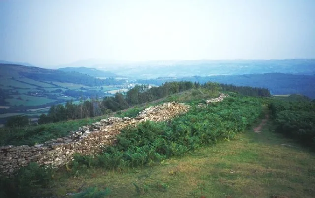
Allt yr Esgair
Mountains & hills · 1.0 km

Allt yr Esgair Hillfort
Hill forts · 1.0 km

Allt yr Esgair Hillfort
Archaeological sites · 1.0 km
Nearby
📷 5Memorials & monuments · South Wales
Gwynne Holford Monument in the churchyard to SW of Church of St Ffraed
Gwynne Holford Monument in the churchyard to SW of Church of St Ffraed — Grade II listed building-listed memorial in wales-south, United Kingdom.
📷 5Historic churches · South Wales
Llansantffraed
Llansantffraed — a church in wales-south, United Kingdom.
📷 5📷 3Archaeological sites · South Wales
Gilestone
Gilestone — a archaeological in wales-south, United Kingdom.
📷 5📷 4Where to eat & stay near St Ffraed's Church
Places to stay
📷 5📷 5Campsites · South Wales
Talybont Farm Camping
Talybont Farm Camping — a campsite in wales south.
 📷 5
📷 5 📷 5
📷 5Campsites · South Wales
Pencelli Castle
Pencelli Castle — a campsite in wales south.
 📷 5
📷 5Caravan parks · South Wales
Pencelli Castle
Pencelli Castle — a caravan park in wales south.
 📷 5
📷 5Places to eat & drink
 📷 5
📷 5Historic pubs · South Wales
White Hart
White Hart — Historic pub — listed building or notable heritage status.
 📷 4
📷 4 📷 7
📷 7 📷 7
📷 7 📷 5
📷 5Restaurants · South Wales
Sultan of Wales
Sultan of Wales — a restaurant in wales south.
 📷 5
📷 5Historic pubs · South Wales
Skirrid Mountain Inn
Skirrid Mountain Inn — Historic pub — listed building or notable heritage status.
More places in this region
 📷 3
📷 3Historic churches · South Wales
All Saints Church, Wraxall
All Saints Church, Wraxall — church in Wraxall, North Somerset, England, UK.
 📷 4
📷 4Historic churches · South Wales
All Saints' Church
All Saints' Church — church in Oystermouth, Swansea, Wales.
 📷 3
📷 3Historic churches · South Wales
Bethania Presbyterian Church
Bethania Presbyterian Church — Calvinistic Methodist chapel in Aberdare.
 📷 3
📷 3Historic churches · South Wales
Bethel, Abernant
Bethel, Abernant — church in Rhondda Cynon Taf, UK.
Frequently asked questions
- Where is St Ffraed's Church?
- St Ffraed's Church is in South Wales, United Kingdom (postcode LD3 7YF), in the parish of Talybont-on-Usk.
- What is St Ffraed's Church?
- St Ffraed's Church — Grade II listed building-listed church in wales-south, United Kingdom.
- How do I get to St Ffraed's Church?
- The nearest railway station is Torpantau, about 10.0 km away. Drivers can use postcode LD3 7YF.
- Is St Ffraed's Church a listed building?
- St Ffraed's Church is officially recognised as Grade II listed building listed.
- Is St Ffraed's Church free to visit?
- Yes, St Ffraed's Church is free to enter.
- How do I get to St Ffraed's Church?
- Drivers can navigate to postcode LD3 7YF. It sits within the Brecon, Radnor and Cwm Tawe parliamentary constituency.