Historic churches · North Wales
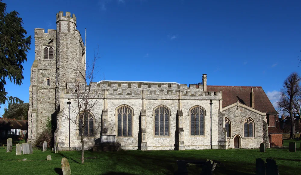
St Cristiolus's Church, Llangristiolus
In or near Newborough.
St Cristiolus's Church, Llangristiolus — church in Anglesey, UK.

Wikimedia Commons contributors — see linked file page for photographer and licence licence
Plan your visit
- Typical visit
- 30 min–1 h
- Nearest railway station
- Bodorgan · 7.1 km
- Free entry
Getting there & planning your visit
St Cristiolus's Church is located in Llangristiolus, Isle of Anglesey, with the postcode LL77 7YE. The nearest railway station is Bodorgan, which is 7.1 km away. Entry to the church is free.
About
St Cristiolus's Church, Llangristiolus is a historic church in the United Kingdom. Records date its origin to 1101. Heritage designation: Grade II* listed building. Affiliated with Anglicanism. Named after Cristiolus. Wikidata describes it as: "church in Anglesey, UK". Coordinates: 53.2365°, -4.3239°.
Photo gallery
Heritage listing
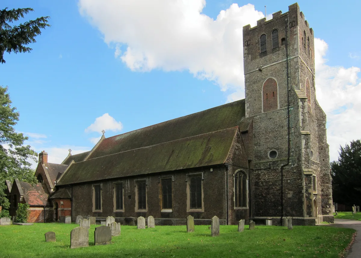
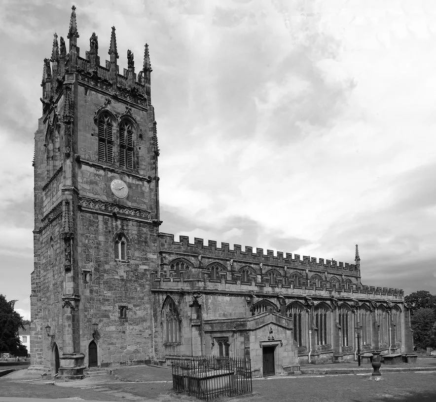
St Cristiolus's Church, Llangristiolus is a medieval church near the village of Llangristiolus, in Anglesey, north Wales. The village, about 1 mile (1.6 km) from the building, takes its name from the church. Reputedly founded by St Cristiolus in 610, the present building dates from the 12th and 13th centuries. Alterations were made in the 16th century, when the large east window in Perpendicular style was added to the chancel – a window which has been described by one guide to the buildings of north Wales as "almost too big to fit" in the wall. Some restoration work took place in the mid-19th century, when further windows were added and the chancel largely rebuilt.
From Cadw under OGL v3.
From the Wikipedia article
St Cristiolus's Church, Llangristiolus is a medieval church near the village of Llangristiolus, in Anglesey, north Wales. The village, about 1 mile (1.6 km) from the building, takes its name from the church. Reputedly founded by St Cristiolus in 610, the present building dates from the 12th and 13th centuries. Alterations were made in the 16th century, when the large east window in Perpendicular style was added to the chancel – a window which has been described by one guide to the buildings of north Wales as "almost too big to fit" in the wall. Some restoration work took place in the mid-19th century, when further windows were added and the chancel largely rebuilt. The church is still in use for weekly Sunday services (in Welsh and English), as part of the Church in Wales, and is one of four churches in a combined parish. It is a Grade II* listed building, a national designation given to "particularly important buildings of more than special interest", in particular because of its age and the east window. The church contains a decorated font from the 12th century, as well as memorials from the 18th, 19th and 20th centuries. Richard Owen, a 19th-century Calvinistic Methodist minister from Llangristiolus, is buried in the graveyard. The churchyard also contains the grave of the noted geologists, Edward and Annie Greenly, who pioneered modern geological mapping in Anglesey.
Excerpt from Wikipedia under CC BY-SA 4.0. See the source article linked in Sources below.
Background
History
St Cristiolus's Church is in central Anglesey, north Wales. It is situated just to the south of the A5 and A55 roads, on raised ground above Malltraeth Marsh. The modern village of Llangristiolus is about 1 mi to the west of the church. The date of foundation of the first building on this site is unknown. Geraint Jones, in a 2006 guide to Anglesey churches, wrote that it is thought that St Cristiolus established a church here in 610. Cristiolus, a 7th-century saint about whom little detail is known, was a follower of St Cadfan, a Breton saint associated with the Christian community on Bardsey Island in Wales. Cristiolus is also credited with the foundation of the church in Eglwyswrw in…
Architecture
The church is built from rubble masonry (mainly gritstone) and dressed with freestone. The nave has three bays, and the chancel at the east end of the nave has two bays; it is slightly wider than the nave. The nave and the chancel have external buttresses.
Sourced from Wikipedia under CC BY-SA 4.0.
- Coordinates
- 53.2365, -4.3239
- District
- Isle of Anglesey
- Parish
- Llangristiolus
- Postcode
- LL77 7YE
- Parliamentary constituency
- Ynys Môn
- Established
- 1101
- Nearest railway station
- Bodorgan — 7.1 km
- Official site
- www.churchinwales.org.uk
Sources
- wikidata: Q7592886 (CC0)
- wikipedia: St Cristiolus's Church, Llangristiolus (CC BY-SA 4.0)
- commons: South side of St Cristiolus, Llangristiolus.jpg (CC BY-SA 4.0)
Other places nearby

Ynys Cefni
Literary houses · 1.4 km

Llangristiolus
Historic churches · 1.4 km

Rhostrehwfa
Historic churches · 1.6 km

Cefncwmwd
Mountains & hills · 1.7 km

Llangristiolus
Villages · 1.9 km

War memorial in front of the Shire Hall
Memorials & monuments · 2.1 km

Tre-Garnedd Moated Site
Literary houses · 2.2 km

Moreia Chapel
Chapels · 2.2 km

Cerrigceinwen
Historic churches · 2.2 km

Llangefni Market
Farmers’ markets · 2.2 km
Llangefni Market
Farmers’ markets · 2.2 km

Llangefni
Historic churches · 2.3 km
Nearby
📷 5📷 5Historic churches · North Wales
Llangristiolus
Llangristiolus is a village and community in the middle of Anglesey, Wales, southwest of Llangefni, and is named after Saint Cristiolus. The River Cefni flows through the village. The village is withi
📷 5Historic churches · North Wales
Rhostrehwfa
Rhostrehwfa is a village in southern-central Anglesey, located southwest of Llangefni. To the southeast is the Malltraeth Marsh. It is situated at a prominent point on the crest of a ridge overlooking
📷 3Mountains & hills · North Wales
Cefncwmwd
Cefncwmwd — a mountain in wales-north, United Kingdom, 84 m.
📷 5📷 5Memorials & monuments · North Wales
War memorial in front of the Shire Hall
War memorial in front of the Shire Hall — Grade II listed building-listed memorial in wales-north, United Kingdom.
Where to eat & stay near St Cristiolus's Church, Llangristiolus
Places to stay
 📷 5
📷 5 📷 5
📷 5Caravan parks · North Wales
Mornest Caravan Park
Mornest Caravan Park — a caravan park in wales north.

Campsites · North Wales
Caeau Ty'n Talwrn - Scout Campsite
Caeau Ty'n Talwrn - Scout Campsite — a campsite in wales north.
 📷 5
📷 5Caravan parks · North Wales
Ael y Garnedd Caravan park
Ael y Garnedd Caravan park — a caravan park in wales north.
 📷 2
📷 2Campsites · North Wales
Pen-Y-Bont Farm
Pen-Y-Bont Farm — a campsite in wales north.
 📷 5
📷 5Campsites · North Wales
Fron Caravan & Camping Park
Fron Caravan & Camping Park — a campsite in wales north.
Places to eat & drink
 📷 5
📷 5Historic pubs · North Wales
The Bull Hotel, Llangefni
The Bull Hotel, Llangefni in Wales North, United Kingdom.
 📷 5
📷 5 📷 5
📷 5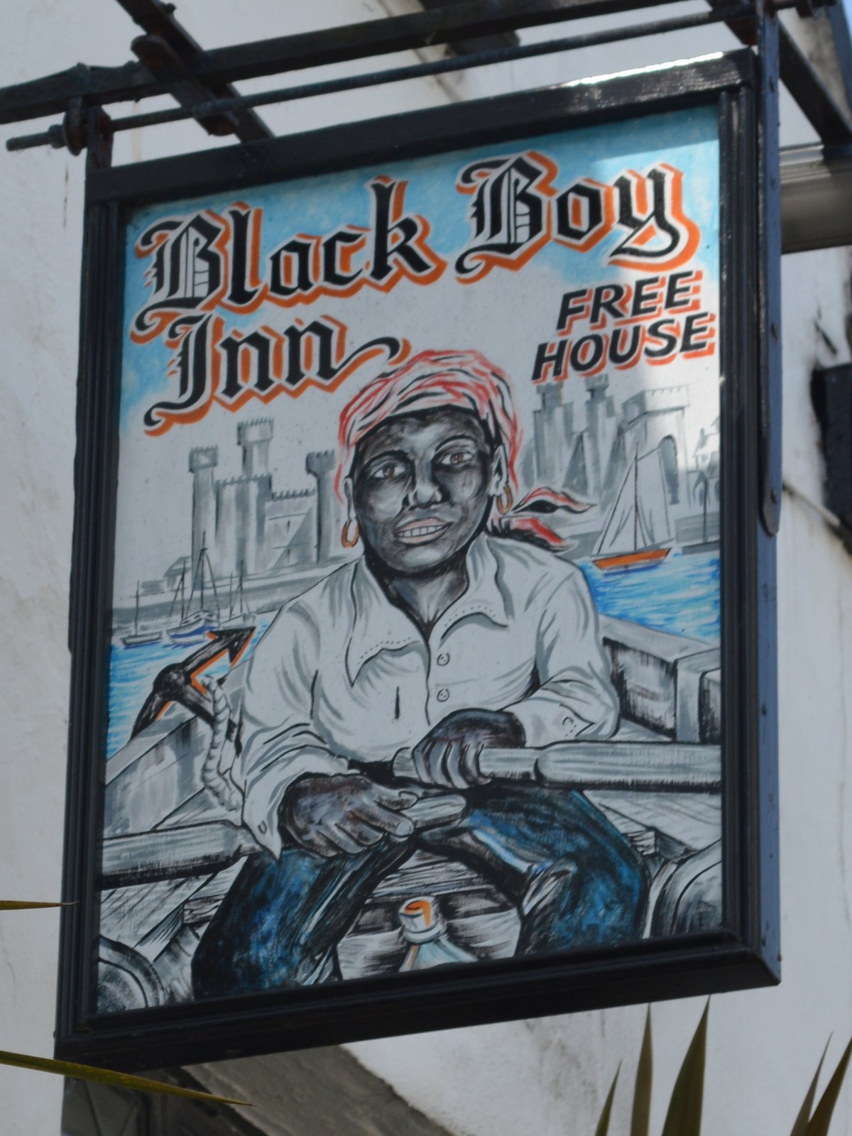 📷 5
📷 5 📷 5📷 5
Other places from this era
 📷 5
📷 5Historic churches · London
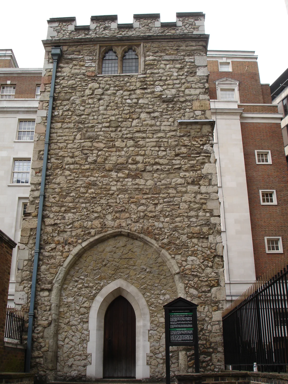
All Hallows Staining
All Hallows Staining — church in City of London, UK.
 📷 5
📷 5Historic churches · London
All Hallows' Church, Tottenham
All Hallows' Church, Tottenham — church in Tottenham, London.
 📷 5
📷 5Historic churches · London
All Saints Church, Kingston upon Thames
All Saints Church, Kingston upon Thames — church in Kingston upon Thames, London.
 📷 5
📷 5Historic churches · London
All Saints' Church, Edmonton
All Saints' Church, Edmonton — church in Edmonton, London.
More places in this region
 📷 3
📷 3Historic churches · North Wales
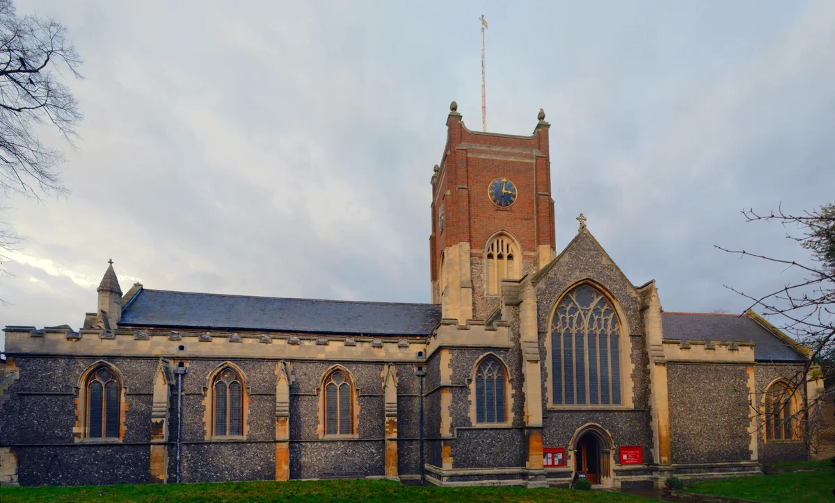
All Saints Church
All Saints Church — Anglican church in Deganwy, Wales.
 📷 3
📷 3Historic churches · North Wales
All Saints Church, Great Saughall
All Saints Church, Great Saughall — grade II listed church in Saughall, Cheshire West and Chester, Cheshire, England, UK.
 📷 3
📷 3Historic churches · North Wales
All Saints Church, Higher Kinnerton
All Saints Church, Higher Kinnerton — church in United Kingdom.
 📷 3
📷 3Historic churches · North Wales
All Saints' Church, Gresford
All Saints' Church, Gresford — church in Gresford, north Wales.
Frequently asked questions
- Where is St Cristiolus's Church, Llangristiolus?
- St Cristiolus's Church, Llangristiolus is in North Wales, United Kingdom (postcode LL77 7YE), in the parish of Llangristiolus.
- What is St Cristiolus's Church, Llangristiolus?
- St Cristiolus's Church, Llangristiolus — church in Anglesey, UK.
- How do I get to St Cristiolus's Church, Llangristiolus?
- The nearest railway station is Bodorgan, about 7.1 km away. Drivers can use postcode LL77 7YE.
- When was St Cristiolus's Church, Llangristiolus built?
- Built or established in 1101.
- Is St Cristiolus's Church, Llangristiolus a listed building?
- St Cristiolus's Church, Llangristiolus is officially recognised as Grade II* listed building listed.
- Is St Cristiolus's Church, Llangristiolus free to visit?
- Yes, St Cristiolus's Church, Llangristiolus is free to enter.
- How do I get to St Cristiolus's Church, Llangristiolus?
- The nearest railway station is Bodorgan, about 7.1 km away. Drivers can navigate to postcode LL77 7YE.