
Abbeys & priories · Scottish Lowlands
St Benedict's Convent, Maxwell Street, Dumfries
In or near Cargenbridge.
St Benedict's Convent, Maxwell Street, Dumfries — category B listed building-listed abbey in scotland-lowlands, United Kingdom.

thejackrustles — CC BY-SA 2.0 via Wikimedia Commons licence

Plan your visit
- Typical visit
- 45 min–1.5 h
- Nearest railway station
- Dumfries · 1.2 km
- Free entry
- Family-friendly
- Limited wheelchair access
Getting there & planning your visit
To visit St Benedict's Convent, you can reach it via Dumfries railway station, which is 1.2 km away. The postcode for sat-nav is DG2 7AW. Accessibility is limited, and it is advisable to check in advance for any specific needs.
About
St Benedict's Convent, Maxwell Street, Dumfries is a category B listed building-listed abbey in scotland-lowlands, United Kingdom, registered on the Historic Environment Scotland register (entry LB26281). Listed status protects buildings and structures of special architectural or historic interest. See the linked Wikipedia article for further details.
Photo gallery
Heritage listing
Category B Date Added 06/03/1981 Local Authority Dumfries And Galloway Planning Authority Dumfries And Galloway Burgh Dumfries NGR NX 96684 75790 Coordinates 296684, 575790 — 1881-84, Peter Paul Pugin. Extension for girl boarders and other school additions, James Barbour. Large Gothic, U-plan complex with enclosed garden. Chapel at NW, 6 bays and single transepts with unfinished stepped lancet gable. SE gable front to courtyard has bell-cote over rose window with cusped circles. Buttressed flanks with 2-light windows. Simple quatrefoiled tracery. 2 side chapels, adjoin transept, one with rose window, other with small apse semi-prismatic glass roof. Gabled porch projects from NW bay. NW gable front 3 large 2 and 3-light pointed arched windows with reticulated tracery. NE flank has 5 exposed bays, window head only appears over semi-octagonal side chapel at second bay. L-plan conventual range (PP Pugin) adjoins chapel. 2-storey, basement and attic, terminates at SE in double gables at right angles to main ridge, on both fronts, 3 storeys with attic windows in gable. Main entrance on NW elevation with chapel projecting to W to form L-plan forecourt. Gable end to left has 2-light mullion and transomed arched and cusped window round and 1st floors, small rose window above, similar 4-light window to right of door, square headed windows above it and door. Dormer windows with arched gablets. Long SW and NE facades, similar in treatment, arched 2-light windows at ground floor and single 1st floor windows. NE facade has central projecting gable with square ground bay broached to floor, canted at 1st floor, arched window above. SW frontage unbroken with regular fenestration. S school window (James Barbour) 3 storeys with attics, lit by rose windows in gable ends and longer gablets.
From Historic Environment Scotland under OGL v3.
Official information
The Old Bridge House Museum, built in 1660, is Dumfries' oldest house and showcases everyday life in the town. Visitors can explore a Victorian family kitchen, nursery, and bedroom, as well as an early dentist's surgery, with interpretive panels providing historical context.
Place summary
St Benedict's Convent is an abbey located on Maxwell Street in Dumfries, in the Scottish Lowlands. This building is designated as a category B listed structure, highlighting its historical and architectural significance.
AI-generated from the structured facts on this page (operator, designation, listing, era). Not a substitute for visiting.
- Coordinates
- 55.0658, -3.6193
- District
- Dumfries and Galloway
- Postcode
- DG2 7AW
- Parliamentary constituency
- Dumfries and Galloway
- Phone
- 030 33 33 3000
- Nearest railway station
- Dumfries — 1.2 km
- Official site
- www.dgculture.co.uk
Sources
- wikidata: Q17795247 (CC0)
Other places nearby

Maxwelltown West Church, Laurieknowe, Dumfries
Historic churches · 0.2 km

The Brigend Theatre
Theatres · 0.2 km

Robert Burns Centre Film Theatre
Theatres · 0.3 km

Laurieknowe Squash and Racketball Club (former Maxwelltown Chapel), School Lane, Dumfries
Historic churches · 0.3 km
Old Bridge House Museum
Museums · 0.3 km

Old Mortality and his pony
Public art & sculpture · 0.3 km
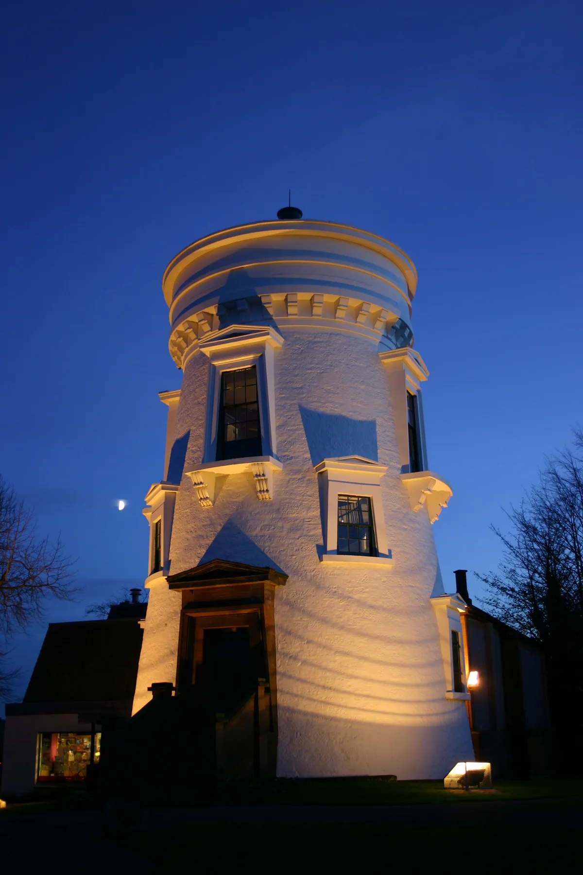
Dumfries Museum
Museums · 0.3 km

Devorgilla Bridge
Historic bridges · 0.3 km

Dumfries Old Bridge
Historic bridges · 0.3 km

Robert Burns Centre
Museums · 0.3 km

Maxwelltown War Memorial
Memorials & monuments · 0.4 km

McGowan Memorial Fountain
Memorials & monuments · 0.4 km
Nearby
📷 5Historic churches · Scottish Lowlands
Maxwelltown West Church, Laurieknowe, Dumfries
Maxwelltown West Church, Laurieknowe, Dumfries — category B listed building-listed church in scotland-lowlands, United Kingdom.
📷 3Theatres · Scottish Lowlands
The Brigend Theatre
The Brigend Theatre is a theatre in the United Kingdom.
📷 5Theatres · Scottish Lowlands
Robert Burns Centre Film Theatre
Robert Burns Centre Film Theatre — a cinema heritage in scotland-lowlands, United Kingdom.
📷 5Historic churches · Scottish Lowlands
Laurieknowe Squash and Racketball Club (former Maxwelltown Chapel), School Lane, Dumfries
Laurieknowe Squash and Racketball Club (former Maxwelltown Chapel), School Lane, Dumfries — category B listed building-listed church in scotland-lowlands, United Kingdom.
📷 3Museums · Scottish Lowlands
Old Bridge House Museum
Old Bridge House Museum — a museum in scotland-lowlands, United Kingdom.
📷 3Public art & sculpture · Scottish Lowlands
Old Mortality and his pony
Old Mortality and his pony — a public art in scotland-lowlands, United Kingdom.
Where to eat & stay near St Benedict's Convent, Maxwell Street, Dumfries
Places to stay
 📷 5
📷 5Caravan parks · Scottish Lowlands
Dumfries Caravan Park
Dumfries Caravan Park — a caravan park in scotland lowlands.
 📷 5
📷 5Hostels · Scottish Lowlands
Marthrown of Mabie
Marthrown of Mabie — a hostel in scotland lowlands.
📷 5Campsites · Scottish Lowlands
Marthrown of Mabie
Marthrown of Mabie — a campsite in scotland lowlands.
 📷 5
📷 5Caravan parks · Scottish Lowlands
Partridge Cottage CAMC CL
Partridge Cottage CAMC CL — a caravan park in scotland lowlands.
 📷 3
📷 3Campsites · Scottish Lowlands
Barnsoul Caravan Park
Barnsoul Caravan Park — a campsite in scotland lowlands.
 📷 5
📷 5Hotels · Scottish Lowlands
Friars Carse Country House Hotel
Friars Carse Country House Hotel — a hotel in scotland lowlands.
Places to eat & drink
 📷 5
📷 5Historic pubs · Scottish Lowlands
75 Friars Vennel, Dumfries
75 Friars Vennel, Dumfries in Scotland Lowlands, United Kingdom.
 📷 5
📷 5Historic pubs · Scottish Lowlands
Queen O' The South Public House, 8-10 Nith Place, Dumfries
Queen O' The South Public House, 8-10 Nith Place, Dumfries in Scotland Lowlands, United Kingdom.
 📷 5
📷 5Historic pubs · Scottish Lowlands
The Globe Inn, 56 High Street, Dumfries
The Globe Inn, 56 High Street, Dumfries in Scotland Lowlands, United Kingdom.
 📷 7
📷 7Historic pubs · Scottish Lowlands
Rob Roy Public House, 63-65 Queensberry Street, Dumfries
Rob Roy Public House, 63-65 Queensberry Street, Dumfries in Scotland Lowlands, United Kingdom.
 📷 5
📷 5Historic pubs · Scottish Lowlands
73-77 English Street, Dumfries
73-77 English Street, Dumfries in Scotland Lowlands, United Kingdom.
 📷 7
📷 7More abbeys in this region
 📷 4
📷 4Abbeys & priories · Scottish Lowlands
Jedburgh Public Hall
Jedburgh Public Hall in England North East, United Kingdom.
 Flagship📷 5
 Flagship📷 5
 📷 5
📷 5Abbeys & priories · Scottish Lowlands
Borders Abbeys Way
Borders Abbeys Way in England North East, United Kingdom.
Frequently asked questions
- Where is St Benedict's Convent, Maxwell Street, Dumfries?
- St Benedict's Convent, Maxwell Street, Dumfries is in the Scottish Lowlands, United Kingdom (postcode DG2 7AW).
- What is St Benedict's Convent, Maxwell Street, Dumfries?
- St Benedict's Convent, Maxwell Street, Dumfries — category B listed building-listed abbey in scotland-lowlands, United Kingdom.
- How do I get to St Benedict's Convent, Maxwell Street, Dumfries?
- The nearest railway station is Dumfries, about 1.2 km away. Drivers can use postcode DG2 7AW.
- Is St Benedict's Convent, Maxwell Street, Dumfries a listed building?
- St Benedict's Convent, Maxwell Street, Dumfries is officially recognised as category B listed building listed.
- How do I get to St Benedict's Convent, Maxwell Street, Dumfries?
- The nearest railway station is Dumfries, about 1.2 km away. Drivers can navigate to postcode DG2 7AW.