
Hill forts · Northern Ireland
Sròn Uamha Hillfort
Sròn Uamha Hillfort — a hill fort in northern-ireland, United Kingdom.

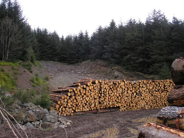
Alan Bowring — CC BY-SA 2.0 via Wikimedia Commons licence
Plan your visit
- Typical visit
- 1 h–2 h
- Free entry
- Dog-friendly
About
Sròn Uamha Hillfort is a hill fort located in northern-ireland, United Kingdom. Sourced from OpenStreetMap (ODbL licence); see local listings for visitor information, opening hours and admission details.
Photo gallery
Place summary
Sròn Uamha Hillfort is a prehistoric hill-fort located in Northern Ireland. Characterised by its elevated position, it provides insights into early settlement patterns and defensive strategies of ancient communities.
AI-generated from the structured facts on this page (operator, designation, listing, era). Not a substitute for visiting.
- Coordinates
- 55.2904, -5.7627
Sources
- osm: way/485158166 (ODbL)
Other places nearby

Borgadel Water, dun
Archaeological sites · 1.3 km

Beinn Theine
Mountains & hills · 1.6 km

Tòrr Dubh
Mountains & hills · 2.1 km
Torr Mhor
Mountains & hills · 2.2 km
Tòrr Mòr
Mountains & hills · 2.2 km

Beinn na Lice
Mountains & hills · 2.6 km
Beinn na Lice
Mountains & hills · 2.7 km

Beinn Bhreac
Mountains & hills · 2.8 km

Chinook Helicopter Crash Memorial
Memorials & monuments · 3.3 km
Neptune WX545 of 36 Squadron Crash Site Memorial
Memorials & monuments · 3.3 km
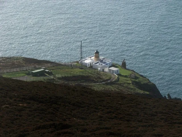
Mull of Kintyre Lighthouse
Lighthouses · 3.4 km

Strone Glen
Gorges · 4.1 km
Nearby
📷 2Archaeological sites · Northern Ireland
Borgadel Water, dun
Borgadel Water, dun — a archaeological in northern-ireland, United Kingdom.
📷 5Mountains & hills · Northern Ireland
Beinn Theine
Beinn Theine — mountain in northern ireland. Elevation: 385 m.
📷 5Mountains & hills · Northern Ireland
Tòrr Dubh
Tòrr Dubh — mountain in northern ireland. Elevation: 284 m.
📷 5📷 5Mountains & hills · Northern Ireland
Tòrr Mòr
Tòrr Mòr — mountain in northern ireland. Elevation: 414 m.
📷 5Mountains & hills · Northern Ireland
Beinn na Lice
Beinn na Lice — mountain in northern ireland. Elevation: 428 m.
Where to eat & stay near Sròn Uamha Hillfort
Places to stay
Caravan parks · Scottish Lowlands
Machrihanish Holiday Park
Machrihanish Holiday Park — a caravan park in scotland lowlands.
 📷 5
📷 5 📷 5
📷 5Hotels · Scottish Lowlands
The Royal Hotel
The Royal Hotel — a hotel in scotland lowlands.
 📷 5
📷 5Caravan parks · Scottish Lowlands
Peninver Sands Holiday Park
Peninver Sands Holiday Park — a caravan park in scotland lowlands.
📷 5Caravan parks · Scottish Lowlands
Peninver Sands Holiday Park
Peninver Sands Holiday Park — a caravan park in scotland lowlands.
Places to eat & drink
 📷 5
📷 5Historic pubs · Scottish Lowlands
40 Main Street, Campbeltown
40 Main Street, Campbeltown in Northern Ireland, United Kingdom.
More places in this region

Frequently asked questions
- Where is Sròn Uamha Hillfort?
- Sròn Uamha Hillfort is in Northern Ireland, United Kingdom.
- What is Sròn Uamha Hillfort?
- Sròn Uamha Hillfort — a hill fort in northern-ireland, United Kingdom.
- How do I get to Sròn Uamha Hillfort?
- Its coordinates are 55.2904°, -5.7627°.
- Is Sròn Uamha Hillfort free to visit?
- Yes, Sròn Uamha Hillfort is free to enter.