Long-distance walking trails · Scottish Highlands
Speyside Way
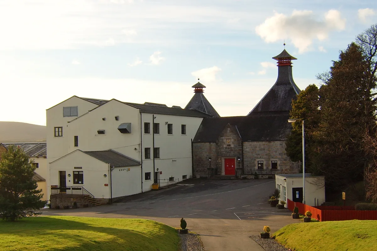
In or near Knockando.
65-mile route through the Speyside whisky country, Buckie to Newtonmore.

Alan Hodgson — CC BY-SA 2.0 via Wikimedia Commons licence
Plan your visit
- Typical visit
- 1 h–2 h
- Free entry
- Dog-friendly
Getting there & planning your visit
Speyside Way is located in the Scottish Highlands, with coordinates 57.5 latitude and -3.4 longitude. There is no nearest railway station or postcode provided. Entry to the trail is free.
About
The Speyside Way (1981) is the 65-mile Scottish long-distance route following the River Spey from Buckie on the Moray coast to Newtonmore in the Cairngorms. Passes through the heart of the Speyside whisky region with eight distilleries on or near the route.
Photo gallery
From the Wikipedia article
The Speyside Way (Doric: Strathspey Way; Scottish Gaelic: Slighe Shrath Spe) is a long-distance path in the Scottish Highlands. The route begins in Buckie and ends at Newtonmore,137 kilometres (85 mi) away. There is an optional spur leading off the main route to Tomintoul, adding 25 kilometres (16 mi) and 865 metres (2,838 ft) of ascent. The route primarily follows the River Spey through the scenery of Banffshire, Morayshire and Inverness-shire in Scotland, passing some of the distilleries that produce Speyside single malts. The first section from Buckie to Spey Bay follows the coastline, while the final section from Aviemore to Newtonmore follows most of the route of the former Strathspey Railway. It is listed as one of Scotland's Great Trails by NatureScot, and links directly to two further Great Trails: the Dava Way and the Moray Coast Trail. About 52,750 people use the path every year, of whom about 2,750 complete the entire route. As with the other Great Trails, the Way is waymarked with a symbol showing a thistle in a hexagon. The Way was opened in 1981, from Spey Bay to Ballindalloch, and was extended over the years to reach Aviemore by 2000. In 2020 the final extension to Newtonmore was completed. In 2021 the route's official website was modernised and its former bootprint logo replaced by a green-blue circle enclosing a stylised distillery and salmon. Since 1994, the Speyside Way Ultramarathon has been run from Cragganmore distillery in Ballindalloch to Buckie, a distance of 36.5 miles (58.7 km).
Excerpt from Wikipedia under CC BY-SA 4.0. See the source article linked in Sources below.
- Coordinates
- 57.5000, -3.4000
- Address
- Scottish Highlands
- Established
- 1981
Sources
- manual: speyside-way (manual)
- wikipedia: Speyside Way (CC BY-SA 4.0)
Other places nearby

Carn na Cailliche
Mountains & hills · 2.7 km
Càrn na Cailliche
Mountains & hills · 2.9 km

Hill of Slackmore
Mountains & hills · 3.4 km

Cairn Uish
Mountains & hills · 4.2 km

Cairn Uish
Mountains & hills · 4.3 km

Knockando Parish Church, Upper Knockando
Historic churches · 4.3 km
Cardhu Distillery
Distilleries · 4.5 km

Elizabeth Cummings and Johnnie Walker Striding Man
Public art & sculpture · 4.5 km
The Linn
Waterfalls · 4.5 km

Meikle Hill
Mountains & hills · 4.5 km

Knockando Woolmill
Watermills · 4.6 km

Knockando
Towns & cities · 4.8 km
Nearby
📷 5Mountains & hills · Scottish Highlands
Carn na Cailliche
Carn na Cailliche — a hill or mountain in scotland highlands.
📷 5Mountains & hills · Scottish Highlands
Càrn na Cailliche
Càrn na Cailliche — mountain in scotland highlands. Elevation: 400 m.
📷 5Mountains & hills · Scottish Highlands
Hill of Slackmore
Hill of Slackmore — mountain in scotland highlands. Elevation: 355 m.
📷 5Mountains & hills · Scottish Highlands
Cairn Uish
Cairn Uish — a hill or mountain in scotland highlands.
📷 5Mountains & hills · Scottish Highlands
Cairn Uish
Cairn Uish — mountain in scotland highlands. Elevation: 366 m.
📷 5Historic churches · Scottish Highlands
Knockando Parish Church, Upper Knockando
Knockando Parish Church, Upper Knockando — category C listed building-listed church in scotland-highlands, United Kingdom.
Where to eat & stay near Speyside Way
Places to stay
 📷 5
📷 5Campsites · Scottish Highlands
Speyside by Craigellachie
Speyside by Craigellachie — a campsite in scotland highlands.
 📷 5
📷 5 📷 3
📷 3Campsites · Scottish Highlands
Aberlour Gardens Camping Park
Aberlour Gardens Camping Park — a campsite in scotland highlands.
 📷 7
📷 7Hotels · Scottish Highlands
Craigellachie Hotel
Craigellachie Hotel — a hotel in scotland highlands.
 📷 5
📷 5Caravan parks · Scottish Highlands
Riverside Caravan Park Elgin
Riverside Caravan Park Elgin — a caravan park in scotland highlands.
 📷 5
📷 5Caravan parks · Scottish Highlands
North Alves Holiday Park
North Alves Holiday Park — a caravan park in scotland highlands.
Other places from this era
 Flagship📷 10
Long-distance walking trails · South East England
Thames Path
184-mile National Trail along the Thames from source to the Barrier.
 📷 5
📷 5Long-distance walking trails · South East England
North Downs Way
153-mile chalk escarpment trail from Farnham to Dover.
 Flagship📷 10
Long-distance walking trails · South East England
South Downs Way
100-mile chalk-ridge trail across the South Downs National Park.
 ★ Iconic📷 4
Long-distance walking trails · South West England
Cotswold Way
102-mile National Trail along the Cotswold escarpment from Chipping Campden to Bath.
More places in this region
 📷 5
📷 5Long-distance walking trails · Scottish Highlands
Great Glen Way
73-mile coast-to-coast Highland trail from Fort William to Inverness.
Frequently asked questions
- Where is Speyside Way?
- Speyside Way is in the Scottish Highlands, United Kingdom.
- What is Speyside Way?
- 65-mile route through the Speyside whisky country, Buckie to Newtonmore.
- How do I get to Speyside Way?
- Its coordinates are 57.5000°, -3.4000°.
- When was Speyside Way built?
- Built or established in 1981.
- Is Speyside Way free to visit?
- Yes, Speyside Way is free to enter.