Caves · East Midlands
Speedwell Cavern
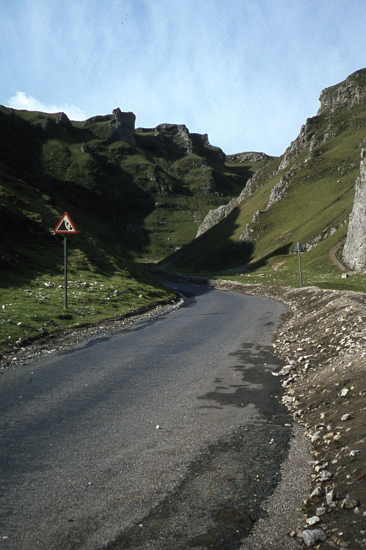
In or near Edale.
Speedwell Cavern is one of the four show caves in Castleton, Derbyshire, England. The cave system consists of a horizontal lead miners' adit (a level passageway driven horizontally into the hillside)

David Hawgood — CC BY-SA 2.0 via Wikimedia Commons licence
Plan your visit
- Typical visit
- 45 min–1.5 h
- Nearest railway station
- Edale · 3.1 km
- Free entry
- Family-friendly
- Dog-friendly
Getting there & planning your visit
To visit Speedwell Cavern, the nearest railway station is Edale, located 3.1 km away. Entry to the cavern is free, and the postcode for sat-nav is S33 8WA.
About
Speedwell Cavern is one of the four show caves in Castleton, Derbyshire, England. The cave system consists of a horizontal lead miners' adit (a level passageway driven horizontally into the hillside) 200 metres (660 ft) below ground leading to the cavern itself, a limestone cave. The narrow adit is permanently flooded, so after descending a long staircase, access to the cave is made by boat. At the end of the adit, the cavern opens up with fluorspar veins, stalactites and stalagmites, and the so-called "Bottomless Pit". This chamber has an underground lake with a 20 metres (66 ft) high waterfall and an extremely deep vertical shaft, now choked to within 20 metres (66 ft) of the surface by rock spoil dumped by miners, after driving the continuation of the canal to the natural streamway beyond, which provided the bulk of the water for the canal. The original depth of the shaft has been estimated, from the amount of spoil placed in the shaft over the years, at around 150 metres (490 ft). The mine was developed in the 1770s but the limited lead ore deposits meant that it was not profitable and it was closed down by 1790. At the foot of Winnats Pass, it is a tourist attraction with an underground boat trip to the cavern. Originally the guide propelled the boat by pushing against the walls with his hands, later the boat was legged through, and now it is powered by an electric motor. A connection was discovered in 2006 between the Speedwell Cavern system and Titan, the largest…
Photo gallery
See it from the streetimagery from 2021
Imagery © Mapillary contributors, CC BY-SA 4.0
Official information
Speedwell Cavern is a historic lead mine located in the Peak District National Park. Visitors can embark on an underground boat journey to explore the cavern's unique geological features and rich mining history.
Protected designations
- Site of Special Scientific Interest: Castleton SSSI
Designations sourced from Natural England open data under OGL v3.
From the Wikipedia article
Speedwell Cavern is one of the four show caves in Castleton, Derbyshire, England. The cave system consists of a horizontal lead miners' adit (a level passageway driven horizontally into the hillside) 200 metres (660 ft) below ground leading to the cavern itself, a limestone cave. The narrow adit is permanently flooded, so after descending a long staircase, access to the cave is made by boat. At the end of the adit, the cavern opens up with fluorspar veins, stalactites and stalagmites, and the so-called "Bottomless Pit". This chamber has an underground lake with a 20 metres (66 ft) high waterfall and an extremely deep vertical shaft, now choked to within 20 metres (66 ft) of the surface by rock spoil dumped by miners, after driving the continuation of the canal to the natural streamway beyond, which provided the bulk of the water for the canal. The original depth of the shaft has been estimated, from the amount of spoil placed in the shaft over the years, at around 150 metres (490 ft). The mine was developed in the 1770s but the limited lead ore deposits meant that it was not profitable and it was closed down by 1790. At the foot of Winnats Pass, it is a tourist attraction with an underground boat trip to the cavern. Originally the guide propelled the boat by pushing against the walls with his hands, later the boat was legged through, and now it is powered by an electric motor. A connection was discovered in 2006 between the Speedwell Cavern system and Titan, the largest natural shaft in the UK, which is 141.5 metres (464 ft) high.
Excerpt from Wikipedia under CC BY-SA 4.0. See the source article linked in Sources below.
- Coordinates
- 53.3414, -1.7921
- County
- Derbyshire
- District
- High Peak
- Parish
- Castleton
- Postcode
- S33 8WA
- Parliamentary constituency
- High Peak
- Nearest railway station
- Edale — 3.1 km
- Official site
- www.speedwellcavern.co.uk
Sources
- wikipedia: Speedwell Cavern (CC BY-SA 4.0)
Featured in this guide
Other places nearby
Suicide Cave(Horseshoe Cave)
Caves · 0.2 km
Suicide Cave
Caves · 0.2 km

Son of Longcliffe
Caves · 0.3 km

Treak Cliff Cavern
Caves · 0.5 km

Rowter Hole
Caves · 0.7 km

Winnats Head
Caves · 0.8 km
Winnats Head Cave
Caves · 0.8 km

Odin Mine crushing wheel
Archaeological sites · 0.9 km

Peakshole Sough
Caves · 0.9 km

Blue John Cavern
Caves · 0.9 km

Titan
Caves · 0.9 km

Rowter Farm Campsite
Campsites · 0.9 km
Nearby
📷 5Caves · East Midlands
Suicide Cave(Horseshoe Cave)
Suicide Cave(Horseshoe Cave) — cave in england east midlands.
📷 5Caves · East Midlands
Suicide Cave
Suicide Cave — a cave broad in england-east-midlands, United Kingdom.
📷 5Caves · East Midlands
Son of Longcliffe
Son of Longcliffe — a cave broad in england-east-midlands, United Kingdom.
📷 3Caves · East Midlands
Treak Cliff Cavern
Treak Cliff Cavern is a cave in the United Kingdom.
📷 5Caves · East Midlands
Rowter Hole
Rowter Hole — a cave broad in england-east-midlands, United Kingdom.
📷 5Where to eat & stay near Speedwell Cavern
Places to stay
📷 5Campsites · East Midlands
Rowter Farm Campsite
Rowter Farm Campsite — a campsite in england east midlands.
 📷 5
📷 5Hostels · East Midlands
Technical Speleological Group
Technical Speleological Group — a hostel in england east midlands.
 📷 5
📷 5Campsites · East Midlands
YHA Castleton Losehill Hall
YHA Castleton Losehill Hall — a campsite in england east midlands.
 📷 5
📷 5Hostels · East Midlands
YHA Castleton Losehill Hall
YHA Castleton Losehill Hall — a hostel in england east midlands. Brand: Youth Hostels Association.
 📷 5
📷 5Caravan parks · East Midlands
Castleton Caravan and Motorhome Club Site
Castleton Caravan and Motorhome Club Site — a caravan park in england east midlands.
📷 5Places to eat & drink
 📷 5
📷 5Historic pubs · East Midlands
The Old Nags Head
The Old Nags Head in England Yorkshire, United Kingdom.
 📷 7
📷 7Historic pubs · East Midlands
The Three Stags' Heads
The Three Stags' Heads in England South East, United Kingdom.
 📷 5
📷 5 📷 5
📷 5Historic pubs · East Midlands
The Chequers Inn and attached outbuildings
The Chequers Inn and attached outbuildings in England East Midlands, United Kingdom.
 📷 7
📷 7Historic pubs · Yorkshire & the Humber
The Fox House
The Fox House in England Yorkshire, United Kingdom.
 📷 5
📷 5Historic pubs · East Midlands
The Hare And Hounds Hotel
The Hare And Hounds Hotel in England Yorkshire, United Kingdom.
More caves in this region
 📷 3📷 5
Caves · East Midlands
Blue John Cavern
Blue John Cavern is a cave in the United Kingdom.
 📷 3
📷 3Caves · East Midlands
Boat House Cave
Boat House Cave is a cave in the United Kingdom.
 📷 3
📷 3Caves · East Midlands
Church Hole
Church Hole is a cave in the United Kingdom.
Frequently asked questions
- Where is Speedwell Cavern?
- Speedwell Cavern is in Derbyshire, Yorkshire, United Kingdom (postcode S33 8WA), in the parish of Castleton.
- What is Speedwell Cavern?
- Speedwell Cavern is one of the four show caves in Castleton, Derbyshire, England. The cave system consists of a horizontal lead miners' adit (a level passageway driven horizontally into the hillside)
- How do I get to Speedwell Cavern?
- The nearest railway station is Edale, about 3.1 km away. Drivers can use postcode S33 8WA.
- Is Speedwell Cavern a protected site?
- Yes — Speedwell Cavern is part of the Castleton SSSI Site of Special Scientific Interest.
- Is Speedwell Cavern free to visit?
- Yes, Speedwell Cavern is free to enter.
- How do I get to Speedwell Cavern?
- The nearest railway station is Edale, about 3.1 km away. Drivers can navigate to postcode S33 8WA.