Mountains & hills · Scottish Islands
South Ward
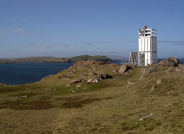
South Ward — mountain in scotland islands. Elevation: 169 m.

Rude Health — CC BY-SA 2.0 via Wikimedia Commons licence
Plan your visit
- Typical visit
- 3 h–8 h
- Best time of year
- Late spring – early autumn (May–Oct)
About
South Ward is a mountain located in scotland islands. Elevation: 169 m. A named British peak recorded in OpenStreetMap. Peaks are typically named on Ordnance Survey 1:50k mapping.
Photo gallery
Place summary
South Ward is a mountain located in the Scottish Islands. It features rugged terrain typical of the region, appealing to experienced hikers and climbers. The mountain offers panoramic views of the surrounding landscape, showcasing the natural beauty of the islands. Visitors can expect a challenging outdoor experience in a remote and scenic setting.
AI-generated from the structured facts on this page (operator, designation, listing, era). Not a substitute for visiting.
- Coordinates
- 60.3652, -1.4208
Sources
- osm: n13382172776 (ODbL)
Other places nearby
Loading nearby places…
Nearby
 Flagship📷 4
Islands · Scottish Islands
Muckle Roe
Muckle Roe — island in Shetland Islands, Scotland, UK.
📷 5Mountains & hills · Scottish Islands
Mid Ward
Mid Ward — mountain in scotland islands. Elevation: 172 m.
 📷 5
📷 5Mountains & hills · Scottish Islands
The Cooses
The Cooses — mountain in scotland islands. Elevation: 112 m.
 📷 5
📷 5Mountains & hills · Scottish Islands
Cumle
Cumle — mountain in scotland islands. Elevation: 162 m.
📷 5Mountains & hills · Scottish Islands
Cumle
Cumle — a hill or mountain in scotland islands.
📷 5Mountains & hills · Scottish Islands
Mid Field
Mid Field — mountain in scotland islands. Elevation: 128 m.
Where to eat & stay near South Ward
Places to stay
 📷 5
📷 5Hostels · Scottish Islands
The Sail Loft
The Sail Loft — a hostel in scotland islands.
 📷 5
📷 5Caravan parks · Scottish Islands
Braewick Caravan Park
Braewick Caravan Park — a caravan park in scotland islands.
 📷 5
📷 5Campsites · Scottish Islands
South Nesting
South Nesting — a campsite in scotland islands.
 📷 5
📷 5Campsites · Scottish Islands
Skeld Caravan Park and Campsite
Skeld Caravan Park and Campsite — a campsite in scotland islands.
 📷 5
📷 5Campsites · Scottish Islands
Oot Ower Lounge
Oot Ower Lounge — a campsite in scotland islands.
 📷 5
📷 5Caravan parks · Scottish Islands
Scalloway Caravan Park
Scalloway Caravan Park — a caravan park in scotland islands.


More mountains in this region
 📷 3
📷 3Mountains & hills · Scottish Islands
Aikerness Bay
Aikerness Bay — bay in Orkney Islands, Scotland, UK.
 📷 3
📷 3Mountains & hills · Scottish Islands
Aith Hope
Aith Hope — bay in Orkney Islands, Scotland, UK.

Mountains & hills · Scottish Islands
Aith Voe
Aith Voe — bay on West Mainland, Shetland Islands, Scotland, UK.
 📷 3
📷 3Mountains & hills · Scottish Islands
Aith Voe
Aith Voe — bay on South Mainland, Shetland Islands, Scotland, UK.
Frequently asked questions
- Where is South Ward?
- South Ward is in the Scottish Islands, United Kingdom.
- What is South Ward?
- South Ward — mountain in scotland islands. Elevation: 169 m.
- How do I get to South Ward?
- Its coordinates are 60.3652°, -1.4208°.