
Lakes · East of England
South Walsham Broad
In or near Horning.
South Walsham Broad — a lake in england east.

Peter Jeffery — CC BY-SA 2.0 via Wikimedia Commons licence

Plan your visit
- Typical visit
- 1 h–2 h
- Nearest railway station
- Acle · 5.2 km
About
A British lake — freshwater body formed by glaciation, fluvial action or, where adjacent to populated areas, by deliberate damming.
Photo gallery
Place summary
South Walsham Broad is a lake located in the East of England. It is part of the Norfolk Broads, a network of rivers and lakes known for their unique wetlands. The area is popular for boating, fishing, and birdwatching, attracting visitors interested in nature and outdoor activities. The surrounding landscape offers various opportunities for walking and enjoying the local flora and fauna.
AI-generated from the structured facts on this page (operator, designation, listing, era). Not a substitute for visiting.
- Coordinates
- 52.6720, 1.4980
- County
- Norfolk
- District
- Broadland
- Parish
- South Walsham
- Postcode
- NR13 6EB
- Parliamentary constituency
- Broadland and Fakenham
- Nearest railway station
- Acle — 5.2 km
Sources
- manual: geonames-9884718 (CC BY 4.0)
Other places nearby

Fairhaven Woodland and Water Garden
Gardens · 0.4 km

The Wiers
Lakes · 0.5 km

Remains Of The West Tower Of The Church Of St Lawrence
Memorials & monuments · 0.7 km

South Walsham
Villages · 0.8 km

Ranworth Village Sign
Public art & sculpture · 0.9 km

South Walsham Village Sign
Public art & sculpture · 0.9 km
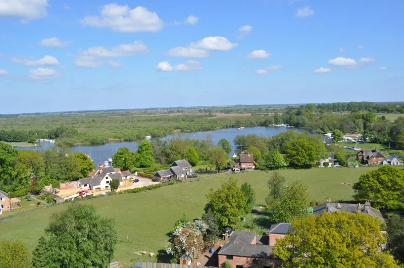
Malthouse Broad
Natural landmarks · 1.0 km

Ranworth
Villages · 1.1 km
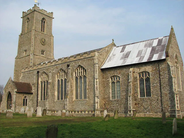
Church of St Helen
Historic churches · 1.3 km

Ranworth Church Village Sign
Public art & sculpture · 1.3 km

Wildlife Centre
Natural landmarks · 1.4 km

Panxworth
Villages · 1.8 km
Nearby
📷 3Gardens · East of England
Fairhaven Woodland and Water Garden
Fairhaven Woodland and Water Garden — a garden in East of England, United Kingdom.
📷 5📷 3Memorials & monuments · East of England
Remains Of The West Tower Of The Church Of St Lawrence
Remains Of The West Tower Of The Church Of St Lawrence — Grade II listed building-listed memorial in england-east, United Kingdom.
📷 5📷 3Public art & sculpture · East of England
Ranworth Village Sign
Ranworth Village Sign — a public art in East of England, United Kingdom.
📷 3Public art & sculpture · East of England
South Walsham Village Sign
South Walsham Village Sign — a public art in East of England, United Kingdom.
Where to eat & stay near South Walsham Broad
Places to stay
 📷 5
📷 5 📷 5
📷 5 📷 5
📷 5 📷 5
📷 5 📷 5
📷 5Campsites · East of England
Decoy Broad Campsite
Decoy Broad Campsite — a campsite in england east.
 📷 5
📷 5Places to eat & drink
 📷 7
📷 7Historic pubs · East of England
Recruiting Sergeant Inn
Recruiting Sergeant Inn in England East, United Kingdom.
 📷 5
📷 5 📷 5
📷 5Restaurants · East of England
The Town House
The Town House — a restaurant in england east. Brand: Stonehouse Pizza and Carvery.
 📷 5
📷 5Historic pubs · East of England
The Top House Public House, Including Boundary Wall To Yard
The Top House Public House, Including Boundary Wall To Yard in England East, United Kingdom.
 📷 5
📷 5 📷 7
📷 7Historic pubs · East of England
The Castle Public House
The Castle Public House in England East, United Kingdom.
More places in this region
 📷 5
📷 5 📷 5
📷 5 📷 5📷 5
Frequently asked questions
- Where is South Walsham Broad?
- South Walsham Broad is in Norfolk, East of England, United Kingdom (postcode NR13 6EB), in the parish of South Walsham.
- What is South Walsham Broad?
- South Walsham Broad — a lake in england east.
- How do I get to South Walsham Broad?
- The nearest railway station is Acle, about 5.2 km away. The nearest town is Horning. Drivers can use postcode NR13 6EB.
- How do I get to South Walsham Broad?
- The nearest railway station is Acle, about 5.2 km away. Drivers can navigate to postcode NR13 6EB.