
Islands · Scottish Islands
South Ronaldsay
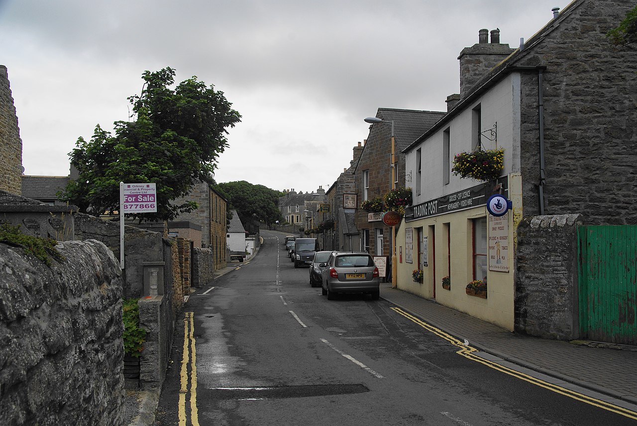
In or near St Margaret's Hope.
South Ronaldsay — one of the Orkney Islands, Scotland, UK.

Wikimedia Commons contributors — see linked file page for photographer and licence licence

Plan your visit
- Typical visit
- 4 h–12 h
- Free entry
- Dog-friendly
Getting there & planning your visit
South Ronaldsay is an island in the Orkney Islands, accessible via postcode KW17 2RL. Entry to the island is free. There is no nearest railway station mentioned, and accessibility details are not provided.
About
South Ronaldsay is a island in the United Kingdom. It covers approximately 50 km². Recent population estimates put it at around 909 people. Part of Orkney Islands. Wikidata describes it as: "one of the Orkney Islands, Scotland, UK". Coordinates: 58.7833°, -2.9500°.
Photo gallery
Summary from the official site
The Scots Language Centre focuses on the Scots language and its place-names, showcasing a map of Scotland in Scots. The map highlights the historical and linguistic significance of place-names, reflecting regional dialects and the evolution of the Scots language over centuries.
From the Wikipedia article
South Ronaldsay (, also , Scots: Sooth Ronalshee) is one of the Orkney Islands off the north coast of Scotland. It is linked to the Orkney Mainland by the Churchill Barriers, running via Burray, Glimps Holm and Lamb Holm.
Excerpt from Wikipedia under CC BY-SA 4.0. See the source article linked in Sources below.
Background
History
In 1627 nine chapels were recorded on the island with some of the names hinting at the existence of Christian worship prior to the Norse conquest of Orkney. They were: Sant Androis at Woundwick, Our Ladie at Halcro, Sant Colmis at Loch of Burwick, Ruid chappell in Sandwick, Sant Tola [Olaf] in Wydwall, Sant Colme in Hoxay, Sant Margrat in the Howp, Sant Colmeis in Grymnes and Sant Ninian in Stow. The locations are all known although little physical evidence remains in several cases. In the early 18th century Sir James Stewart commenced significant agricultural improvements in a 170 ha enclosure called the Park of Cara. This was located at the northern end of South Ronaldsay overlooking…
Sourced from Wikipedia under CC BY-SA 4.0.
- Coordinates
- 58.7833, -2.9500
- District
- Orkney Islands
- Postcode
- KW17 2RL
- Parliamentary constituency
- Orkney and Shetland
- Population
- 909
Sources
- wikidata: Q584681 (CC0)
- wikipedia: South Ronaldsay (CC BY-SA 4.0)
- commons: Windwick, South Ronaldsay.jpg (CC BY-SA 4.0)
Other places nearby

Ward Hill
Mountains & hills · 0.4 km

Former water mill
Watermills · 0.6 km

Upper Olad
Historic houses · 0.7 km

Olad's Summit
Viewpoints · 1.1 km

Stews Standing stone (Prehistoric)
Stone circles · 1.4 km

Sandwick Mill (former watermill now a storehouse)
Watermills · 1.4 km
Site of St Ninian's Chapel and burial ground
Archaeological sites · 1.4 km

Sandwick House, South Ronaldsay
Historic houses · 1.5 km

Site of Mucklehouse Ruid Chapel and burial ground (around C14)
Archaeological sites · 1.6 km

South Ronaldsay, Brough of Windwick
Vineyards · 1.7 km

The Brough
Archaeological sites · 1.7 km

HMS Narborough
Other places · 1.8 km
Nearby
📷 5Mountains & hills · Scottish Islands
Ward Hill
Ward Hill — mountain in scotland islands. Elevation: 118 m.
📷 3Watermills · Scottish Islands
Former water mill
Former water mill is a watermill in the United Kingdom.
📷 3Historic houses · Scottish Islands
Upper Olad
Upper Olad — a historic house in Scottish Islands, United Kingdom.
📷 3📷 5Stone circles · Scottish Islands
Stews Standing stone (Prehistoric)
Stews Standing stone (Prehistoric) — a stone circle in Scottish Islands, United Kingdom.
📷 3Watermills · Scottish Islands
Sandwick Mill (former watermill now a storehouse)
Sandwick Mill (former watermill now a storehouse) is a watermill in the United Kingdom.
Where to eat & stay near South Ronaldsay
Places to stay
 📷 5📷 5
 📷 5
📷 5 📷 7
📷 7 📷 5
📷 5 📷 5
📷 5Campsites · Scottish Islands
John O'Groats Caravan and Camping Site
John O'Groats Caravan and Camping Site — a campsite in scotland islands.
More places in this region
 📷 5
📷 5Islands · Scottish Islands
Bac Beag
Bac Beag — Scottish island, part of the Treshnish Isles in the Inner Hebrides.
 📷 5
📷 5Islands · Scottish Islands
Bac Mòr
Bac Mòr — island in Argyll and Bute, Scotland, UK, one of the Treshnish Isles.
 Flagship📷 3
Islands · Scottish Islands
Baleshare
Baleshare — flat tidal island in the Outer Hebrides, Scotland, UK.
 Flagship📷 5
Islands · Scottish Islands
Barra
Barra — island in Outer Hebrides, Scotland, UK.
Frequently asked questions
- Where is South Ronaldsay?
- South Ronaldsay is in the Scottish Islands, United Kingdom (postcode KW17 2RL).
- What is South Ronaldsay?
- South Ronaldsay — one of the Orkney Islands, Scotland, UK.
- How do I get to South Ronaldsay?
- The nearest town is St Margaret's Hope. Drivers can use postcode KW17 2RL.
- Is South Ronaldsay free to visit?
- Yes, South Ronaldsay is free to enter.
- How do I get to South Ronaldsay?
- Drivers can navigate to postcode KW17 2RL. It sits within the Orkney and Shetland parliamentary constituency.