
Islands · Scottish Islands
South Lewis, Harris and North Uist NSA
In or near Lochmaddy.
South Lewis, Harris and North Uist NSA in Scotland Islands, United Kingdom.

Scottish Government — CC BY-SA 3.0 via Wikimedia Commons licence

Plan your visit
- Typical visit
- 4 h–12 h
- Free entry
- Dog-friendly
About
South Lewis, Harris and North Uist NSA is a place of interest in Scotland Islands, United Kingdom — drawn from open-data sources for visitor reference. See the linked Wikipedia article for the full description.
Photo gallery
From the Wikipedia article
South Lewis, Harris and North Uist is a large national scenic area (NSA) in the Western Isles of Scotland. It is one of 40 such areas in Scotland, which are defined so as to identify areas of exceptional scenery and to ensure its protection from inappropriate development. The designated area covers 202,388 ha in total, of which 112,301 ha is on land, with a further 90,087 ha being marine (i.e. below low tide level), making it the largest of the NSAs in both total and marine area. The designated area includes the mountainous south west of Lewis, all of Harris, the Sound of Harris and the northern part of North Uist. National scenic areas are primarily designated due to the scenic qualities of an area, however NSAs may well have other special qualities, for example related to culture, history, archaeology, geology or wildlife. Areas with such qualities may be protected via other national and international designations that overlap with the NSA designation. There are several Natura 2000 sites within the designated area of the NSA. Although the national scenic area designation provides a degree of additional protection via the planning process, there are no bodies equivalent to a national park authority, and whilst local authorities (in this case Comhairle nan Eilean Siar) can produce a management strategy for each one, only the three national scenic areas within Dumfries and Galloway have current management strategies.
Excerpt from Wikipedia under CC BY-SA 4.0. See the source article linked in Sources below.
Background
Description
North Harris contains Clisham (799m), the highest peak in the Outer Hebrides. Steep-sided glens, with precipitous crags, have a mountainous character. Exposure and grazing prevent tree growth. Deep sea lochs in the east penetrate far into the hills. The east coast of Harris has many bays and islets. The west coast has wide, sandy beaches with machair. Rocky headlands, separating the bays, have been sculptured into geos and stacks. Scattered islands lies in the Sound of Harris between South Harris and North Uist. On North Uist the spectacular deep peatland supports a wide variety of vegetation and birds. The settlement of Lochmaddy (an anglicisation of the Scottish Gaelic Loch nam Madadh) is…
Sourced from Wikipedia under CC BY-SA 4.0.
- Coordinates
- 57.6760, -7.0660
- Address
- Western Isles, Scotland
- Established
- 1981
Sources
- wikidata: Q7567818 (CC0)
- wikipedia: South Lewis, Harris and North Uist National Scenic Area (CC BY-SA 4.0)
Other places nearby
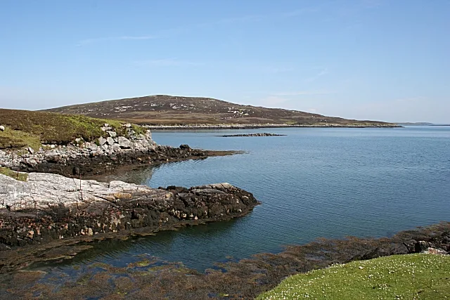
Tahay
Islands · 1.8 km

Cnoc a' Chombaiste
Mountains & hills · 2.1 km
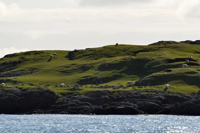
Hermetray
Islands · 2.2 km

Sursaigh
Islands · 2.2 km

North Uist, Groatay, Dun Mhic Laitheann
Vineyards · 3.2 km

Dun Mhic Laitheann
Archaeological sites · 3.2 km

Sgarabhaigh
Islands · 3.4 km

Tobha Beag
Mountains & hills · 3.4 km

Groay
Islands · 3.5 km
Crogary na Hoe
Mountains & hills · 4.0 km
Crogary na Hoe
Mountains & hills · 4.0 km

Cnoc Mòr an t-Sagairt
Mountains & hills · 4.8 km
Nearby
Flagship📷 4📷 2Mountains & hills · Scottish Islands
Cnoc a' Chombaiste
Cnoc a' Chombaiste — mountain in scotland highlands. Elevation: 35 m.
📷 3Islands · Scottish Islands
Hermetray
Hermetray — uninhabited island off North Uist, in the Outer Hebrides of Scotland.
📷 4Islands · Scottish Islands
Sursaigh
Sursaigh — island in Outer Hebrides, Scotland, UK.
📷 5Vineyards · Scottish Islands
North Uist, Groatay, Dun Mhic Laitheann
North Uist, Groatay, Dun Mhic Laitheann — a UK vineyard in scotland highlands, producing English or Welsh wine from cool-climate grape varieties.
📷 5Archaeological sites · Scottish Islands
Dun Mhic Laitheann
Dun Mhic Laitheann — a archaeological in scotland-highlands, United Kingdom.
Where to eat & stay near South Lewis, Harris and North Uist NSA
Places to stay
 📷 5
📷 5Hostels · Scottish Islands
Berneray Hostel
Berneray Hostel — a hostel in scotland highlands.
 📷 5
📷 5Hostels · Scottish Islands
John's Bunkhouse
John's Bunkhouse — a hostel in scotland highlands.
 📷 5
📷 5Hotels · Scottish Islands
Hamersay House
Hamersay House — a hotel in scotland highlands.
📷 5B&Bs · Scottish Islands
The Old Courthouse
The Old Courthouse — a bed-and-breakfast in scotland highlands.
 📷 5
📷 5Campsites · Scottish Islands
Clachan Sands Camping Area
Clachan Sands Camping Area — a campsite in scotland highlands.
 📷 5
📷 5Campsites · Scottish Islands
West Harris Trust Camping Spot
West Harris Trust Camping Spot — a campsite in scotland highlands.
Places to eat & drink
 📷 5
📷 5Historic pubs · Scottish Islands
Rodel Hotel, Harris
Rodel Hotel, Harris in Scotland Highlands, United Kingdom.
 📷 5
📷 5More places in this region
 📷 5
📷 5Islands · Scottish Islands
Bac Beag
Bac Beag — Scottish island, part of the Treshnish Isles in the Inner Hebrides.
 📷 5
📷 5Islands · Scottish Islands
Bac Mòr
Bac Mòr — island in Argyll and Bute, Scotland, UK, one of the Treshnish Isles.
 Flagship📷 3
Islands · Scottish Islands
Baleshare
Baleshare — flat tidal island in the Outer Hebrides, Scotland, UK.
 Flagship📷 5
Islands · Scottish Islands
Barra
Barra — island in Outer Hebrides, Scotland, UK.
Frequently asked questions
- Where is South Lewis, Harris and North Uist NSA?
- South Lewis, Harris and North Uist NSA is in the Scottish Islands, United Kingdom.
- What is South Lewis, Harris and North Uist NSA?
- South Lewis, Harris and North Uist NSA in Scotland Islands, United Kingdom.
- How do I get to South Lewis, Harris and North Uist NSA?
- Its coordinates are 57.6760°, -7.0660°.
- When was South Lewis, Harris and North Uist NSA built?
- Built or established in 1981.
- Who owns South Lewis, Harris and North Uist NSA?
- South Lewis, Harris and North Uist NSA is owned by NatureScot.
- Is South Lewis, Harris and North Uist NSA free to visit?
- Yes, South Lewis, Harris and North Uist NSA is free to enter.