Mountains & hills · North East England
Sourlands Hill
Sourlands Hill — mountain in england north east. Elevation: 192 m.

John H Darch — CC BY-SA 2.0 via Wikimedia Commons licence
Plan your visit
- Typical visit
- 3 h–8 h
- Best time of year
- Late spring – early autumn (May–Oct)
About
Sourlands Hill is a mountain located in england north east. Elevation: 192 m. A named British peak recorded in OpenStreetMap. Peaks are typically named on Ordnance Survey 1:50k mapping.
Photo gallery
Place summary
Sourlands Hill is a mountain located in North-East England. It is part of the region's natural landscape, offering various outdoor activities for visitors. The area is suitable for hiking and enjoying the surrounding scenery. The elevation provides views of the nearby countryside, appealing to those interested in nature and outdoor pursuits.
AI-generated from the structured facts on this page (operator, designation, listing, era). Not a substitute for visiting.
- Coordinates
- 54.5297, -2.4088
Sources
- osm: n5295457220 (ODbL)
Other places nearby
Loading nearby places…
Nearby
📷 5Mountains & hills · North East England
Sourlands Hill
Sourlands Hill — a hill or mountain in england north east.
 📷 3
📷 3Historic bridges · North East England
Warcop Old Bridge
Warcop Old Bridge — scheduled monument-listed bridge in england-north-east, United Kingdom.
 📷 5
📷 5Mountains & hills · North East England
Rain Hill
Rain Hill — mountain in england north east. Elevation: 170.7 m.
 📷 5
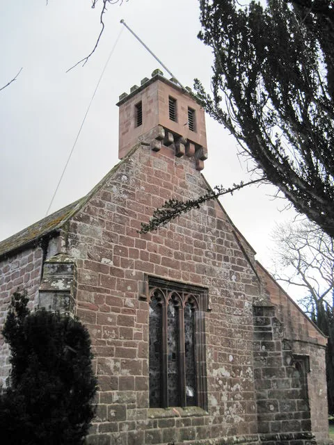
📷 5Historic churches · North East England
St Columba's Church, Warcop
St Columba's Church, Warcop is a historic church in the United Kingdom.
 📷 5
📷 5Mountains & hills · North East England
Vicarage Bank
Vicarage Bank — mountain in england north east. Elevation: 177.5 m.
 📷 3
📷 3Memorials & monuments · North East England
Warcop War Memorial
Warcop War Memorial — Grade II listed building-listed memorial in england-north-east, United Kingdom.
Where to eat & stay near Sourlands Hill
Places to stay
 📷 5
📷 5Caravan parks · North East England
Grassgill
Grassgill — a caravan park in england north east.
 📷 5
📷 5Caravan parks · North East England
Wild Rose Caravan Site
Wild Rose Caravan Site — a caravan park in england north east.
 📷 5
📷 5Hotels · North East England
Hilton
Hilton in England North East, United Kingdom.
 📷 5
📷 5Caravan parks · North West England
Chapel Farm Caravan Park
Chapel Farm Caravan Park — a caravan park in england north west.
 📷 5
📷 5Hotels · North East England
Augill Castle
Augill Castle — a hotel in england north east.
 📷 5
📷 5Caravan parks · North East England
Park House Caravan Park
Park House Caravan Park — a caravan park in england north east.
Places to eat & drink
 📷 5
📷 5Historic pubs · North East England
1, Scattergate
1, Scattergate in England North East, United Kingdom.
 📷 5
📷 5Cafés · North West England
The White Hare Cafe
The White Hare Cafe — a café in england north west.
 📷 5
📷 5Historic pubs · North East England
Tan Hill Inn
Tan Hill Inn in England North East, United Kingdom.
 📷 5
📷 5Cafés · North West England
The Cross Keys Temperance Inn
The Cross Keys Temperance Inn — a café in england north west.
 📷 5
📷 5Cafés · North West England
Gun Dog Coffee Shop
Gun Dog Coffee Shop — a café in england north west.
 📷 3
📷 3Historic pubs · North East England
Langwathby
Langwathby in England North East, United Kingdom.
More mountains in this region
 📷 3
📷 3Mountains & hills · North East England
Angletarn Pikes
Angletarn Pikes — Named summit at 566 m.
 📷 3
📷 3Mountains & hills · North East England
Angletarn Pikes South Top
Angletarn Pikes South Top — Named summit at 563.6 m.
 📷 3
📷 3Mountains & hills · North East England
Ard Crags
Ard Crags — Named summit at 581 m.
 📷 3
📷 3Mountains & hills · North East England
Arnison Crag
Arnison Crag — Named summit at 433 m.
Frequently asked questions
- Where is Sourlands Hill?
- Sourlands Hill is in North-East England, United Kingdom.
- What is Sourlands Hill?
- Sourlands Hill — mountain in england north east. Elevation: 192 m.
- How do I get to Sourlands Hill?
- Its coordinates are 54.5297°, -2.4088°.