Canal locks · South East England
Sonning Lock
Sonning Lock — lock on River Thames.
.jpg?width=1200)
Wikimedia Commons contributors — see linked file page for photographer and licence licence
.jpg)
Plan your visit
- Typical visit
- 20 min–45 min
- Nearest railway station
- Earley · 3.5 km
- Free entry
- Dog-friendly
About
Sonning Lock is a canal lock in the United Kingdom. Wikidata describes it as: "lock on River Thames". Coordinates: 51.4726°, -0.9187°.
Photo gallery
From the Wikipedia article
Sonning Lock is a lock and associated weir situated on the River Thames at the village of Sonning near Reading, Berkshire, England. The first lock was built by the Thames Navigation Commission in 1773 and it has been rebuilt three times since then. There is a weir a little upstream at the top of the island where Sonning Backwater separates from the main course of the river.
Excerpt from Wikipedia under CC BY-SA 4.0. See the source article linked in Sources below.
Background
History
A weir at Sonning is recorded as belonging to the Blunte family in the 15th century. This was associated with the mill and fisheries and mention is made of a "Locke-heise" at this time. The flash lock was replaced in 1773 by the pound lock. This was the highest upstream of the eight locks constructed after the Thames and Isis Navigation Act 1750 (24 Geo. 2. c. 8). It was commissioned in 1771 but took two years to build. Fir wood was originally used for these locks, but this decayed very quickly and was replaced at Sonning by oak in 1787. Repairs took place in 1827 when the old flash lock was brought back temporarily into use. By this time a lock house had been built. The lock-keeper from…
Visiting
The lock is a short walk upstream from Sonning Bridge, which itself is close to the centre of Sonning. It is also accessible via a short footpath between St Andrew's Church and the river. The path by the river continues into the town of Reading.
Sourced from Wikipedia under CC BY-SA 4.0.
- Coordinates
- 51.4726, -0.9187
- District
- Wokingham
- Parish
- Sonning
- Postcode
- RG4 6SU
- Parliamentary constituency
- Earley and Woodley
- Nearest railway station
- Earley — 3.5 km
Sources
- wikidata: Q7561977 (CC0)
- wikipedia: Sonning Lock (CC BY-SA 4.0)
- commons: Sonning Lock (geograph 5546855).jpg (CC BY-SA 4.0)
Other places nearby
Loading nearby places…
Nearby
 📷 5
📷 5Natural landmarks · South East England
Reading Blue Coat School
Reading Blue Coat School — a school heritage in england-south-east, United Kingdom.
 📷 5
📷 5Theatres · South East England
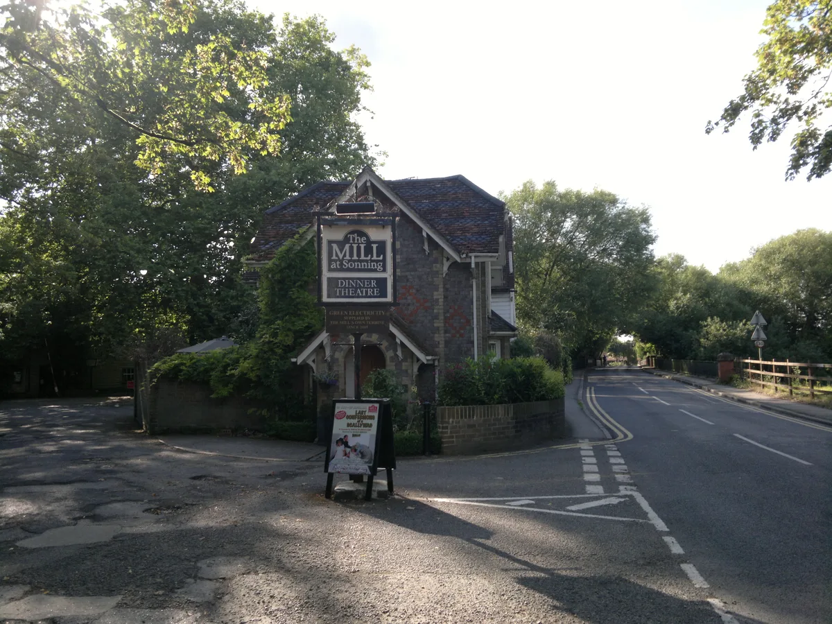
The Mill at Sonning
The Mill at Sonning is a theatre in the United Kingdom.
 📷 5
📷 5Cemeteries · South East England
Saint Andrew's Church
Saint Andrew's Church is a cemetery in the United Kingdom.
 📷 5
📷 5Historic churches · South East England
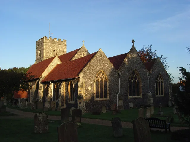
St Andrew's Church, Sonning
St Andrew's Church, Sonning — church in Sonning, Wokingham, Berkshire, England, UK.
 📷 5
📷 5Mills · South East England
The Mill at Sonning
The Mill at Sonning — theatre and restaurant, converted from an 18th-century flour mill.
Hotels · South East England
The Great House Hotel
The Great House Hotel — a hotel in england south east.
More places in this region
 📷 5
📷 5Canal locks · South East England
Abbey View Lock
Abbey View Lock — canal lock in Bath and North East Somerset, Somerset, England, UK.
 📷 5
📷 5Canal locks · South East England
Aldermaston Lock
Aldermaston Lock — lock on the Kennet and Avon Canal in Aldermaston, Berkshire, England, UK.
 📷 5
📷 5Canal locks · South East England
Allbrook Lock
Allbrook Lock — lock on the Itchen Navigation in the civil parish of Otterbourne, Hampshire, UK.
 📷 5
📷 5Canal locks · South East England
Bath Deep Lock
Bath Deep Lock — lock on the Kennet and Avon Canal, in Bath, UK.
Frequently asked questions
- Where is Sonning Lock?
- Sonning Lock is in South East England, in the United Kingdom — coordinates 51.4726°, -0.9187°. The nearest railway station is Earley, around 3.5 km away.
- Is Sonning Lock free to visit?
- Yes — admission to Sonning Lock is free.