
Towns & cities · East Midlands
Snelland
Snelland — a village located in West Lindsey, United Kingdom.

Wikimedia Commons contributors — see linked file page for photographer and licence licence

Plan your visit
- Typical visit
- 3 h–6 h
- Nearest railway station
- Market Rasen · 8.7 km
- Free entry
- Family-friendly
- Dog-friendly
Getting there & planning your visit
To visit Snelland, you can take a train to Market Rasen station, which is 8.7 km away. The postcode for Snelland is LN3 5AA. Entry to the town is free.
About
Snelland is a town, city, village or settlement in the United Kingdom. Recent population estimates put it at around 79 people. Wikidata describes it as: "a village located in West Lindsey, United Kingdom". Coordinates: 53.3111°, -0.3842°.
Photo gallery
Protected designations
- National Nature Reserve: BARDNEY LIMEWOODS
Designations sourced from Natural England open data under OGL v3.
From the Wikipedia article
Snelland is a village and civil parish in the West Lindsey district of Lincolnshire, England. It is situated approximately 9 miles (14 km) north-east from the city and county town of Lincoln and about 5 miles (8 km) from the town of Market Rasen. The civil parish includes the hamlet of Swinthorpe. The population at the 2011 census was included in the civil parish of Friesthorpe. Snelland is listed in the Domesday Book of 1086 as "Sneleslunt", with seven households. The nearby deserted medieval village of Swinthorpe is listed as "Sonetorp", with three households. There is evidence that a Cistercian grange existed at Swinthorpe, attached to Kirkstead Abbey. The parish church is a Grade II listed building built of limestone and dedicated to All Saints. It dates from the 12th century when the original church was constructed. However, it was likely reconstructed in the 15th century and then it was restored and largely rebuilt in 1863 by Edward Browning of Stamford. It was rebuilt in the early Decorated style. It has a bell gable which contains two bells. However, some of the original building remains with the south wall being the earliest part of the present building. Two windows on the south of the nave are in the late Decorated style of about 1440. Two further windows, of the same period were moved from their original positions during the later rebuilding of 1863. The first window is now the north-east window of the aisle. The second is a smaller window which is now in the Vestry and has been cut from a single stone. The Lincolnshire Architectural Society believes that this would have originally been positioned low as a side window in the chancel and would have served as a "leper's window". Aside from the windows, some medieval heads also remain from the earlier church. The rectory - which is next to the church - was built in 1862 and is now a private residence. Snelland railway station opened in the village in 1848, and closed in 1965. It is built of Ancaster stone.…
Excerpt from Wikipedia under CC BY-SA 4.0. See the source article linked in Sources below.
- Coordinates
- 53.3111, -0.3842
- County
- Lincolnshire
- District
- West Lindsey
- Parish
- Snelland
- Postcode
- LN3 5AA
- Parliamentary constituency
- Gainsborough
- Population
- 79
- Nearest railway station
- Market Rasen — 8.7 km
Sources
- wikidata: Q953154 (CC0)
- wikipedia: Snelland (CC BY-SA 4.0)
- commons: All Saints' church, Snelland - geograph.org.uk - 186648.jpg (CC BY-SA 4.0)
Other places nearby

Snelland
Villages · 0.5 km

Wickenby Picnic Area
Natural landmarks · 0.7 km

Broadbent Theatre
Theatres · 1.7 km
Wickenby
Historic churches · 1.7 km
The Rickyard
Galleries · 1.8 km

Fulnetby
Historic churches · 2.4 km

RAF Wickenby
Museums · 2.4 km

Clay Bridge
Historic bridges · 2.6 km
Bullington, Lincolnshire
Historic churches · 2.7 km

Friesthorpe
Historic churches · 2.9 km

Stainton by Langworth village cross
Historic houses · 3.2 km

Rand, Lincolnshire
Historic churches · 3.2 km
Snelland is a village in Lincolnshire, situated within the East Midlands region. Visitors can explore several notable local churches, including St Lawrence's Church in Snarford and St Michael's Church in Buslingthorpe. The area also offers the RAF Wickenby museum as a key attraction for those interested in local history.
At a glance
- Population
- 79
- Administrative county
- Lincolnshire
- Constituency
- Gainsborough
- Top categories near here
Things to see in Snelland
30 attractions within 12 km — showing the 24 most editorially-significant. Full guide: things to do in Snelland →
📷 3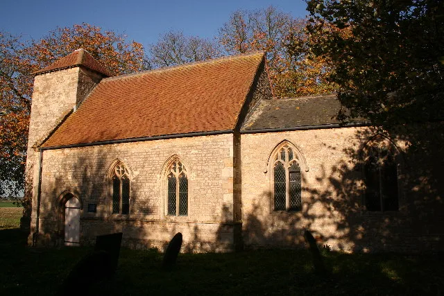 📷 3
📷 3Historic churches · East Midlands
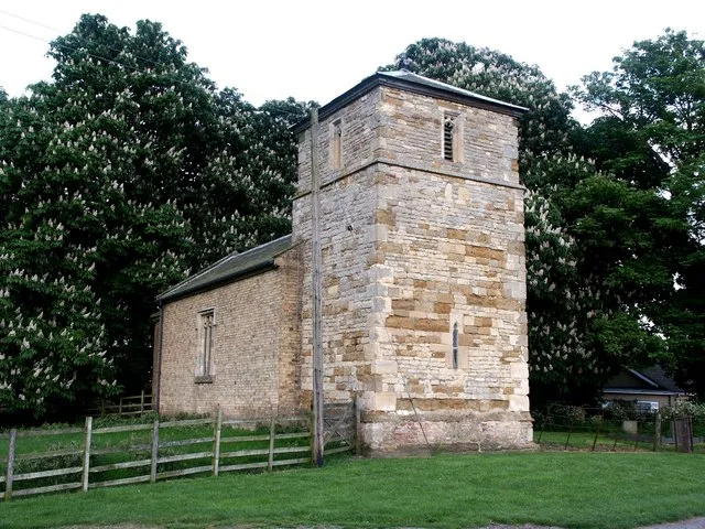
St Lawrence's Church, Snarford
St Lawrence's Church, Snarford — church in West Lindsey, UK.
 📷 3
📷 3Historic churches · East Midlands
St Michael's Church, Buslingthorpe
St Michael's Church, Buslingthorpe — church in Buslingthorpe, Lincolnshire, England, UK.
 📷 3
📷 3Zoos & aquariums · East Midlands
Woodside Wildlife Park
Woodside Wildlife Park in England East Midlands, United Kingdom.
 📷 3
📷 3Natural landmarks · East Midlands
strawberry Fields
strawberry Fields — a place in East Midlands, United Kingdom.
📷 3Natural landmarks · East Midlands
Wickenby Picnic Area
Wickenby Picnic Area — a place in East Midlands, United Kingdom.
📷 3Zoos & aquariums · East Midlands
Lincoln Zoo
Lincoln Zoo — a zoo aquarium in East Midlands, United Kingdom.
📷 3📷 3Historic houses · East Midlands
Stainton by Langworth village cross
Stainton by Langworth village cross — a Grade II-listed historic house in england-east-midlands, United Kingdom.
 📷 3
📷 3Historic churches · East Midlands
Church of St Cornelius
Church of St Cornelius — Grade I listed building-listed church in england-east-midlands, United Kingdom.
📷 3Historic bridges · East Midlands
Clay Bridge
Clay Bridge — Grade II listed building-listed bridge in england-east-midlands, United Kingdom.
 📷 5📷 5
Museums · East Midlands
RAF Wickenby
RAF Wickenby — a museum in england-east-midlands, United Kingdom.
 📷 5
📷 5Historic churches · East Midlands
Barlings
Barlings and Low Barlings are two small hamlets lying south off the A158 road at Langworth, about 7 miles (11 km) east of Lincoln in the West Lindsey district of Lincolnshire, England. Low Barlings is
📷 5Historic churches · East Midlands
Bullington, Lincolnshire
Bullington, Lincolnshire — a church in england-east-midlands, United Kingdom.
 📷 5
📷 5Historic churches · East Midlands
Faldingworth
Faldingworth — a church in england-east-midlands, United Kingdom.
 📷 5
📷 5Historic churches · East Midlands
Buslingthorpe, Lincolnshire
Buslingthorpe is a hamlet and civil parish in the West Lindsey district of Lincolnshire, England. It is half a mile east of the A46 at Faldingworth and 3 miles (5 km) south-west from Market Rasen. The
📷 5Historic churches · East Midlands
Friesthorpe
Friesthorpe — a church in england-east-midlands, United Kingdom.
📷 5Historic churches · East Midlands
Fulnetby
Fulnetby — a church in england-east-midlands, United Kingdom.
 📷 5
📷 5Historic churches · East Midlands
Linwood, Lincolnshire
Linwood, Lincolnshire — a church in england-east-midlands, United Kingdom.
 📷 5
📷 5Historic churches · East Midlands
Lissington
Lissington — a church in england-east-midlands, United Kingdom.
 📷 5
📷 5Historic churches · East Midlands
Scothern
Scothern — a church in england-east-midlands, United Kingdom.
📷 5Historic churches · East Midlands
Wickenby
Wickenby — a church in england-east-midlands, United Kingdom.
 📷 5
📷 5Campsites · East Midlands
Barlings Country Holiday Park
Barlings Country Holiday Park — a campsite in england east midlands.
Nearby
📷 5📷 3Natural landmarks · East Midlands
Wickenby Picnic Area
Wickenby Picnic Area — a place in East Midlands, United Kingdom.
📷 3📷 5Historic churches · East Midlands
Wickenby
Wickenby — a church in england-east-midlands, United Kingdom.
📷 3📷 5Historic churches · East Midlands
Fulnetby
Fulnetby — a church in england-east-midlands, United Kingdom.
Where to eat & stay near Snelland
Places to stay
📷 5Campsites · East Midlands
Barlings Country Holiday Park
Barlings Country Holiday Park — a campsite in england east midlands.
 📷 5
📷 5Caravan parks · East Midlands
Langdale Lakes
Langdale Lakes — a caravan park in england east midlands.
 📷 5
📷 5Campsites · East Midlands
Welton Manor Camp Site
Welton Manor Camp Site — a campsite in england east midlands.
 📷 5
📷 5Caravan parks · East Midlands
Stonecliff Park
Stonecliff Park — a caravan park in england east midlands.
 📷 5
📷 5Campsites · East Midlands
Lincolnshire Lanes
Lincolnshire Lanes — a campsite in england east midlands.
 📷 5
📷 5Places to eat & drink
 📷 5
📷 5 📷 7
📷 7 📷 5
📷 5 📷 5
📷 5Restaurants · East Midlands
Cafe Zoot
Cafe Zoot — a restaurant in england east midlands.
 📷 5
📷 5Historic pubs · East Midlands
268, High Street
268, High Street in England East Midlands, United Kingdom.
 📷 5
📷 5Cafés · East Midlands
Madame Waffle
Madame Waffle — a café in england east midlands.
More towns in this region
 📷 5
📷 5 📷 5
📷 5Towns & cities · East Midlands
Marholm
Marholm — village and civil parish in Cambridgeshire, UK.
 📷 5
📷 5Towns & cities · East Midlands
Thornhaugh
Thornhaugh — village and civil parish in Cambridgeshire, UK.
 Flagship📷 4
Towns & cities · East Midlands
Austerfield
Austerfield — village and civil parish in South Yorkshire, England, UK.
Frequently asked questions
- Where is Snelland?
- Snelland is in Lincolnshire, the East Midlands, United Kingdom (postcode LN3 5AA), in the parish of Snelland.
- What is Snelland?
- Snelland — a village located in West Lindsey, United Kingdom.
- How do I get to Snelland?
- The nearest railway station is Market Rasen, about 8.7 km away. Drivers can use postcode LN3 5AA.
- Is Snelland a protected site?
- Yes — Snelland is part of the BARDNEY LIMEWOODS National Nature Reserve.
- Is Snelland free to visit?
- Yes, Snelland is free to enter.
- How do I get to Snelland?
- Drivers can navigate to postcode LN3 5AA. It sits within the Gainsborough parliamentary constituency.