Historic bridges · East of England
Smeaton's Bridge
In or near Ickwell.
Smeaton's Bridge — Grade II listed building-listed bridge in england-london, United Kingdom.

Philip Jeffrey — CC BY-SA 2.0 via Wikimedia Commons licence
Plan your visit
- Typical visit
- 15 min–30 min
- Nearest railway station
- Biggleswade · 4.8 km
- Free entry
- Dog-friendly
Getting there & planning your visit
To visit Smeaton's Bridge, the nearest railway station is Biggleswade, located 4.8 km away. Entry to the bridge is free. The postcode for sat-nav is SG18 9LX.
About
Smeaton's Bridge is a Grade II listed building-listed bridge in england-london, United Kingdom, registered on the National Heritage List for England (NHLE entry 1274444). Listed status protects buildings and structures of special architectural or historic interest. See the linked Wikipedia article for further details.
Photo gallery
Heritage listing
Perth Bridge (also known as Smeaton's Bridge, locally, the Old Bridge, and in the local dialect of Scots, the Auld Brig) is a toll-free bridge in the city of Perth, Scotland. A Category A listed structure, it spans the River Tay, connecting Perth, on the western side of the river, to Bridgend, on its eastern side, carrying both automotive and pedestrian traffic of West Bridge Street (the A85). An earlier bridge was demolished at the same location in 1621 (its location marked by a stone tablet at the bottom of the High Street), and many unsuccessful attempts were made to replace it. A subscription was started by James VI and several noblemen to help with the construction cost, but the king's death in 1625 suspended the scheme and a series of ferryboats were instead used.
From the Historic England List Entry under OGL v3.
Protected designations
- Site of Special Scientific Interest: Southill Lake and Woods SSSI
Designations sourced from Natural England open data under OGL v3.
From the Wikipedia article
Perth Bridge (also known as Smeaton's Bridge, locally, the Old Bridge, and in the local dialect of Scots, the Auld Brig) is a toll-free bridge in the city of Perth, Scotland. A Category A listed structure, it spans the River Tay, connecting Perth, on the western side of the river, to Bridgend, on its eastern side, carrying both automotive and pedestrian traffic of West Bridge Street (the A85). An earlier bridge was demolished at the same location in 1621 (its location marked by a stone tablet at the bottom of the High Street), and many unsuccessful attempts were made to replace it. A subscription was started by James VI and several noblemen to help with the construction cost, but the king's death in 1625 suspended the scheme and a series of ferryboats were instead used. The replacement bridge was completed in October 1771, which places it in the Georgian era (George Street, which leads up to the bridge from the city, was built at the same time); however, its plaque states the year in which construction began, 1766, as its "built" date. The engineer of its construction was John Smeaton, after whom the bridge is colloquially named. Funded by Thomas Hay, 9th Earl of Kinnoull, the government, and public subscription, the bridge was put to the test three years after its completion. In February 1774, during a quick thaw, broken ice became wedged under the arches and created a natural dam. Large sections of Perth, including the North Inch and South Inch, were flooded. The bridge, however, stood firm. It has survived many subsequent floods, and marks documenting these levels are visible on one of its piers. An increase in traffic resulted in the bridge being widened in 1869 by A.D. Stewart. Its stone parapets were removed, and footpaths projected over iron brackets.
Excerpt from Wikipedia under CC BY-SA 4.0. See the source article linked in Sources below.
- Coordinates
- 52.0749, -0.3287
- District
- Central Bedfordshire
- Parish
- Southill
- Postcode
- SG18 9LX
- Parliamentary constituency
- North Bedfordshire
- Nearest railway station
- Biggleswade — 4.8 km
Sources
- wikidata: Q26564112 (CC0)
- wikipedia: Smeaton's Bridge (CC BY-SA 4.0)
Other places nearby

Queen Annes Summerhouse
Follies · 0.7 km

Old Warden
Museums · 0.9 km

Old Warden Guest House
B&Bs · 1.1 km

Southill Baptist Chapel
Chapels · 1.4 km

Bridge And Underpass Approximately 350 Metres North East Of Old Warden Park
Historic bridges · 1.4 km
Church of St Leonard, Old Warden
Historic churches · 1.5 km

Eagle Redoubt
Public art & sculpture · 1.5 km
Dolphin Jardiniere & Tazza
Public art & sculpture · 1.6 km
The Swiss Garden
Gardens · 1.6 km

Shuttleworth Collection
Museums · 1.7 km

Old Warden Castle
Literary houses · 1.7 km

The Shuttleworth Collection
Natural landmarks · 1.7 km
Nearby
📷 5Follies · East of England
Queen Annes Summerhouse
Queen Annes Summerhouse — Folly or eyecatcher.
📷 5📷 7B&Bs · East of England
Old Warden Guest House
Old Warden Guest House — a bed-and-breakfast in england london.
📷 5Chapels · East of England
Southill Baptist Chapel
Southill Baptist Chapel is a chapel in the United Kingdom.
📷 5Historic bridges · East of England
Bridge And Underpass Approximately 350 Metres North East Of Old Warden Park
Bridge And Underpass Approximately 350 Metres North East Of Old Warden Park — Grade II listed building-listed bridge in england-london, United Kingdom.
📷 5Historic churches · East of England
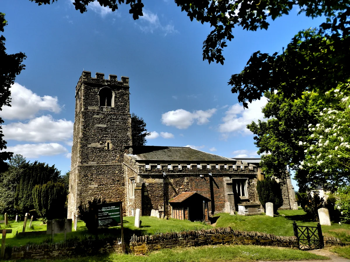
Church of St Leonard, Old Warden
Church of St Leonard, Old Warden — church in Old Warden, Bedfordshire, England, UK.
Where to eat & stay near Smeaton's Bridge
Places to stay
📷 7B&Bs · East of England
Old Warden Guest House
Old Warden Guest House — a bed-and-breakfast in england london.
 📷 5
📷 5Campsites · East of England
Boyd Memorial Campsite and Activity Centre
Boyd Memorial Campsite and Activity Centre — a campsite in england london.
 📷 5
📷 5Campsites · East of England
Henlow Bridge Lakes and Riverside
Henlow Bridge Lakes and Riverside — a campsite in england london.
 📷 5
📷 5Campsites · East of England
Jordans Close Scout Activity Centre
Jordans Close Scout Activity Centre — a campsite in england london.
 📷 5
📷 5Caravan parks · East of England
Caravan Club Site (members)
Caravan Club Site (members) — a caravan park in england london.
 📷 5
📷 5Places to eat & drink
 📷 5
📷 5 📷 5
📷 5 📷 5
📷 5 📷 5
📷 5Historic pubs · East of England
The White Hart Public House
The White Hart Public House in England East, United Kingdom.
 📷 5
📷 5Historic pubs · East of England
Kings Arms Public House
Kings Arms Public House in England East, United Kingdom.
 📷 5
📷 5More bridges in this region
.JPG?width=1200) 📷 5
📷 5Historic bridges · East of England
Albert Bridge
Albert Bridge is a historic bridge in the United Kingdom.
.jpg?width=1200) 📷 5
📷 5Historic bridges · East of England
Bedford Town Bridge
Bedford Town Bridge is a historic bridge in the United Kingdom.
 📷 5
📷 5Historic bridges · East of England
Bethnal Green and King's Lynn Line
Bethnal Green and King's Lynn Line is a historic bridge in the United Kingdom.
 📷 5
📷 5Historic bridges · East of England
Bethnal Green and King's Lynn Line
Bethnal Green and King's Lynn Line is a historic bridge in the United Kingdom.
Frequently asked questions
- Where is Smeaton's Bridge?
- Smeaton's Bridge is in London, United Kingdom (postcode SG18 9LX), in the parish of Southill.
- What is Smeaton's Bridge?
- Smeaton's Bridge — Grade II listed building-listed bridge in england-london, United Kingdom.
- How do I get to Smeaton's Bridge?
- The nearest railway station is Biggleswade, about 4.8 km away. Drivers can use postcode SG18 9LX.
- Is Smeaton's Bridge a listed building?
- Smeaton's Bridge is officially recognised as Grade II listed building listed.
- Is Smeaton's Bridge a protected site?
- Yes — Smeaton's Bridge is part of the Southill Lake and Woods SSSI Site of Special Scientific Interest.
- Is Smeaton's Bridge free to visit?
- Yes, Smeaton's Bridge is free to enter.
- How do I get to Smeaton's Bridge?
- The nearest railway station is Biggleswade, about 4.8 km away. Drivers can navigate to postcode SG18 9LX.