
Beaches · South West England
Small's Cove
In or near South Milton.
Small's Cove is a beach in the United Kingdom.

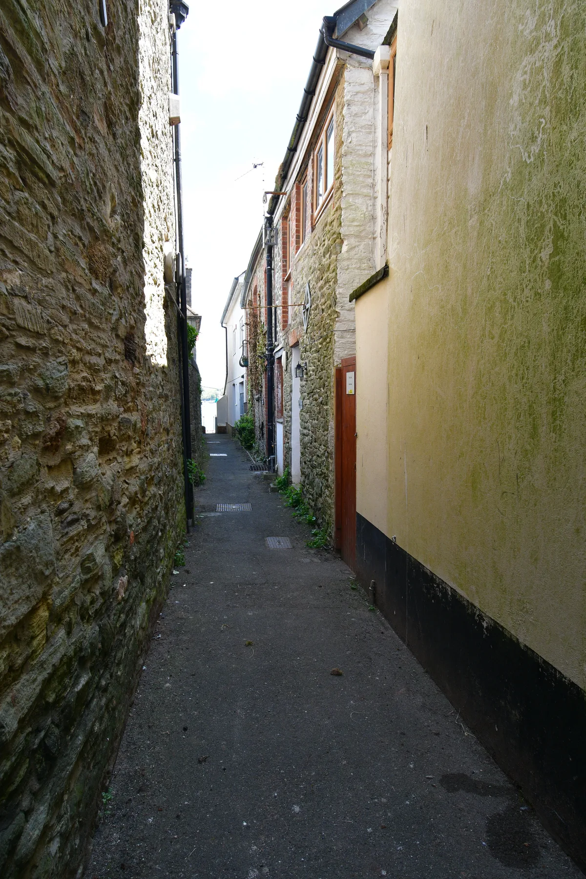
Adrian Dust — CC BY-SA 2.0 via Wikimedia Commons licence

Plan your visit
- Typical visit
- 1 h–3 h
- Best time of year
- Summer (Jun–Aug)
- Nearest railway station
- Kingsbridge Park Side · 5.3 km
- Free entry
- Family-friendly
- Dog-friendly
Getting there & planning your visit
To visit Small's Cove, the nearest railway station is Kingsbridge Park Side, located 5.3 km away. The postcode for sat-nav is TQ8 8PU, and entry to the beach is free.
About
Small's Cove is a beach on the coast of Devon, South-West England. The site is within the South Devon National Landscape (AONB), and is a designated Site of Special Scientific Interest. It sits within the South Devon parliamentary constituency. The nearest railway station is Kingsbridge Park Side, about 5.3 km away. Postcode area TQ8.
Photo gallery
Protected designations
- Site of Special Scientific Interest: Salcombe to Kingsbridge Estuary SSSI
- Area of Outstanding Natural Beauty: South Devon
Designations sourced from Natural England open data under OGL v3.
From the Wikipedia article
Small's Creek was one of the three watercourses that flowed into Small's Pond, a small body of water of several acres in area, located near the intersection of Queen Street and Kingston Road, in Toronto, Ontario. There is a small plain between the shore of Lake Ontario and the bluffs which marked the shore of the larger Glacial Lake Iroquois, and bedrock was shallow on the plain. Small's Creek, Tomlin's Creek, the other watercourse that drains into Small's Pond, and Ashbridge's Creek to the east were all small, short watercourses, with their headwaters on that small plain, had each become polluted by the turn of the 20th century, when the regions they flowed through were annexed into the growing city of Toronto. A gentleman farmer named Charles Coxwell Small, who was also the Clerk of Upper Canada's Privy Council, dammed creeks to create a millpond to power sawmills on his property, and the pond and one of the creeks were named after him. After a few years of debate, in 1909, the three creeks were buried, and turned into sewers. Small's Pond also became polluted, and was drained and filled in, in 1935.
Excerpt from Wikipedia under CC BY-SA 4.0. See the source article linked in Sources below.
- Coordinates
- 50.2334, -3.7649
- County
- Devon
- District
- South Hams
- Parish
- East Portlemouth
- Postcode
- TQ8 8PU
- Parliamentary constituency
- South Devon
- Nearest railway station
- Kingsbridge Park Side — 5.3 km
Sources
- osm: w156118752 (ODbL)
- wikipedia: Small's Creek (CC BY-SA 4.0)
Other places nearby

Salcombe War Memorial and Shelter
Memorials & monuments · 0.3 km
Salcombe War Memorial
Memorials & monuments · 0.3 km

Fisherman's Cove
Beaches · 0.3 km

The Ferry Inn
Historic pubs · 0.3 km

Mill Bay
Beaches · 0.4 km

Former Look Out Tower Incorporated With Tower House At Corner Of Newton Road
Memorials & monuments · 0.4 km

Victoria Inn
Historic pubs · 0.5 km
Salcombe
Villages · 0.5 km

Salcombe Harbour
Harbours & ports · 0.6 km
Folly End, Quay House, Tideway, and Waterfront Buildings
Museums · 0.6 km

Salcombe Maritime Museum
Museums · 0.6 km

Salcombe Lifeboat Station
Museums · 0.6 km
Nearby
📷 3Memorials & monuments · South West England
Salcombe War Memorial and Shelter
Salcombe War Memorial and Shelter — Grade II listed building-listed memorial in england-south-west, United Kingdom.
📷 3Memorials & monuments · South West England
Salcombe War Memorial
Salcombe War Memorial — a memorial in South West England, United Kingdom.
📷 5Beaches · South West England
Fisherman's Cove
Fisherman's Cove is a beach in the United Kingdom.
📷 5Historic pubs · South West England
The Ferry Inn
The Ferry Inn in England South West, United Kingdom.
📷 5📷 3Memorials & monuments · South West England
Former Look Out Tower Incorporated With Tower House At Corner Of Newton Road
Former Look Out Tower Incorporated With Tower House At Corner Of Newton Road — Grade II listed building-listed memorial in england-south-west, United Kingdom.
Where to eat & stay near Small's Cove
Places to stay
 📷 5
📷 5Caravan parks · South West England
Southern Mill
Southern Mill — a caravan park in england south west.
 📷 5
📷 5Campsites · South West England
Ilton Castle Farm
Ilton Castle Farm — a campsite in england south west.
 📷 5
📷 5 📷 5
📷 5Campsites · South West England
Higher Rew Campsite
Higher Rew Campsite — a campsite in england south west.
 📷 5
📷 5Campsites · South West England
Alston Farm
Alston Farm — a campsite in england south west.
 📷 5
📷 5Campsites · South West England
Wilton Farm Campsite
Wilton Farm Campsite — a campsite in england south west.
Places to eat & drink
📷 5Historic pubs · South West England
The Ferry Inn
The Ferry Inn in England South West, United Kingdom.
📷 7 📷 7
📷 7Historic pubs · South West England
King Of Prussia Inn
King Of Prussia Inn in England South West, United Kingdom.
 📷 7
📷 7Historic pubs · South West England
The Old Chapel Inn
The Old Chapel Inn in England South West, United Kingdom.
 📷 6
📷 6Historic pubs · South West England
Dolphin Inn
Dolphin Inn in England South West, United Kingdom.
 📷 7
📷 7Historic pubs · South West England
White Hart Hotel And The Assembly Rooms
White Hart Hotel And The Assembly Rooms in England South West, United Kingdom.
More beaches in this region
 📷 5
📷 5Beaches · South West England
Alum Chine Beach
Alum Chine Beach is a beach in the United Kingdom.
 📷 5
📷 5Beaches · South West England
Bournemouth Beach
Bournemouth Beach — beach in Bournemouth, Dorset, UK.
 📷 5
📷 5Beaches · South West England
Bournemouth East Beach
Bournemouth East Beach is a beach in the United Kingdom.
 📷 5
📷 5Beaches · South West England
Bournemouth West Beach
Bournemouth West Beach is a beach in the United Kingdom.
Frequently asked questions
- Where is Small's Cove?
- Small's Cove is in Devon, South-West England, United Kingdom (postcode TQ8 8PU), in the parish of East Portlemouth.
- What is Small's Cove?
- Small's Cove is a beach in the United Kingdom.
- How do I get to Small's Cove?
- The nearest railway station is Kingsbridge Park Side, about 5.3 km away. The nearest town is South Milton. Drivers can use postcode TQ8 8PU.
- Is Small's Cove a protected site?
- Yes — Small's Cove is part of the Salcombe to Kingsbridge Estuary SSSI Site of Special Scientific Interest and the South Devon National Landscape (AONB).
- Is Small's Cove free to visit?
- Yes, Small's Cove is free to enter.
- How do I get to Small's Cove?
- The nearest railway station is Kingsbridge Park Side, about 5.3 km away. Drivers can navigate to postcode TQ8 8PU.