Reservoirs & lochs · North West England
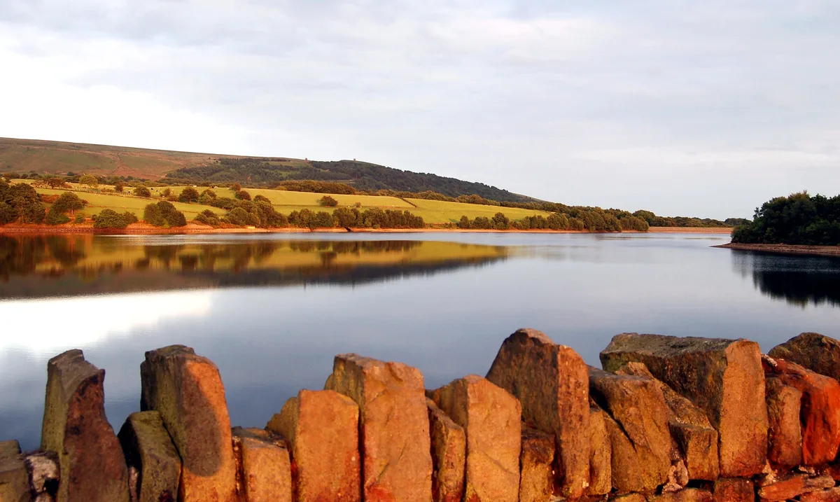
Simpson Ground Reservoir
In or near Cartmel Fell.
Simpson Ground Reservoir — reservoir in Cumbria, England, UK.

Wikimedia Commons contributors — see linked file page for photographer and licence licence
Plan your visit
- Typical visit
- 1 h–2.5 h
- Nearest railway station
- Lakeside · 2.0 km
- Free entry
- Dog-friendly
Getting there & planning your visit
To visit Simpson Ground Reservoir, the nearest railway station is Lakeside, which is 2 km away. The postcode for sat-nav is LA11 6NX, and entry to the reservoir is free.
About
Simpson Ground Reservoir is a reservoir in the United Kingdom. Wikidata describes it as: "reservoir in Cumbria, England, UK". Coordinates: 54.2683°, -2.9300°.
Photo gallery
From the Wikipedia article
Simpson Ground Reservoir is a reservoir in Cumbria, England, near the southeastern end of Windermere. It is located within a Forestry Commission conifer plantation, to the east of Staveley-in-Cartmel and provides fresh water supply for Grange-Over-Sands and the Haweswater aqueduct to Barrow. The reservoir, which covers an area of 6.89 hectares (17.0 acres), was established in 1957. The reservoir, at an altitude of 193 metres (633 feet), measures 455 m × 194 m (1,493 ft × 636 ft), and has a capacity of 44 million gallons. A plaque near the bank commemorates the opening of the reservoir on 4 May 1957 by the Lancashire County Council.
Excerpt from Wikipedia under CC BY-SA 4.0. See the source article linked in Sources below.
- Coordinates
- 54.2683, -2.9300
- District
- Westmorland and Furness
- Parish
- Cartmel Fell
- Postcode
- LA11 6NX
- Parliamentary constituency
- Westmorland and Lonsdale
- Nearest railway station
- Lakeside — 2 km
Sources
- wikidata: Q7521100 (CC0)
- wikipedia: Simpson Ground Reservoir (CC BY-SA 4.0)
- commons: Simpson Ground Reservoir - geograph.org.uk - 346394.jpg (CC BY-SA 4.0)
Other places nearby

Cop o' Cow Hill
Mountains & hills · 0.3 km

Staveley Fell
Mountains & hills · 0.8 km

Lake Side
Villages · 1.3 km

Barrow Wife Hill
Mountains & hills · 1.3 km

Fell Foot Wood Campsite
Campsites · 1.5 km

Staveley in Cartmel War Memorial
Memorials & monuments · 1.6 km
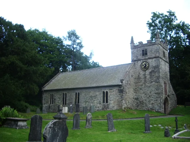
St Mary's Church, Staveley
Historic churches · 1.6 km

Fell Foot
Natural landmarks · 1.7 km
Millerbeck Light Railway
Natural landmarks · 1.7 km

Accommodation Bridge Carrying Path Over The Lakeside And Haverthwaite Railway (Ngr Sd 871377)
Historic bridges · 1.9 km

Saskills
Mountains & hills · 1.9 km

Lakeside railway station (England)
Heritage railway stations · 2.0 km
Nearby
📷 5Mountains & hills · North West England
Cop o' Cow Hill
Cop o' Cow Hill — mountain in england north west. Elevation: 212 m.
📷 5Mountains & hills · North West England
Staveley Fell
Staveley Fell — a hill or mountain in england north west.
📷 5📷 5Mountains & hills · North West England
Barrow Wife Hill
Barrow Wife Hill — mountain in england north west. Elevation: 219 m.
📷 5Campsites · North West England
Fell Foot Wood Campsite
Fell Foot Wood Campsite — a campsite in england north west.
📷 3Memorials & monuments · North West England
Staveley in Cartmel War Memorial
Staveley in Cartmel War Memorial — a memorial in england-north-west, United Kingdom.
Where to eat & stay near Simpson Ground Reservoir
Places to stay
📷 5Campsites · North West England
Fell Foot Wood Campsite
Fell Foot Wood Campsite — a campsite in england north west.
 📷 5
📷 5Caravan parks · North West England
Whitestone Caravan Park
Whitestone Caravan Park — a caravan park in england north west.
 📷 5
📷 5Caravan parks · North West England
Newby Bridge Caravan Park
Newby Bridge Caravan Park — a caravan park in england north west.
📷 5Caravan parks · North West England
Oak Head Caravan Park
Oak Head Caravan Park — a caravan park in england north west.
 📷 3
📷 3Campsites · North West England
Moss Howe Farm campsite
Moss Howe Farm campsite — a campsite in england north west.
 📷 5
📷 5Caravan parks · North West England
Avon Wood
Avon Wood — a caravan park in england north west.
Places to eat & drink
 📷 5
📷 5Restaurants · North West England
L'Enclume
L'Enclume — a restaurant in england north west.
 📷 4
📷 4Restaurants · North West England
L'Enclume
L'Enclume (pronounced [lɑ̃.klym], French for "the anvil") is a Modern British restaurant opened in 2002 in Cartmel, Cumbria, England, run by the chef Simon Rogan and his partner, Penny Tapsell. L'Encl
 📷 7
📷 7 📷 7
📷 7Cafés · North West England
Joey's Cafe
Joey's Cafe — a café in england north west.
 📷 7
📷 7Historic pubs · North West England
Hole in t'Wall public house, With Attached Buildings To South
Hole in t'Wall public house, With Attached Buildings To South in England North West, United Kingdom.
 📷 5
📷 5Historic pubs · North West England
Sun Cottage Sun Inn Public House
Sun Cottage Sun Inn Public House in England North West, United Kingdom.
More places in this region
 Flagship📷 5
Reservoirs & lochs · North West England
Yarrow Reservoir
Yarrow Reservoir — reservoir in Lancashire, England, UK.
.jpg?width=1200) 📷 3
📷 3Reservoirs & lochs · North West England
Abbey Village Reservoir
Abbey Village Reservoir — reservoir in Lancashire, England, UK.
 📷 3
📷 3Reservoirs & lochs · North West England
Anglezarke Reservoir
Anglezarke Reservoir — reservoir in Lancashire, England, UK.
 📷 3
📷 3Reservoirs & lochs · North West England
Ashworth Moor Reservoir
Ashworth Moor Reservoir — reservoir in Greater Manchester, England, UK.
Frequently asked questions
- Where is Simpson Ground Reservoir?
- Simpson Ground Reservoir is in North-West England, United Kingdom (postcode LA11 6NX), in the parish of Cartmel Fell.
- What is Simpson Ground Reservoir?
- Simpson Ground Reservoir — reservoir in Cumbria, England, UK.
- How do I get to Simpson Ground Reservoir?
- The nearest railway station is Lakeside, about 2.0 km away. Drivers can use postcode LA11 6NX.
- Is Simpson Ground Reservoir free to visit?
- Yes, Simpson Ground Reservoir is free to enter.
- How do I get to Simpson Ground Reservoir?
- The nearest railway station is Lakeside, about 2.0 km away. Drivers can navigate to postcode LA11 6NX.