
Historic bridges · South West England
Simonsbath Bridge At Ngr Ss 7720 3909
In or near Challacombe.
Simonsbath Bridge At Ngr Ss 7720 3909 — Grade II listed building-listed bridge in england-south-west, United Kingdom.

nick macneill — CC BY-SA 2.0 via Wikimedia Commons licence

Plan your visit
- Typical visit
- 15 min–30 min
- Free entry
- Dog-friendly
About
Simonsbath Bridge At Ngr Ss 7720 3909 is a Grade II listed building-listed bridge in england-south-west, United Kingdom, registered on the National Heritage List for England (NHLE entry 1345374). Listed status protects buildings and structures of special architectural or historic interest. See the linked Wikipedia article for further details.
Photo gallery
See it from the streetimagery from 2025
Imagery © Mapillary contributors, CC BY-SA 4.0
Heritage listing
Details SS73NE EXMOOR CP SIMONSBATH 11/13 Simonsbath Bridge at NGR SS 7720 3909 II Road bridge over River Barle. Medieval in origin, subsequently extensively rebuilt especially after 1952 floods. Flat bedded slate, random rubble voussoirs, slate bedded on end to form saddle back coping. Three arch span. West side 3 semi-circular headed arches, cutwaters rising to spring of arch with flat pilasters above. East side pointed arch central opening, flanked by 2 slightly different semi-circular headed arches, cutwaters between with recessed ledge, parapet rebuilt behind. (Photograph in NMR). Listing NGR: SS7719839095 Legacy The contents of this record have been generated from a legacy data system. Legacy System number: 265426 Legacy System: LBS
From the Historic England List Entry under OGL v3.
Protected designations
- Site of Special Scientific Interest: North Exmoor SSSI
- Site of Special Scientific Interest: River Barle SSSI
Designations sourced from Natural England open data under OGL v3.
Place summary
Simonsbath Bridge, located in South-West England at NGR SS 7720 3909, is a Grade II listed building. This structure is notable for its historical significance and architectural features typical of its era.
AI-generated from the structured facts on this page (operator, designation, listing, era). Not a substitute for visiting.
- Coordinates
- 51.1379, -3.7567
- District
- Somerset
- Parish
- Exmoor
- Postcode
- TA24 7SH
- Parliamentary constituency
- Tiverton and Minehead
Sources
- wikidata: Q26629008 (CC0)
Other places nearby

Simonsbath House
Historic houses · 0.1 km

Simonsbath
Villages · 0.2 km

Halscombe Stone Setting
Archaeological sites · 0.8 km

Halscombe Stone Setting
Archaeological sites · 0.8 km

Flexbarrow
Mountains & hills · 1.4 km

Wheal Eliza
Historic houses · 1.6 km
Wheal Eliza
Archaeological sites · 1.6 km

Winstitchen
Mountains & hills · 1.6 km

The Calf
Mountains & hills · 2.7 km
Cow Castle
Mountains & hills · 2.8 km
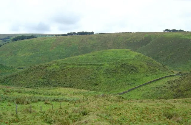
Cow Castle
Castles · 2.8 km

Rexy Barrow
Burial mounds & barrows · 2.9 km
Nearby
📷 3Historic houses · South West England
Simonsbath House
Simonsbath House — house in Exmoor, West Somerset, England, UK.
📷 5📷 5Archaeological sites · South West England
Halscombe Stone Setting
Halscombe Stone Setting — a archaeological in england-south-west, United Kingdom.
📷 5Archaeological sites · South West England
Halscombe Stone Setting
Halscombe Stone Setting — archaeological in england south west. Operated by he.
📷 5Mountains & hills · South West England
Flexbarrow
Flexbarrow — mountain in england south west. Elevation: 339 m.
📷 3Historic houses · South West England
Wheal Eliza
Wheal Eliza — a historic house in england-south-west, United Kingdom.
Where to eat & stay near Simonsbath Bridge At Ngr Ss 7720 3909
Places to stay
 📷 5
📷 5Campsites · South West England
Westermill Farm Campsite
Westermill Farm Campsite — a campsite in england south west.
 📷 5
📷 5Hostels · South West England
Pinkery Farm (Expedition Centre)
Pinkery Farm (Expedition Centre) — a hostel in england south west.
 📷 5
📷 5Campsites · South West England
Cloud Farm Campsite
Cloud Farm Campsite — a campsite in england south west.
 📷 5
📷 5Hostels · South West England
Blindwell Bunkhouse
Blindwell Bunkhouse — a hostel in england south west.
 📷 5
📷 5Hostels · South West England
Exford Youth Hostel
Exford Youth Hostel — a hostel in england south west.
📷 5Campsites · South West England
Exmoor Youth Hostel Campsite
Exmoor Youth Hostel Campsite — a campsite in england south west.
Places to eat & drink
 📷 5
📷 5Historic pubs · South West England
The Blue Ball Inn
The Blue Ball Inn in England South West, United Kingdom.
 📷 5
📷 5Historic pubs · South West England
The London Inn
The London Inn in England South West, United Kingdom.
 📷 7
📷 7Historic pubs · South West England
Rock House Hotel
Rock House Hotel in England South West, United Kingdom.
 📷 7
📷 7Historic pubs · South West England
Rising Sun Hotel (Main Part)
Rising Sun Hotel (Main Part) in England South West, United Kingdom.
 📷 7
📷 7Historic pubs · South West England
Kings Arms Public House
Kings Arms Public House in England South West, United Kingdom.
 📷 5
📷 5Historic pubs · South West England
Pack o' Cards
Pack o' Cards in England South West, United Kingdom.
More bridges in this region
 📷 5
📷 5Historic bridges · South West England
Avoncliff Aqueduct
Avoncliff Aqueduct is a historic bridge in the United Kingdom.
📷 5Historic bridges · South West England
Avoncliff Aqueduct
Avoncliff Aqueduct is a historic bridge in the United Kingdom.
 📷 5
📷 5Historic bridges · South West England
Bradford Viaduct
Bradford Viaduct is a historic bridge in the United Kingdom.
 📷 5
📷 5Historic bridges · South West England
Chippenham Viaduct
Chippenham Viaduct is a historic bridge in the United Kingdom.
Frequently asked questions
- Where is Simonsbath Bridge At Ngr Ss 7720 3909?
- Simonsbath Bridge At Ngr Ss 7720 3909 is in South-West England, United Kingdom (postcode TA24 7SH), in the parish of Exmoor.
- What is Simonsbath Bridge At Ngr Ss 7720 3909?
- Simonsbath Bridge At Ngr Ss 7720 3909 — Grade II listed building-listed bridge in england-south-west, United Kingdom.
- How do I get to Simonsbath Bridge At Ngr Ss 7720 3909?
- The nearest town is Challacombe. Drivers can use postcode TA24 7SH.
- Is Simonsbath Bridge At Ngr Ss 7720 3909 a listed building?
- Simonsbath Bridge At Ngr Ss 7720 3909 is officially recognised as Grade II listed building listed.
- Is Simonsbath Bridge At Ngr Ss 7720 3909 a protected site?
- Yes — Simonsbath Bridge At Ngr Ss 7720 3909 is part of the North Exmoor SSSI Site of Special Scientific Interest and the River Barle SSSI Site of Special Scientific Interest.
- Is Simonsbath Bridge At Ngr Ss 7720 3909 free to visit?
- Yes, Simonsbath Bridge At Ngr Ss 7720 3909 is free to enter.
- How do I get to Simonsbath Bridge At Ngr Ss 7720 3909?
- Drivers can navigate to postcode TA24 7SH. It sits within the Tiverton and Minehead parliamentary constituency.